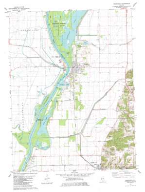
Meredosia Topo Map Illinois
To zoom in, hover over the map of Meredosia
USGS Topo Quad 39090g5 - 1:24,000 scale
| Topo Map Name: | Meredosia |
| USGS Topo Quad ID: | 39090g5 |
| Print Size: | ca. 21 1/4" wide x 27" high |
| Southeast Coordinates: | 39.75° N latitude / 90.5° W longitude |
| Map Center Coordinates: | 39.8125° N latitude / 90.5625° W longitude |
| U.S. State: | IL |
| Filename: | o39090g5.jpg |
| Download Map JPG Image: | Meredosia topo map 1:24,000 scale |
| Map Type: | Topographic |
| Topo Series: | 7.5´ |
| Map Scale: | 1:24,000 |
| Source of Map Images: | United States Geological Survey (USGS) |
| Alternate Map Versions: |
Meredosia SE IL 1975, updated 1976 Download PDF Buy paper map Meredosia IL 1980, updated 1981 Download PDF Buy paper map Meredosia IL 2012 Download PDF Buy paper map Meredosia IL 2015 Download PDF Buy paper map |
1:24,000 Topo Quads surrounding Meredosia
> Back to 39090e1 at 1:100,000 scale
> Back to 39090a1 at 1:250,000 scale
> Back to U.S. Topo Maps home
Meredosia topo map: Gazetteer
Meredosia: Islands
Eagle Island elevation 129m 423′McGees Island elevation 129m 423′
Wilsons Island elevation 131m 429′
Meredosia: Lakes
Barlow Lake elevation 129m 423′Billings Lake elevation 129m 423′
Carver Lake elevation 129m 423′
Chisel Lake elevation 129m 423′
Meredosia Lake elevation 129m 423′
Seamans Pond elevation 130m 426′
Smith Lake elevation 131m 429′
Woods Lake elevation 129m 423′
Meredosia: Populated Places
Bluffs elevation 143m 469′Columbus (historical) elevation 136m 446′
Meredosia elevation 135m 442′
Naples elevation 134m 439′
Shady Acres elevation 138m 452′
Meredosia: Streams
Coon Run elevation 131m 429′Eagle Run elevation 133m 436′
McKee Creek elevation 131m 429′
South Fork McKee Creek elevation 131m 429′
Spring Run elevation 137m 449′
Willow Creek elevation 129m 423′
Wolf Run elevation 135m 442′
Meredosia digital topo map on disk
Buy this Meredosia topo map showing relief, roads, GPS coordinates and other geographical features, as a high-resolution digital map file on DVD:


