Virginia Topo Map Illinois
To zoom in, hover over the map of Virginia
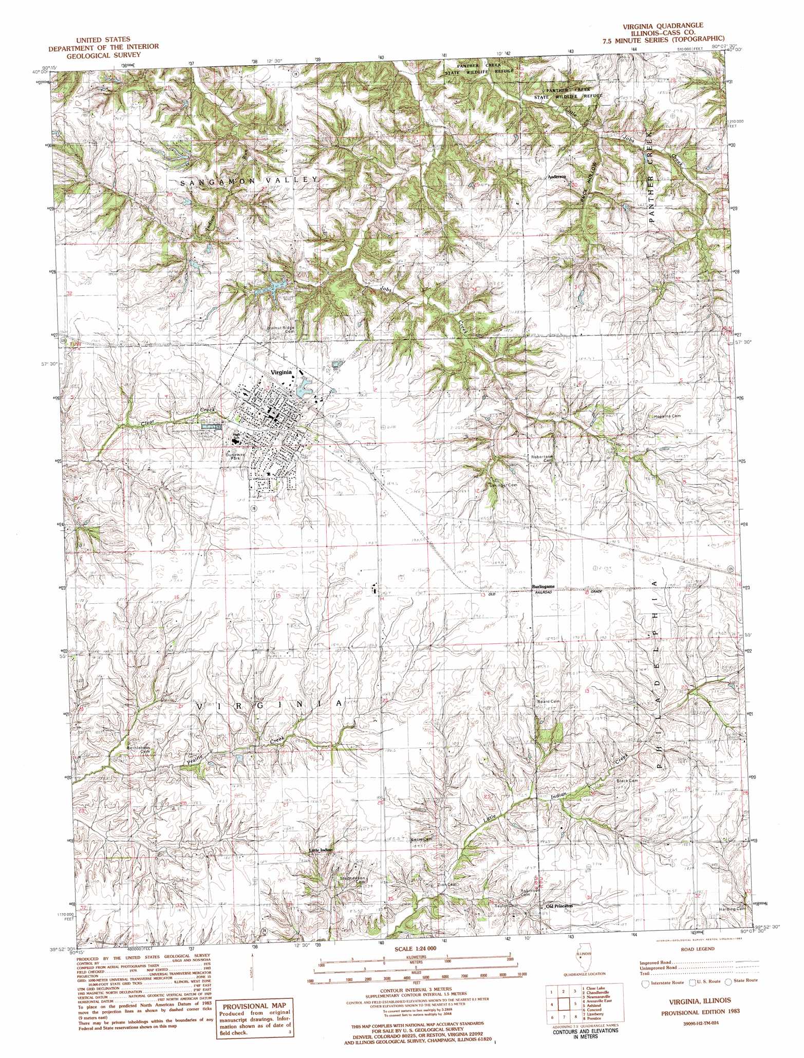
USGS Topo Quad 39090h2 - 1:24,000 scale
| Topo Map Name: | Virginia |
| USGS Topo Quad ID: | 39090h2 |
| Print Size: | ca. 21 1/4" wide x 27" high |
| Southeast Coordinates: | 39.875° N latitude / 90.125° W longitude |
| Map Center Coordinates: | 39.9375° N latitude / 90.1875° W longitude |
| U.S. State: | IL |
| Filename: | o39090h2.jpg |
| Download Map JPG Image: | Virginia topo map 1:24,000 scale |
| Map Type: | Topographic |
| Topo Series: | 7.5´ |
| Map Scale: | 1:24,000 |
| Source of Map Images: | United States Geological Survey (USGS) |
| Alternate Map Versions: |
Virginia IL 1983, updated 1983 Download PDF Buy paper map Virginia IL 2012 Download PDF Buy paper map Virginia IL 2015 Download PDF Buy paper map |
1:24,000 Topo Quads surrounding Virginia
Ray |
Astoria |
Bath |
Kilbourne |
Biggs |
Beardstown |
Clear Lake |
Chandlerville |
Newmansville |
Oakford |
Arenzville West |
Arenzville East |
Virginia |
Ashland |
Tallula |
Chapin |
Concord |
Literberry |
Prentice |
Pleasant Plains |
Winchester |
Lynnville |
Jacksonville |
Alexander |
New Berlin |
> Back to 39090e1 at 1:100,000 scale
> Back to 39090a1 at 1:250,000 scale
> Back to U.S. Topo Maps home
Virginia topo map: Gazetteer
Virginia: Dams
Virginia Lake Dam elevation 176m 577′Virginia: Parks
Dunaway Park elevation 189m 620′Virginia: Populated Places
Anderson elevation 187m 613′Burlingame elevation 190m 623′
Kisch elevation 189m 620′
Little Indian elevation 183m 600′
Old Princeton elevation 184m 603′
Virginia elevation 186m 610′
Virginia: Reservoirs
Virginia Lake elevation 176m 577′Virginia: Valleys
Buck Hollow elevation 161m 528′Virginia digital topo map on disk
Buy this Virginia topo map showing relief, roads, GPS coordinates and other geographical features, as a high-resolution digital map file on DVD: