Versailles Topo Map Illinois
To zoom in, hover over the map of Versailles
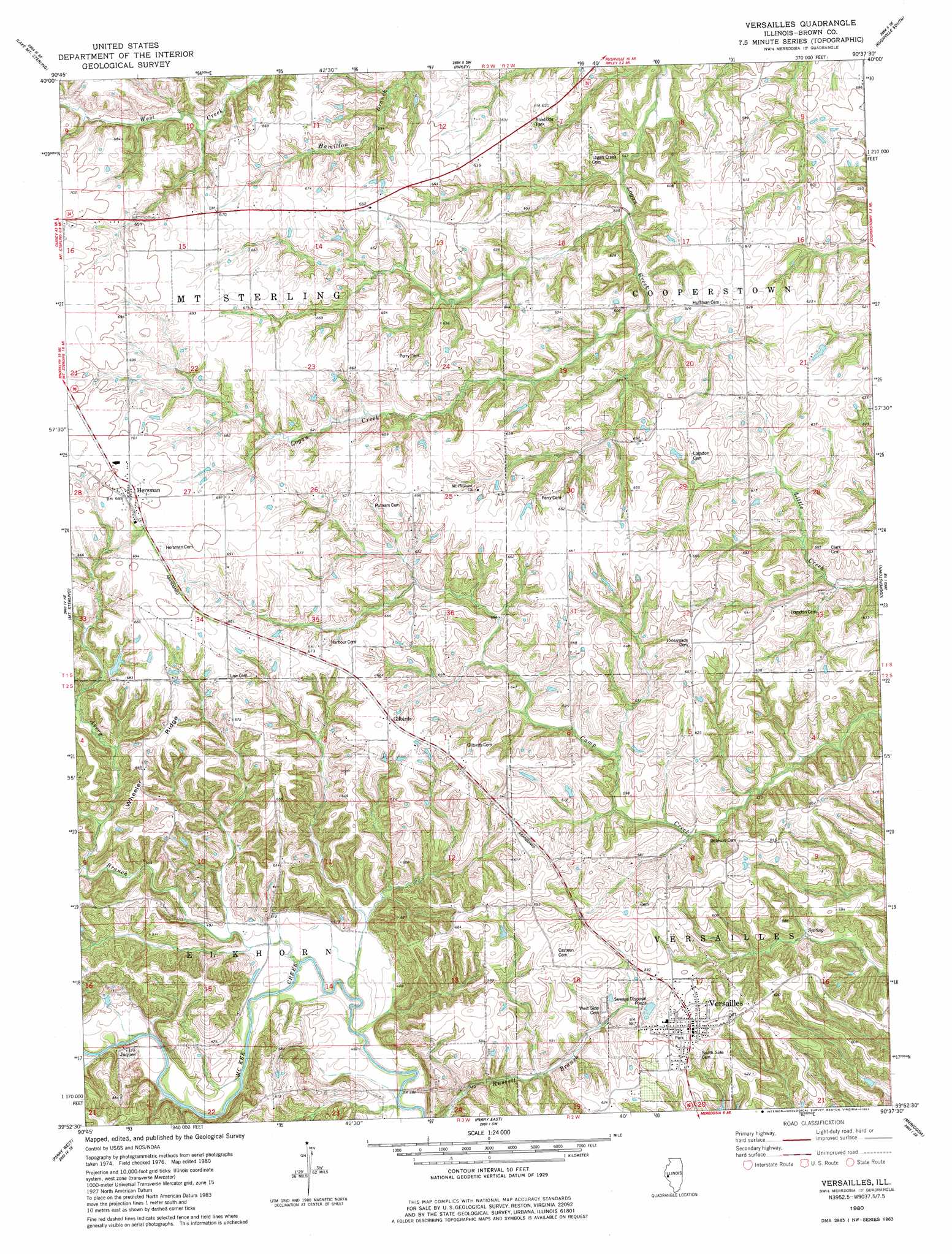
USGS Topo Quad 39090h6 - 1:24,000 scale
| Topo Map Name: | Versailles |
| USGS Topo Quad ID: | 39090h6 |
| Print Size: | ca. 21 1/4" wide x 27" high |
| Southeast Coordinates: | 39.875° N latitude / 90.625° W longitude |
| Map Center Coordinates: | 39.9375° N latitude / 90.6875° W longitude |
| U.S. State: | IL |
| Filename: | o39090h6.jpg |
| Download Map JPG Image: | Versailles topo map 1:24,000 scale |
| Map Type: | Topographic |
| Topo Series: | 7.5´ |
| Map Scale: | 1:24,000 |
| Source of Map Images: | United States Geological Survey (USGS) |
| Alternate Map Versions: |
Versailles IL 1980, updated 1981 Download PDF Buy paper map Versailles IL 2012 Download PDF Buy paper map Versailles IL 2015 Download PDF Buy paper map |
1:24,000 Topo Quads surrounding Versailles
Augusta |
Camden |
Erwin |
Rushville North |
Ray |
Clayton |
Lake Mount Sterling |
Ripley |
Rushville South |
Beardstown |
Kellerville |
Mount Sterling |
Versailles |
Cooperstown |
Arenzville West |
Fishhook |
Perry West |
Perry East |
Meredosia |
Chapin |
Baylis |
New Salem |
Griggsville |
Florence |
Winchester |
> Back to 39090e1 at 1:100,000 scale
> Back to 39090a1 at 1:250,000 scale
> Back to U.S. Topo Maps home
Versailles topo map: Gazetteer
Versailles: Dams
Hambaugh-Martin Structure Number 5 Dam elevation 162m 531′Kleinlein Farm Pond Dam elevation 197m 646′
Versailles: Populated Places
Gilbirds elevation 201m 659′Hersman elevation 213m 698′
Jaques elevation 156m 511′
Versailles elevation 193m 633′
Versailles: Reservoirs
Hambaugh-Martin Number Five Reservoir elevation 162m 531′Kleinlein Farm Pond elevation 197m 646′
Versailles: Ridges
Wheeler Ridge elevation 208m 682′Versailles: Springs
Versailles Springs elevation 154m 505′Versailles: Streams
Avery Branch elevation 143m 469′Versailles digital topo map on disk
Buy this Versailles topo map showing relief, roads, GPS coordinates and other geographical features, as a high-resolution digital map file on DVD: