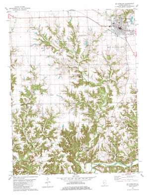
Mount Sterling Topo Map Illinois
To zoom in, hover over the map of Mount Sterling
USGS Topo Quad 39090h7 - 1:24,000 scale
| Topo Map Name: | Mount Sterling |
| USGS Topo Quad ID: | 39090h7 |
| Print Size: | ca. 21 1/4" wide x 27" high |
| Southeast Coordinates: | 39.875° N latitude / 90.75° W longitude |
| Map Center Coordinates: | 39.9375° N latitude / 90.8125° W longitude |
| U.S. State: | IL |
| Filename: | o39090h7.jpg |
| Download Map JPG Image: | Mount Sterling topo map 1:24,000 scale |
| Map Type: | Topographic |
| Topo Series: | 7.5´ |
| Map Scale: | 1:24,000 |
| Source of Map Images: | United States Geological Survey (USGS) |
| Alternate Map Versions: |
Mt Sterling IL 1981, updated 1981 Download PDF Buy paper map Mt Sterling IL 1981, updated 1981 Download PDF Buy paper map Mount Sterling IL 2012 Download PDF Buy paper map Mount Sterling IL 2015 Download PDF Buy paper map |
1:24,000 Topo Quads surrounding Mount Sterling
> Back to 39090e1 at 1:100,000 scale
> Back to 39090a1 at 1:250,000 scale
> Back to U.S. Topo Maps home
Mount Sterling topo map: Gazetteer
Mount Sterling: Airports
Brown County Flyers Association Airport elevation 220m 721′Mount Sterling: Bridges
Gerrish Bridge elevation 146m 479′Mount Sterling: Mines
Mount Sterling Quarry elevation 172m 564′Mount Sterling: Parks
Mount Sterling Commercial Historic District elevation 224m 734′Mount Sterling: Populated Places
Buckhorn elevation 219m 718′Fargo elevation 227m 744′
Mount Sterling elevation 221m 725′
White Oak Springs (historical) elevation 208m 682′
Mount Sterling: Post Offices
Highview Post Office (historical) elevation 204m 669′Mount Sterling: Streams
Doby Branch elevation 179m 587′Dry Fork elevation 145m 475′
Mount Sterling: Valleys
Cronin Hollow elevation 164m 538′Sarrah Hollow elevation 146m 479′
Mount Sterling digital topo map on disk
Buy this Mount Sterling topo map showing relief, roads, GPS coordinates and other geographical features, as a high-resolution digital map file on DVD:


