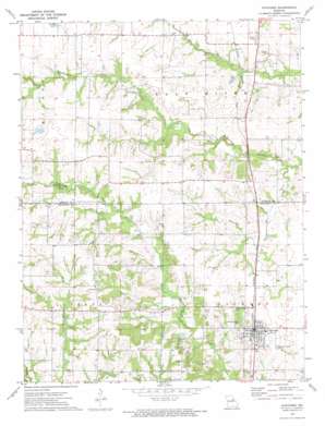
Auxvasse Topo Map Missouri
To zoom in, hover over the map of Auxvasse
USGS Topo Quad 39091a8 - 1:24,000 scale
| Topo Map Name: | Auxvasse |
| USGS Topo Quad ID: | 39091a8 |
| Print Size: | ca. 21 1/4" wide x 27" high |
| Southeast Coordinates: | 39° N latitude / 91.875° W longitude |
| Map Center Coordinates: | 39.0625° N latitude / 91.9375° W longitude |
| U.S. State: | MO |
| Filename: | o39091a8.jpg |
| Download Map JPG Image: | Auxvasse topo map 1:24,000 scale |
| Map Type: | Topographic |
| Topo Series: | 7.5´ |
| Map Scale: | 1:24,000 |
| Source of Map Images: | United States Geological Survey (USGS) |
| Alternate Map Versions: |
Auxvasse MO 1972, updated 1974 Download PDF Buy paper map Auxvasse MO 2012 Download PDF Buy paper map Auxvasse MO 2015 Download PDF Buy paper map |
1:24,000 Topo Quads surrounding Auxvasse
> Back to 39091a1 at 1:100,000 scale
> Back to 39090a1 at 1:250,000 scale
> Back to U.S. Topo Maps home
Auxvasse topo map: Gazetteer
Auxvasse: Dams
August H Fenck Senior Dam elevation 263m 862′Bastian Lake Dam elevation 258m 846′
Feutz Lake Lower East Dam elevation 265m 869′
Feutz Lake Upper East Dam elevation 270m 885′
Lamers Lake Dam elevation 252m 826′
Lehenbaur Lake Section 28 Dam elevation 260m 853′
Sydenstricken Dam elevation 250m 820′
Vanderkamp Lake Dam elevation 273m 895′
Auxvasse: Populated Places
Auxvasse elevation 265m 869′Bryans (historical) elevation 247m 810′
Champ elevation 248m 813′
Concord elevation 277m 908′
Ortiz (historical) elevation 256m 839′
Auxvasse: Post Offices
Champ Post Office (historical) elevation 248m 813′Auxvasse: Reservoirs
August H Fenck Senior Lake elevation 263m 862′E B Feutz Lake elevation 270m 885′
Shellabarger Lake elevation 258m 846′
Stephenson Lake elevation 250m 820′
William Lamers Lake elevation 252m 826′
Auxvasse: Streams
Jesse Creek elevation 238m 780′Smith Branch elevation 246m 807′
Auxvasse digital topo map on disk
Buy this Auxvasse topo map showing relief, roads, GPS coordinates and other geographical features, as a high-resolution digital map file on DVD:


