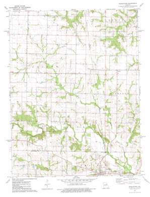
Middletown Topo Map Missouri
To zoom in, hover over the map of Middletown
USGS Topo Quad 39091b4 - 1:24,000 scale
| Topo Map Name: | Middletown |
| USGS Topo Quad ID: | 39091b4 |
| Print Size: | ca. 21 1/4" wide x 27" high |
| Southeast Coordinates: | 39.125° N latitude / 91.375° W longitude |
| Map Center Coordinates: | 39.1875° N latitude / 91.4375° W longitude |
| U.S. State: | MO |
| Filename: | o39091b4.jpg |
| Download Map JPG Image: | Middletown topo map 1:24,000 scale |
| Map Type: | Topographic |
| Topo Series: | 7.5´ |
| Map Scale: | 1:24,000 |
| Source of Map Images: | United States Geological Survey (USGS) |
| Alternate Map Versions: |
Middletown MO 1973, updated 1977 Download PDF Buy paper map Middletown MO 2012 Download PDF Buy paper map Middletown MO 2014 Download PDF Buy paper map |
1:24,000 Topo Quads surrounding Middletown
> Back to 39091a1 at 1:100,000 scale
> Back to 39090a1 at 1:250,000 scale
> Back to U.S. Topo Maps home
Middletown topo map: Gazetteer
Middletown: Dams
Allison Lake Dam elevation 226m 741′Barber Lake Dam elevation 228m 748′
Bruce Crysdale Dam elevation 230m 754′
Camerer Dam elevation 225m 738′
Clithero Lake Dam elevation 219m 718′
Clithero Lake Dam elevation 225m 738′
Ehrlick Dam South elevation 223m 731′
Ehrlick Lake Dam elevation 215m 705′
Heim Lake Dam elevation 216m 708′
Heim Lake Dam elevation 206m 675′
Ray Lake Dam elevation 229m 751′
Wendells Lake Dam elevation 226m 741′
Middletown: Populated Places
Estes elevation 225m 738′Gazette elevation 235m 770′
Middletown elevation 208m 682′
Middletown: Post Offices
Mount Carmel Post Office (historical) elevation 231m 757′Middletown: Reservoirs
Camerer Lake elevation 225m 738′Clithero Lake elevation 219m 718′
Clithero Lake elevation 225m 738′
Drysdale Lake elevation 230m 754′
Ehrlick Lake elevation 215m 705′
Wendell L Heim Lake elevation 216m 708′
Wendells Lake elevation 226m 741′
Middletown: Streams
Johns Branch elevation 198m 649′Lost Creek elevation 213m 698′
Sandy Creek elevation 195m 639′
Middletown digital topo map on disk
Buy this Middletown topo map showing relief, roads, GPS coordinates and other geographical features, as a high-resolution digital map file on DVD:


