Frankford Topo Map Missouri
To zoom in, hover over the map of Frankford
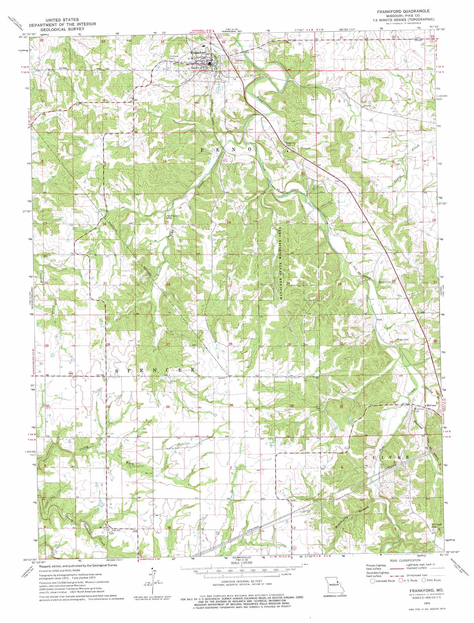
USGS Topo Quad 39091d3 - 1:24,000 scale
| Topo Map Name: | Frankford |
| USGS Topo Quad ID: | 39091d3 |
| Print Size: | ca. 21 1/4" wide x 27" high |
| Southeast Coordinates: | 39.375° N latitude / 91.25° W longitude |
| Map Center Coordinates: | 39.4375° N latitude / 91.3125° W longitude |
| U.S. State: | MO |
| Filename: | o39091d3.jpg |
| Download Map JPG Image: | Frankford topo map 1:24,000 scale |
| Map Type: | Topographic |
| Topo Series: | 7.5´ |
| Map Scale: | 1:24,000 |
| Source of Map Images: | United States Geological Survey (USGS) |
| Alternate Map Versions: |
Frankford MO 1973, updated 1977 Download PDF Buy paper map Frankford MO 2012 Download PDF Buy paper map Frankford MO 2015 Download PDF Buy paper map |
1:24,000 Topo Quads surrounding Frankford
Rensselaer |
Hannibal West |
Hannibal East |
Hull |
Barry |
Center |
New London |
Hannibal Se |
Ashburn |
Rockport |
Perry Ne |
Spencerburg |
Frankford |
Vera |
Louisana |
Farber |
Vandalia |
Curryville |
Bowling Green |
Cyrene |
Vandalia Lake |
Middletown |
New Hartford |
Louisville |
Eolia |
> Back to 39091a1 at 1:100,000 scale
> Back to 39090a1 at 1:250,000 scale
> Back to U.S. Topo Maps home
Frankford topo map: Gazetteer
Frankford: Parks
Ranacker State Wildlife Area elevation 204m 669′Frankford: Populated Places
Frankford elevation 187m 613′Prankford elevation 171m 561′
Frankford: Post Offices
McCune Post Office (historical) elevation 201m 659′Frankford: Streams
Gailey Branch elevation 193m 633′Little Creek elevation 165m 541′
Little Peno Creek elevation 165m 541′
Railroad Branch elevation 195m 639′
Weatherly Branch elevation 206m 675′
Frankford digital topo map on disk
Buy this Frankford topo map showing relief, roads, GPS coordinates and other geographical features, as a high-resolution digital map file on DVD: