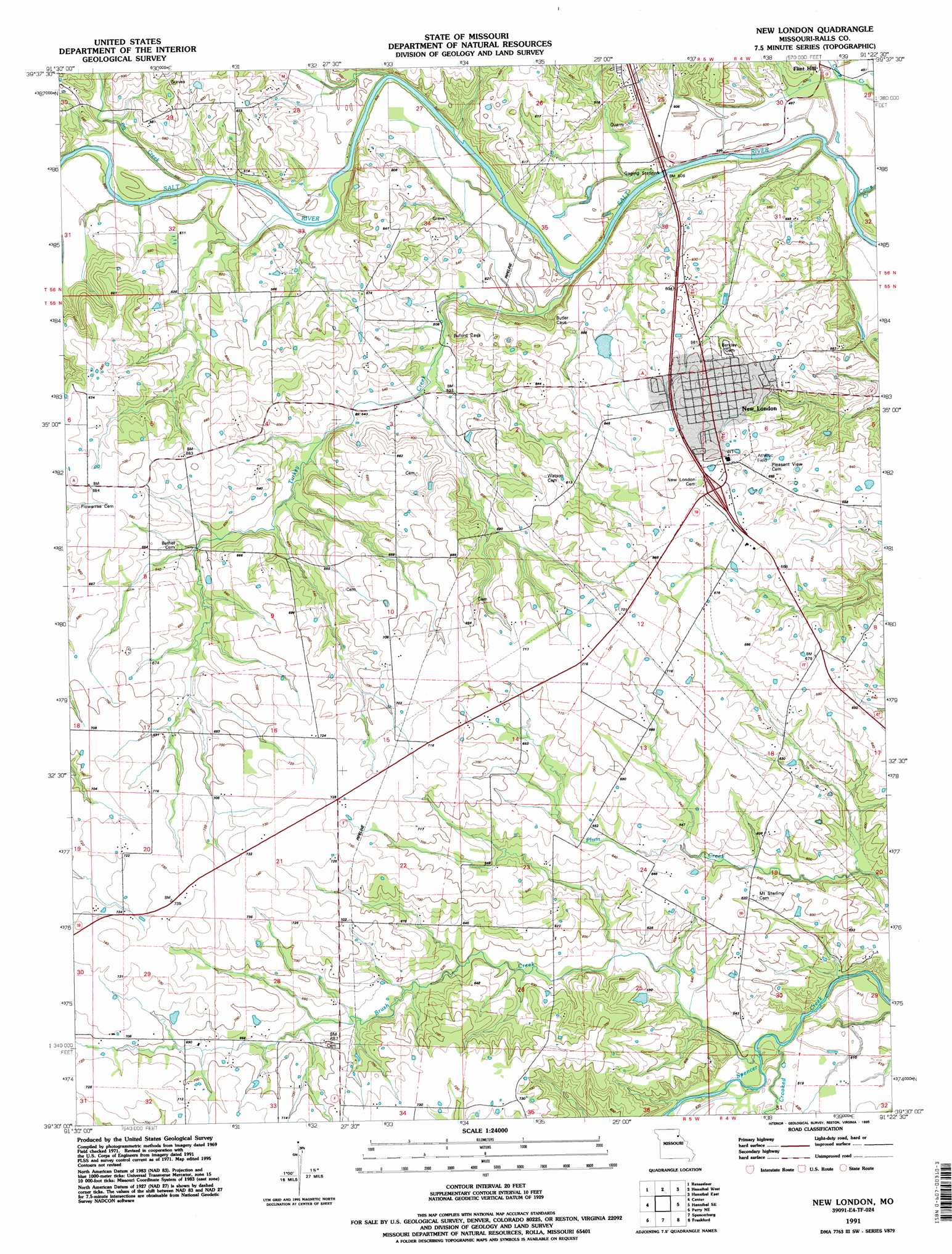
New London Topo Map Missouri
To zoom in, hover over the map of New London
USGS Topo Quad 39091e4 - 1:24,000 scale
| Topo Map Name: | New London |
| USGS Topo Quad ID: | 39091e4 |
| Print Size: | ca. 21 1/4" wide x 27" high |
| Southeast Coordinates: | 39.5° N latitude / 91.375° W longitude |
| Map Center Coordinates: | 39.5625° N latitude / 91.4375° W longitude |
| U.S. State: | MO |
| Filename: | o39091e4.jpg |
| Download Map JPG Image: | New London topo map 1:24,000 scale |
| Map Type: | Topographic |
| Topo Series: | 7.5´ |
| Map Scale: | 1:24,000 |
| Source of Map Images: | United States Geological Survey (USGS) |
| Alternate Map Versions: |
New London MO 1971, updated 1973 Download PDF Buy paper map New London MO 1991, updated 1995 Download PDF Buy paper map New London MO 2012 Download PDF Buy paper map New London MO 2014 Download PDF Buy paper map |
1:24,000 Topo Quads surrounding New London
Philadelphia |
Palmyra |
Quincy Sw |
Marblehead |
Payson |
Monroe City |
Rensselaer |
Hannibal West |
Hannibal East |
Hull |
Joanna |
Center |
New London |
Hannibal Se |
Ashburn |
Perry |
Perry Ne |
Spencerburg |
Frankford |
Vera |
Hutchison |
Farber |
Vandalia |
Curryville |
Bowling Green |
> Back to 39091e1 at 1:100,000 scale
> Back to 39090a1 at 1:250,000 scale
> Back to U.S. Topo Maps home
New London topo map: Gazetteer
New London: Dams
Number 276 Dam elevation 219m 718′New London: Populated Places
Flint Hill elevation 152m 498′New London elevation 200m 656′
New London: Streams
Big Creek elevation 151m 495′Brush Creek elevation 155m 508′
Camp Creek elevation 146m 479′
Crooked Creek elevation 155m 508′
Turkey Creek elevation 154m 505′
New London digital topo map on disk
Buy this New London topo map showing relief, roads, GPS coordinates and other geographical features, as a high-resolution digital map file on DVD: