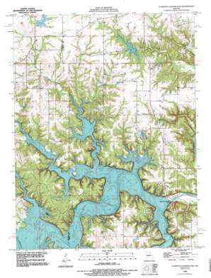
Joanna Topo Map Missouri
To zoom in, hover over the map of Joanna
USGS Topo Quad 39091e6 - 1:24,000 scale
| Topo Map Name: | Joanna |
| USGS Topo Quad ID: | 39091e6 |
| Print Size: | ca. 21 1/4" wide x 27" high |
| Southeast Coordinates: | 39.5° N latitude / 91.625° W longitude |
| Map Center Coordinates: | 39.5625° N latitude / 91.6875° W longitude |
| U.S. State: | MO |
| Filename: | o39091e6.jpg |
| Download Map JPG Image: | Joanna topo map 1:24,000 scale |
| Map Type: | Topographic |
| Topo Series: | 7.5´ |
| Map Scale: | 1:24,000 |
| Source of Map Images: | United States Geological Survey (USGS) |
| Alternate Map Versions: |
Joanna MO 1959, updated 1960 Download PDF Buy paper map Joanna MO 1959, updated 1976 Download PDF Buy paper map Clarence Cannon Dam MO 1990, updated 1995 Download PDF Buy paper map Clarence Cannon Dam MO 2012 Download PDF Buy paper map Clarence Cannon Dam MO 2014 Download PDF Buy paper map |
1:24,000 Topo Quads surrounding Joanna
> Back to 39091e1 at 1:100,000 scale
> Back to 39090a1 at 1:250,000 scale
> Back to U.S. Topo Maps home
Joanna topo map: Gazetteer
Joanna: Dams
Clarence Cannon Dam elevation 163m 534′Monroe City Dam elevation 194m 636′
Monroe City South Lake Dam elevation 216m 708′
Thompson Lake Dam elevation 216m 708′
Joanna: Parks
Frank Russell Recreation Area elevation 213m 698′Indian Creek Recreation Area elevation 198m 649′
John F Spalding Recreation Area elevation 202m 662′
M W Boudreaux Recreation Area elevation 199m 652′
Ray Behrens Recreation Area elevation 208m 682′
Spillway Recreation Area elevation 171m 561′
Joanna: Populated Places
Joanna elevation 185m 606′Shaver Ford elevation 185m 606′
The Landing elevation 220m 721′
Joanna: Reservoirs
Henderson Lake elevation 185m 606′Mark Twain Lake elevation 163m 534′
Monroe City Lake elevation 194m 636′
Monroe Lake B elevation 216m 708′
Joanna: Ridges
Cedar Ridge elevation 190m 623′Joanna: Streams
Dry Fork elevation 185m 606′Ely Branch elevation 185m 606′
Indian Creek elevation 185m 606′
Lick Creek elevation 185m 606′
Little Indian Creek elevation 185m 606′
Madden Branch elevation 185m 606′
Pigeon Roost Creek elevation 185m 606′
Sandy Creek elevation 185m 606′
Joanna: Trails
Hickory Bluff Trail elevation 208m 682′Lick Creek Trail elevation 213m 698′
Joanna digital topo map on disk
Buy this Joanna topo map showing relief, roads, GPS coordinates and other geographical features, as a high-resolution digital map file on DVD:


