Marblehead Topo Map Illinois
To zoom in, hover over the map of Marblehead
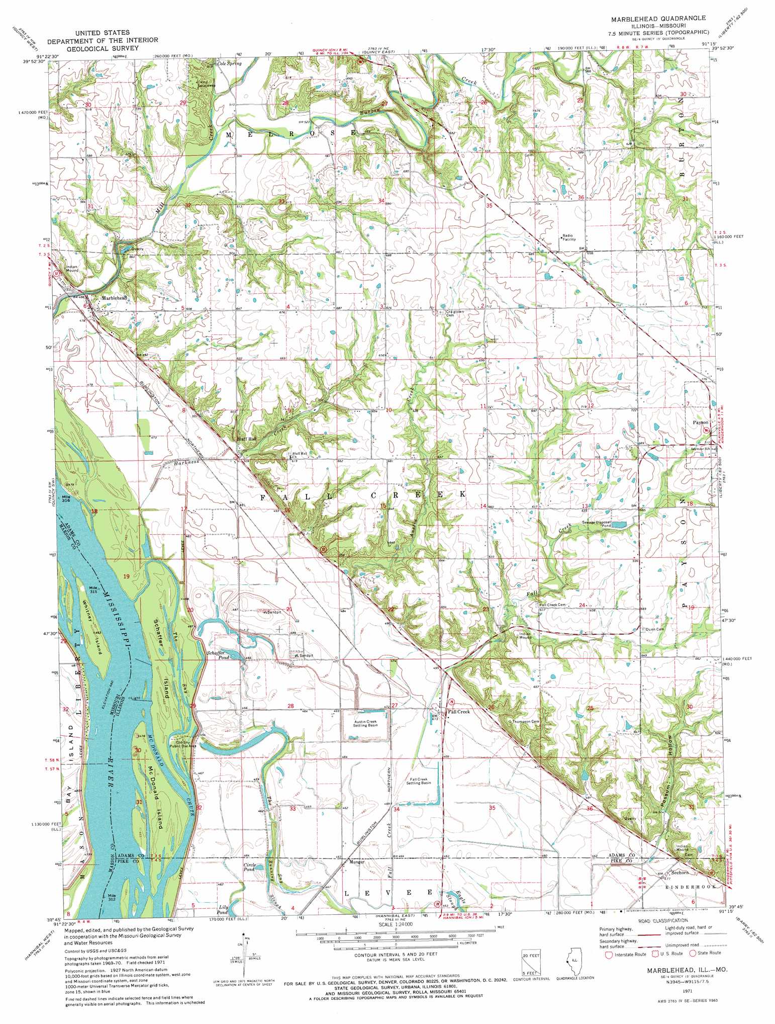
USGS Topo Quad 39091g3 - 1:24,000 scale
| Topo Map Name: | Marblehead |
| USGS Topo Quad ID: | 39091g3 |
| Print Size: | ca. 21 1/4" wide x 27" high |
| Southeast Coordinates: | 39.75° N latitude / 91.25° W longitude |
| Map Center Coordinates: | 39.8125° N latitude / 91.3125° W longitude |
| U.S. States: | IL, MO |
| Filename: | o39091g3.jpg |
| Download Map JPG Image: | Marblehead topo map 1:24,000 scale |
| Map Type: | Topographic |
| Topo Series: | 7.5´ |
| Map Scale: | 1:24,000 |
| Source of Map Images: | United States Geological Survey (USGS) |
| Alternate Map Versions: |
Marblehead IL 1971, updated 1973 Download PDF Buy paper map Marblehead IL 1996, updated 1998 Download PDF Buy paper map Marblehead IL 2012 Download PDF Buy paper map Marblehead IL 2015 Download PDF Buy paper map |
1:24,000 Topo Quads surrounding Marblehead
La Grange |
Long Island |
Mendon |
Coatsburg |
Camp Point |
Maywood |
Quincy West |
Quincy East |
Columbus |
Liberty |
Palmyra |
Quincy Sw |
Marblehead |
Payson |
Richfield |
Rensselaer |
Hannibal West |
Hannibal East |
Hull |
Barry |
Center |
New London |
Hannibal Se |
Ashburn |
Rockport |
> Back to 39091e1 at 1:100,000 scale
> Back to 39090a1 at 1:250,000 scale
> Back to U.S. Topo Maps home
Marblehead topo map: Gazetteer
Marblehead: Basins
Austin Creek Settling Basin elevation 142m 465′Fall Creek Settling Basin elevation 140m 459′
Marblehead: Channels
The Sny elevation 144m 472′Marblehead: Dams
Mayer Pond Dam elevation 161m 528′Marblehead: Islands
McDonald Island elevation 144m 472′Schaffer Island elevation 144m 472′
Whitney Island elevation 144m 472′
Marblehead: Lakes
Circle Pond elevation 139m 456′Rogers Lake (historical) elevation 140m 459′
Schaffer Pond elevation 140m 459′
Marblehead: Mines
Marblehead Quarry elevation 150m 492′Marblehead: Parks
Old Sny Public Use Area elevation 144m 472′Marblehead: Populated Places
Fall Creek elevation 145m 475′Marblehead elevation 150m 492′
Munger elevation 141m 462′
Seehorn elevation 145m 475′
Marblehead: Post Offices
Marblehead Post Office (historical) elevation 151m 495′Marblehead: Reservoirs
Mayer Pond elevation 161m 528′Marblehead: Springs
Cole Spring elevation 168m 551′Marblehead: Streams
Austin Creek elevation 142m 465′Burton Creek elevation 150m 492′
Marblehead: Valleys
Possum Hollow elevation 151m 495′Marblehead digital topo map on disk
Buy this Marblehead topo map showing relief, roads, GPS coordinates and other geographical features, as a high-resolution digital map file on DVD: