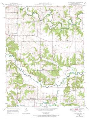
Philadelphia Topo Map Missouri
To zoom in, hover over the map of Philadelphia
USGS Topo Quad 39091g6 - 1:24,000 scale
| Topo Map Name: | Philadelphia |
| USGS Topo Quad ID: | 39091g6 |
| Print Size: | ca. 21 1/4" wide x 27" high |
| Southeast Coordinates: | 39.75° N latitude / 91.625° W longitude |
| Map Center Coordinates: | 39.8125° N latitude / 91.6875° W longitude |
| U.S. State: | MO |
| Filename: | o39091g6.jpg |
| Download Map JPG Image: | Philadelphia topo map 1:24,000 scale |
| Map Type: | Topographic |
| Topo Series: | 7.5´ |
| Map Scale: | 1:24,000 |
| Source of Map Images: | United States Geological Survey (USGS) |
| Alternate Map Versions: |
Philadelphia MO 1949, updated 1967 Download PDF Buy paper map Philadelphia MO 1950 Download PDF Buy paper map Philadelphia MO 2012 Download PDF Buy paper map Philadelphia MO 2014 Download PDF Buy paper map |
1:24,000 Topo Quads surrounding Philadelphia
> Back to 39091e1 at 1:100,000 scale
> Back to 39090a1 at 1:250,000 scale
> Back to U.S. Topo Maps home
Philadelphia topo map: Gazetteer
Philadelphia: Airports
Bevill Airport elevation 210m 688′Philadelphia: Dams
Doctor J W Well Dam elevation 211m 692′Russel Sandifer Dam elevation 195m 639′
Philadelphia: Populated Places
Little Union elevation 203m 666′Newmarket elevation 185m 606′
Philadelphia elevation 215m 705′
Philadelphia: Reservoirs
Doctor J W Well Lake elevation 211m 692′Sandifer Lake elevation 195m 639′
Philadelphia: Streams
Big Branch elevation 152m 498′Keller Branch elevation 168m 551′
Newmarket Branch elevation 168m 551′
Pigeon Creek elevation 169m 554′
Sees Creek elevation 159m 521′
South Fork North River elevation 157m 515′
Philadelphia digital topo map on disk
Buy this Philadelphia topo map showing relief, roads, GPS coordinates and other geographical features, as a high-resolution digital map file on DVD:


