Madison Topo Map Missouri
To zoom in, hover over the map of Madison
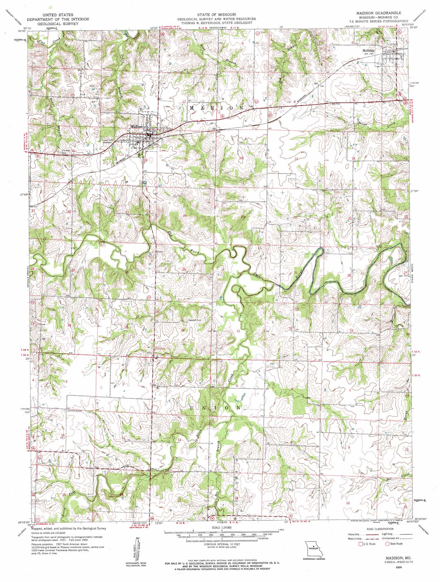
USGS Topo Quad 39092d2 - 1:24,000 scale
| Topo Map Name: | Madison |
| USGS Topo Quad ID: | 39092d2 |
| Print Size: | ca. 21 1/4" wide x 27" high |
| Southeast Coordinates: | 39.375° N latitude / 92.125° W longitude |
| Map Center Coordinates: | 39.4375° N latitude / 92.1875° W longitude |
| U.S. State: | MO |
| Filename: | o39092d2.jpg |
| Download Map JPG Image: | Madison topo map 1:24,000 scale |
| Map Type: | Topographic |
| Topo Series: | 7.5´ |
| Map Scale: | 1:24,000 |
| Source of Map Images: | United States Geological Survey (USGS) |
| Alternate Map Versions: |
Madison MO 1959, updated 1960 Download PDF Buy paper map Madison MO 2012 Download PDF Buy paper map Madison MO 2014 Download PDF Buy paper map |
1:24,000 Topo Quads surrounding Madison
Macon |
Clarence |
Lentner |
Shelbina |
Lakenan |
Jacksonville |
Duncans Bridge |
Woodlawn |
Granville |
Goss |
Moberly |
Middle Grove |
Madison |
Paris West |
Paris East |
Renick |
Clark |
Tulip |
Rowena |
Molino |
Harrisburg |
Sturgeon |
Centralia |
Centralia Ne |
Mexico West |
> Back to 39092a1 at 1:100,000 scale
> Back to 39092a1 at 1:250,000 scale
> Back to U.S. Topo Maps home
Madison topo map: Gazetteer
Madison: Dams
O'Bannon Dam elevation 247m 810′Madison: Populated Places
Holliday elevation 238m 780′Madison elevation 244m 800′
Madison: Streams
Allen Creek elevation 214m 702′Baker Branch elevation 216m 708′
Bee Branch elevation 219m 718′
Horne Branch elevation 223m 731′
Pedee Branch elevation 213m 698′
Reese Fork elevation 226m 741′
Madison digital topo map on disk
Buy this Madison topo map showing relief, roads, GPS coordinates and other geographical features, as a high-resolution digital map file on DVD: