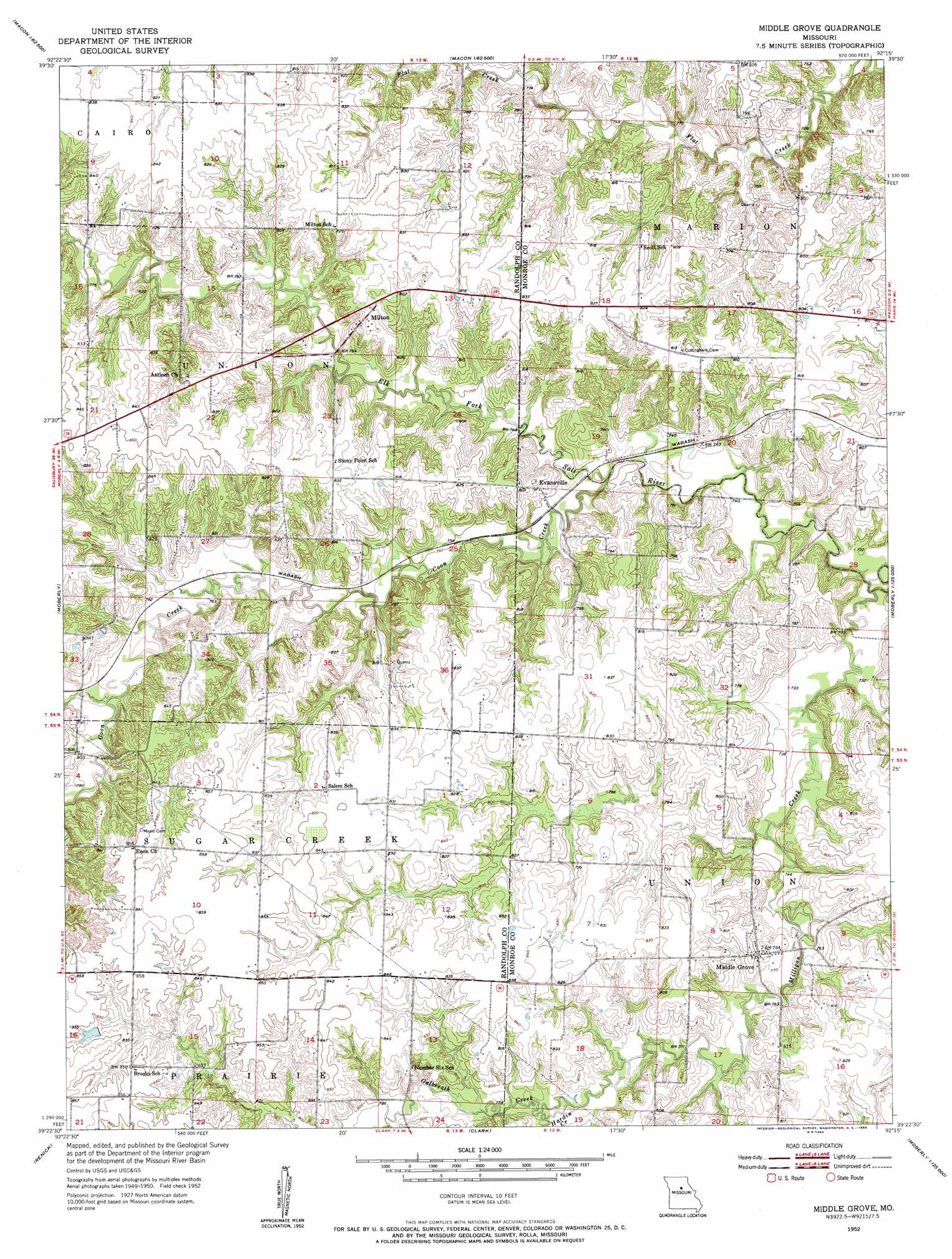
Middle Grove Topo Map Missouri
To zoom in, hover over the map of Middle Grove
USGS Topo Quad 39092d3 - 1:24,000 scale
| Topo Map Name: | Middle Grove |
| USGS Topo Quad ID: | 39092d3 |
| Print Size: | ca. 21 1/4" wide x 27" high |
| Southeast Coordinates: | 39.375° N latitude / 92.25° W longitude |
| Map Center Coordinates: | 39.4375° N latitude / 92.3125° W longitude |
| U.S. State: | MO |
| Filename: | o39092d3.jpg |
| Download Map JPG Image: | Middle Grove topo map 1:24,000 scale |
| Map Type: | Topographic |
| Topo Series: | 7.5´ |
| Map Scale: | 1:24,000 |
| Source of Map Images: | United States Geological Survey (USGS) |
| Alternate Map Versions: |
Middle Grove MO 1952, updated 1955 Download PDF Buy paper map Middle Grove MO 2012 Download PDF Buy paper map Middle Grove MO 2014 Download PDF Buy paper map |
1:24,000 Topo Quads surrounding Middle Grove
Bevier South |
Macon |
Clarence |
Lentner |
Shelbina |
College Mound |
Jacksonville |
Duncans Bridge |
Woodlawn |
Granville |
Huntsville |
Moberly |
Middle Grove |
Madison |
Paris West |
Higbee |
Renick |
Clark |
Tulip |
Rowena |
Burton |
Harrisburg |
Sturgeon |
Centralia |
Centralia Ne |
> Back to 39092a1 at 1:100,000 scale
> Back to 39092a1 at 1:250,000 scale
> Back to U.S. Topo Maps home
Middle Grove topo map: Gazetteer
Middle Grove: Dams
Anderson Lake Dam elevation 249m 816′Brown Lake Dam elevation 248m 813′
Johnson Lake Dam elevation 236m 774′
Mallory Lake Dam elevation 241m 790′
McCowan Dam elevation 241m 790′
Middle Grove: Populated Places
Evansville elevation 233m 764′Middle Grove elevation 242m 793′
Milton elevation 254m 833′
Middle Grove: Reservoirs
Anderson Lake elevation 249m 816′Johnson Lake elevation 236m 774′
Mallory Lake elevation 241m 790′
Middle Grove: Streams
Coon Creek elevation 223m 731′Galbreath Creek elevation 235m 770′
Hardin Creek elevation 235m 770′
Milligan Creek elevation 221m 725′
Middle Grove digital topo map on disk
Buy this Middle Grove topo map showing relief, roads, GPS coordinates and other geographical features, as a high-resolution digital map file on DVD: