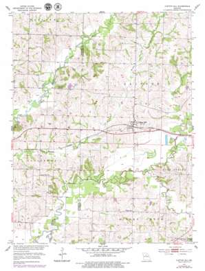
Clifton Hill Topo Map Missouri
To zoom in, hover over the map of Clifton Hill
USGS Topo Quad 39092d6 - 1:24,000 scale
| Topo Map Name: | Clifton Hill |
| USGS Topo Quad ID: | 39092d6 |
| Print Size: | ca. 21 1/4" wide x 27" high |
| Southeast Coordinates: | 39.375° N latitude / 92.625° W longitude |
| Map Center Coordinates: | 39.4375° N latitude / 92.6875° W longitude |
| U.S. State: | MO |
| Filename: | o39092d6.jpg |
| Download Map JPG Image: | Clifton Hill topo map 1:24,000 scale |
| Map Type: | Topographic |
| Topo Series: | 7.5´ |
| Map Scale: | 1:24,000 |
| Source of Map Images: | United States Geological Survey (USGS) |
| Alternate Map Versions: |
Clifton Hill MO 1953, updated 1955 Download PDF Buy paper map Clifton Hill MO 1953, updated 1979 Download PDF Buy paper map Clifton Hill MO 2012 Download PDF Buy paper map Clifton Hill MO 2014 Download PDF Buy paper map |
1:24,000 Topo Quads surrounding Clifton Hill
> Back to 39092a1 at 1:100,000 scale
> Back to 39092a1 at 1:250,000 scale
> Back to U.S. Topo Maps home
Clifton Hill topo map: Gazetteer
Clifton Hill: Dams
Brown Lake Dam elevation 206m 675′Dan Shepherd Dam elevation 217m 711′
J P Ryals Lake Dam elevation 212m 695′
Quinn and Fitzgerald Lake Dam elevation 203m 666′
Clifton Hill: Populated Places
Clifton Hill elevation 218m 715′Mount Airy elevation 228m 748′
Clifton Hill: Reservoirs
Big Lake elevation 217m 711′Brown Lake elevation 206m 675′
J P Ryals Lake elevation 212m 695′
Quinn and Fitzgerald Lake elevation 203m 666′
Clifton Hill: Streams
Dark Creek elevation 198m 649′Silver Creek elevation 195m 639′
Sweet Spring Creek elevation 198m 649′
Clifton Hill digital topo map on disk
Buy this Clifton Hill topo map showing relief, roads, GPS coordinates and other geographical features, as a high-resolution digital map file on DVD:


