Bevier North Topo Map Missouri
To zoom in, hover over the map of Bevier North
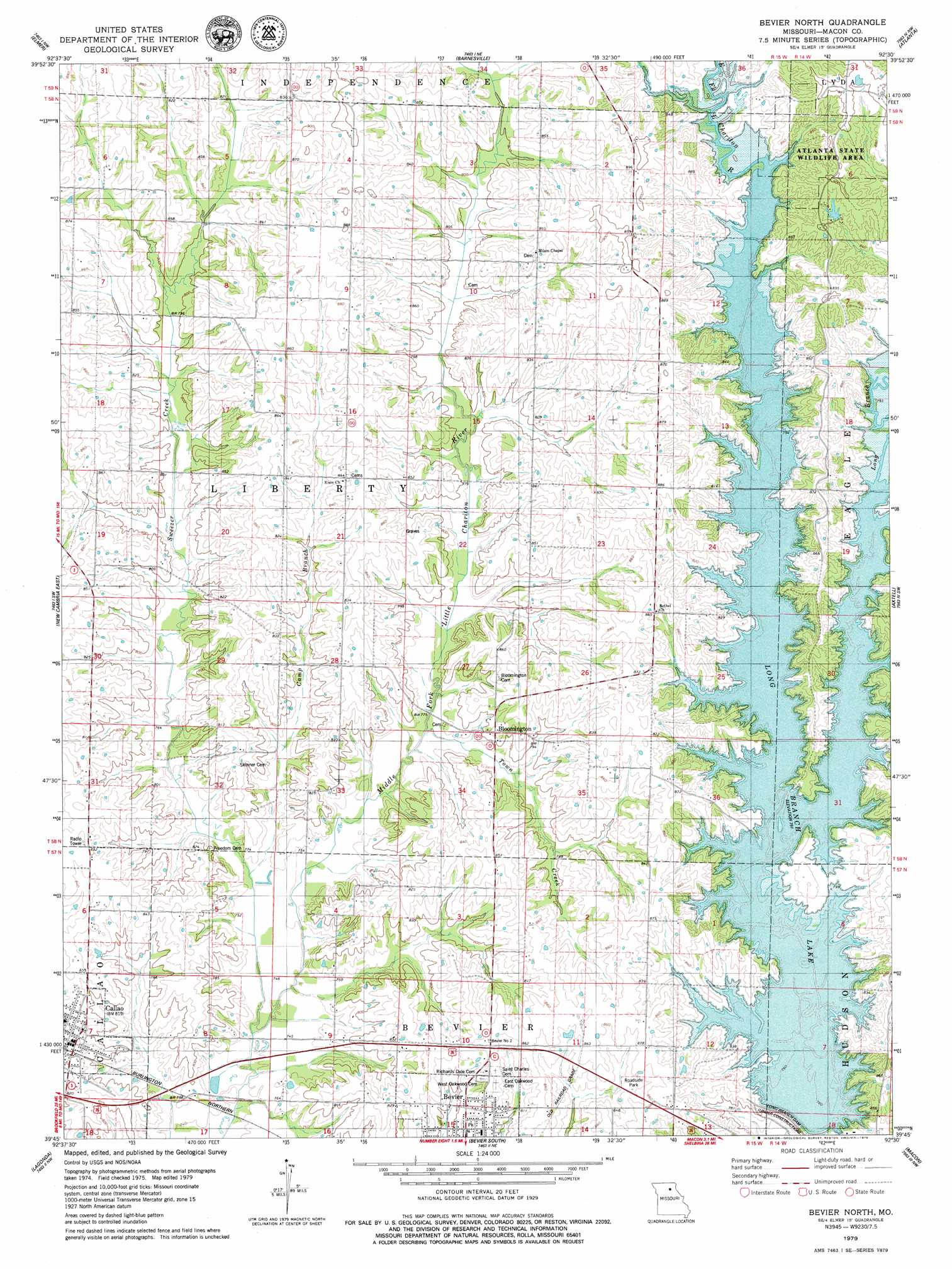
USGS Topo Quad 39092g5 - 1:24,000 scale
| Topo Map Name: | Bevier North |
| USGS Topo Quad ID: | 39092g5 |
| Print Size: | ca. 21 1/4" wide x 27" high |
| Southeast Coordinates: | 39.75° N latitude / 92.5° W longitude |
| Map Center Coordinates: | 39.8125° N latitude / 92.5625° W longitude |
| U.S. State: | MO |
| Filename: | o39092g5.jpg |
| Download Map JPG Image: | Bevier North topo map 1:24,000 scale |
| Map Type: | Topographic |
| Topo Series: | 7.5´ |
| Map Scale: | 1:24,000 |
| Source of Map Images: | United States Geological Survey (USGS) |
| Alternate Map Versions: |
Bevier North MO 1979, updated 1979 Download PDF Buy paper map Bevier North MO 2012 Download PDF Buy paper map Bevier North MO 2014 Download PDF Buy paper map |
1:24,000 Topo Quads surrounding Bevier North
Nind |
Gifford |
Millard |
La Plata |
Locust Hill |
New Boston |
Elmer |
Barnesville |
Atlanta |
Sue City |
New Cambria West |
New Cambria East |
Bevier North |
Axtell |
Redman |
Wien |
Lagonda |
Bevier South |
Macon |
Clarence |
Bynumville |
Prairie Hill |
College Mound |
Jacksonville |
Duncans Bridge |
> Back to 39092e1 at 1:100,000 scale
> Back to 39092a1 at 1:250,000 scale
> Back to U.S. Topo Maps home
Bevier North topo map: Gazetteer
Bevier North: Dams
Claude Bloomberg Dam elevation 266m 872′Long Branch Dam elevation 241m 790′
McVicker Lake Dam elevation 243m 797′
Bevier North: Populated Places
Bloomington elevation 251m 823′Callao elevation 250m 820′
Seney elevation 269m 882′
Bevier North: Post Offices
Seney Post Office elevation 269m 882′Bevier North: Reservoirs
Claude Bloomberg Lake elevation 266m 872′Long Branch Lake elevation 242m 793′
Bevier North: Streams
Camp Branch elevation 228m 748′Lick Creek elevation 243m 797′
Long Branch elevation 241m 790′
Sweezer Creek elevation 226m 741′
Town Creek elevation 232m 761′
Bevier North digital topo map on disk
Buy this Bevier North topo map showing relief, roads, GPS coordinates and other geographical features, as a high-resolution digital map file on DVD: