Leonard Topo Map Missouri
To zoom in, hover over the map of Leonard
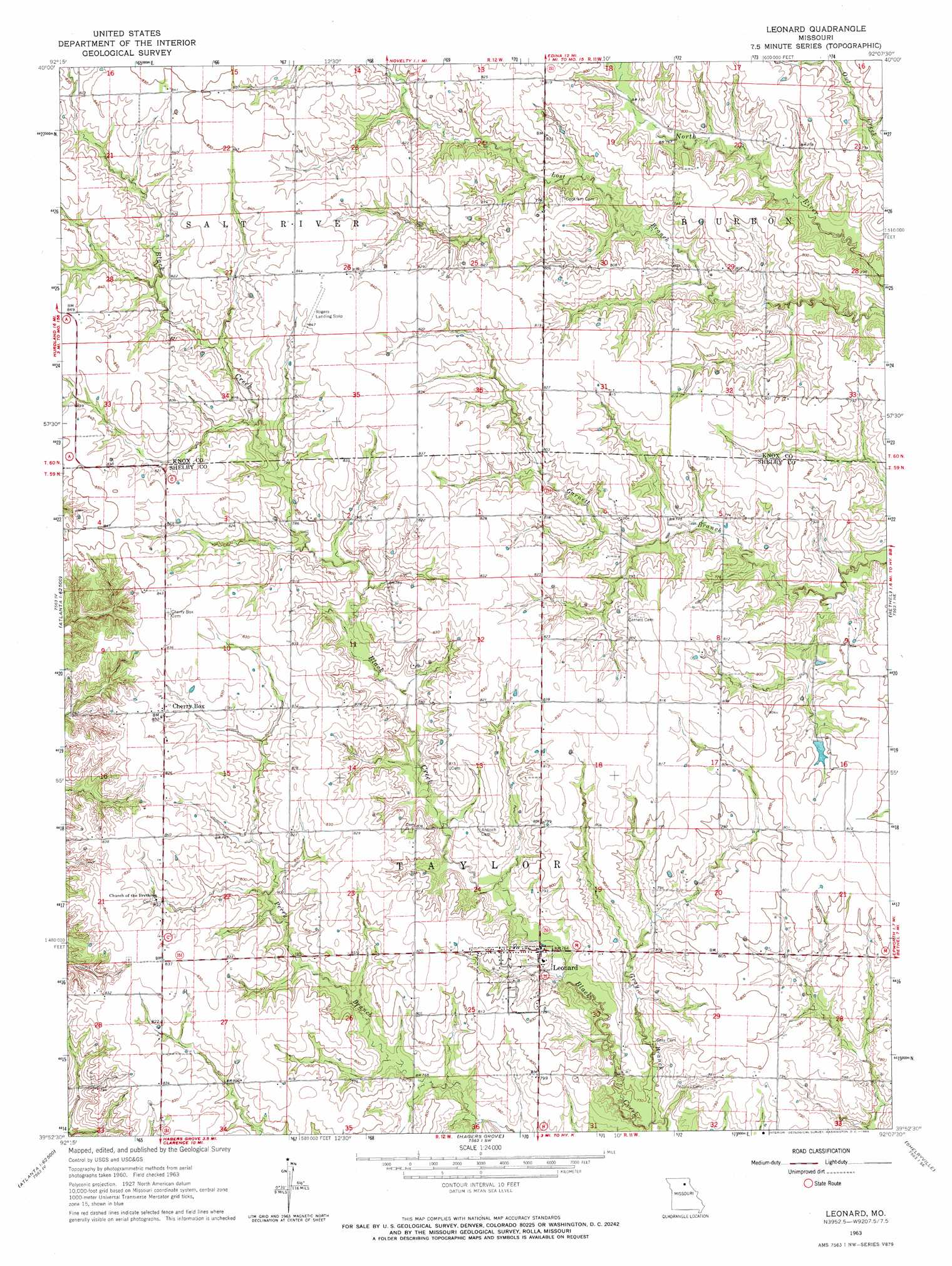
USGS Topo Quad 39092h2 - 1:24,000 scale
| Topo Map Name: | Leonard |
| USGS Topo Quad ID: | 39092h2 |
| Print Size: | ca. 21 1/4" wide x 27" high |
| Southeast Coordinates: | 39.875° N latitude / 92.125° W longitude |
| Map Center Coordinates: | 39.9375° N latitude / 92.1875° W longitude |
| U.S. State: | MO |
| Filename: | o39092h2.jpg |
| Download Map JPG Image: | Leonard topo map 1:24,000 scale |
| Map Type: | Topographic |
| Topo Series: | 7.5´ |
| Map Scale: | 1:24,000 |
| Source of Map Images: | United States Geological Survey (USGS) |
| Alternate Map Versions: |
Leonard MO 1963, updated 1965 Download PDF Buy paper map Leonard MO 2012 Download PDF Buy paper map Leonard MO 2014 Download PDF Buy paper map |
1:24,000 Topo Quads surrounding Leonard
Brashear |
Hurdland |
Edina |
Knox City |
Deer Ridge |
La Plata |
Locust Hill |
Novelty |
Edina Se |
La Belle |
Atlanta |
Sue City |
Leonard |
Bethel |
Newark |
Axtell |
Redman |
Hagers Grove |
Shelbyville |
Burksville |
Macon |
Clarence |
Lentner |
Shelbina |
Lakenan |
> Back to 39092e1 at 1:100,000 scale
> Back to 39092a1 at 1:250,000 scale
> Back to U.S. Topo Maps home
Leonard topo map: Gazetteer
Leonard: Dams
Browning Lake Dam elevation 232m 761′Browning Lake Dam elevation 242m 793′
Caldwell Lake Section 6 Dam elevation 237m 777′
Caldwell Lake Section 7 Dam elevation 241m 790′
Leonard: Populated Places
Cherry Box elevation 253m 830′Leonard elevation 238m 780′
Leonard: Streams
Gray Branch elevation 226m 741′Hilton Branch elevation 231m 757′
Leonard digital topo map on disk
Buy this Leonard topo map showing relief, roads, GPS coordinates and other geographical features, as a high-resolution digital map file on DVD: