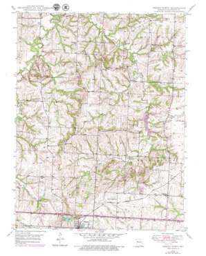
Odessa North Topo Map Missouri
To zoom in, hover over the map of Odessa North
USGS Topo Quad 39093a8 - 1:24,000 scale
| Topo Map Name: | Odessa North |
| USGS Topo Quad ID: | 39093a8 |
| Print Size: | ca. 21 1/4" wide x 27" high |
| Southeast Coordinates: | 39° N latitude / 93.875° W longitude |
| Map Center Coordinates: | 39.0625° N latitude / 93.9375° W longitude |
| U.S. State: | MO |
| Filename: | o39093a8.jpg |
| Download Map JPG Image: | Odessa North topo map 1:24,000 scale |
| Map Type: | Topographic |
| Topo Series: | 7.5´ |
| Map Scale: | 1:24,000 |
| Source of Map Images: | United States Geological Survey (USGS) |
| Alternate Map Versions: |
Odessa North MO 1949, updated 1976 Download PDF Buy paper map Odessa North MO 1950 Download PDF Buy paper map Odessa North MO 2012 Download PDF Buy paper map Odessa North MO 2015 Download PDF Buy paper map |
1:24,000 Topo Quads surrounding Odessa North
> Back to 39093a1 at 1:100,000 scale
> Back to 39092a1 at 1:250,000 scale
> Back to U.S. Topo Maps home
Odessa North topo map: Gazetteer
Odessa North: Dams
Bullard Lake Dam elevation 237m 777′Coats Lake Dam elevation 235m 770′
Fahrmeier Lake Dam elevation 235m 770′
Fahrmeier Lake Dam elevation 245m 803′
Hoeppner North Lake Dam elevation 249m 816′
Huenefeld Lake Dam elevation 233m 764′
Huenfeld Lake Dam elevation 226m 741′
Kuester Lake Dam elevation 241m 790′
Lake Venita Dam elevation 262m 859′
Land of Lakes Dam North elevation 260m 853′
Land of Lakes Dam South elevation 247m 810′
Little Sni-A-Bar Watershed Structure Number 1 Dam elevation 239m 784′
Little Sni-A-Bar Watershed Structure Number 1-S Dam elevation 239m 784′
Little Sni-A-Bar Watershed Structure Number 28 Dam elevation 257m 843′
Little Sni-A-Bar Watershed Structure Number 29 Dam elevation 226m 741′
Little Sni-A-Bar Watershed Structure Number 30 Dam elevation 229m 751′
Little Sni-A-Bar Watershed Structure Number 31 Dam elevation 230m 754′
Little Sni-A-Bar Watershed Structure Number 33 Dam elevation 224m 734′
Little Sni-A-Bar Watershed Structure Number 39 Dam elevation 241m 790′
Little Sni-A-Bar Watershed Structure Number 4 Dam elevation 231m 757′
Little Sni-A-Bar Watershed Structure Number 41 Dam elevation 253m 830′
Little Sni-A-Bar Watershed Structure Number 42 Dam elevation 275m 902′
Little Sni-A-Bar Watershed Structure Number 43 Dam elevation 271m 889′
Little Sni-A-Bar Watershed Structure Number 44 Dam elevation 265m 869′
Little Sni-A-Bar Watershed Structure Number 45 Dam elevation 277m 908′
Odessa Hills Lake Dam elevation 236m 774′
RLDS Church Campground Upper Lake Dam elevation 226m 741′
Rodick Lake Dam elevation 235m 770′
Wehmueller Lake Dam elevation 234m 767′
Wellington-Napoleon Watershed Structure V-21 Dam elevation 225m 738′
Wooden Lake Section 27 Dam elevation 253m 830′
Odessa North: Populated Places
Greenton elevation 304m 997′Odessa North: Reservoirs
Lafayette County Lake Number 4 elevation 231m 757′Lake Venita elevation 262m 859′
Land of Lakes Reservoir elevation 260m 853′
Number 147 Reservoir elevation 235m 770′
Number 188 Reservoir elevation 237m 777′
Odessa Hills Lake elevation 236m 774′
Odessa North: Streams
Big Branch elevation 211m 692′East Fork Sni-A-Bar Creek elevation 211m 692′
Odessa North: Summits
Bryant Knob elevation 275m 902′Odessa North digital topo map on disk
Buy this Odessa North topo map showing relief, roads, GPS coordinates and other geographical features, as a high-resolution digital map file on DVD:


