Lexington West Topo Map Missouri
To zoom in, hover over the map of Lexington West
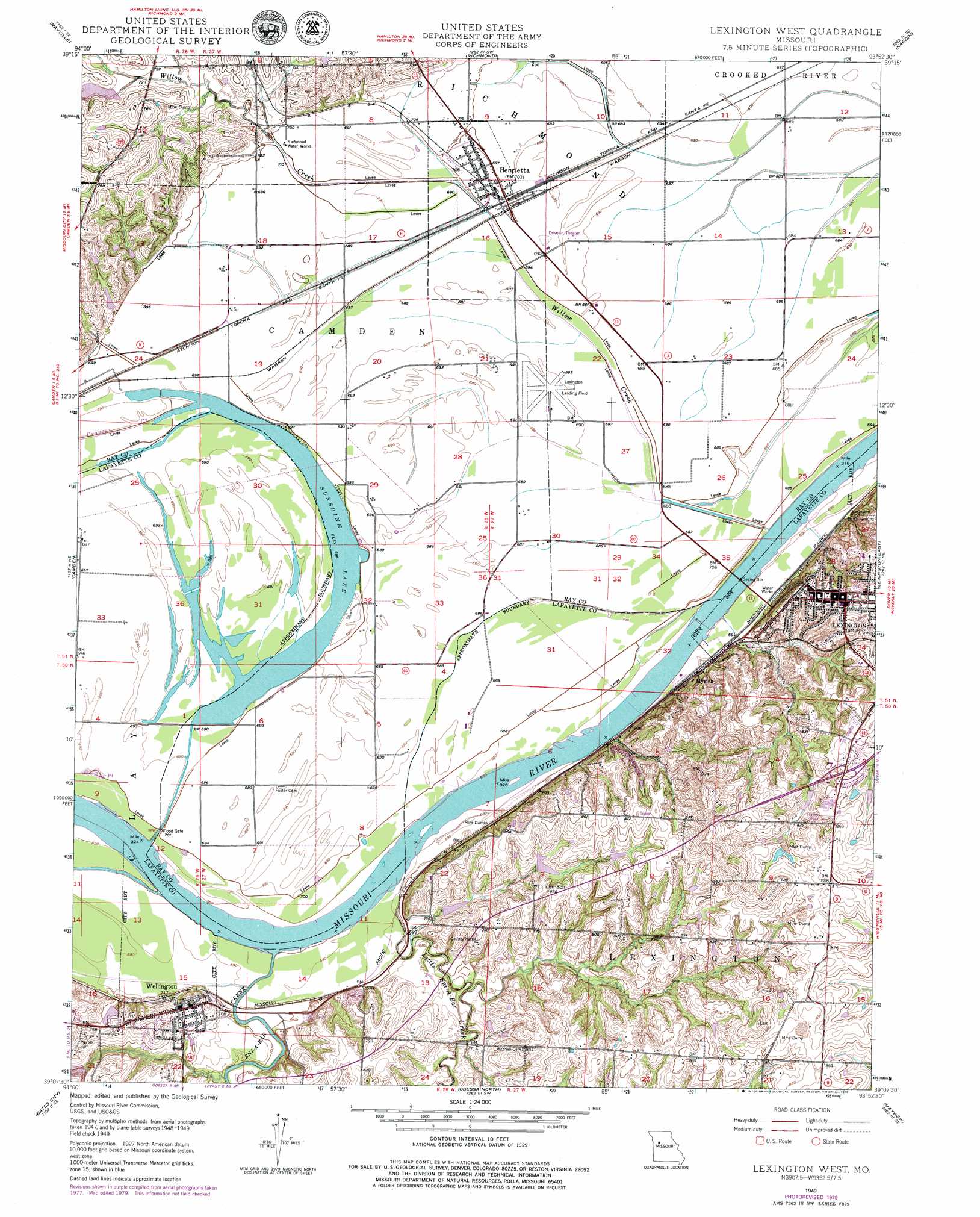
USGS Topo Quad 39093b8 - 1:24,000 scale
| Topo Map Name: | Lexington West |
| USGS Topo Quad ID: | 39093b8 |
| Print Size: | ca. 21 1/4" wide x 27" high |
| Southeast Coordinates: | 39.125° N latitude / 93.875° W longitude |
| Map Center Coordinates: | 39.1875° N latitude / 93.9375° W longitude |
| U.S. State: | MO |
| Filename: | o39093b8.jpg |
| Download Map JPG Image: | Lexington West topo map 1:24,000 scale |
| Map Type: | Topographic |
| Topo Series: | 7.5´ |
| Map Scale: | 1:24,000 |
| Source of Map Images: | United States Geological Survey (USGS) |
| Alternate Map Versions: |
Lexington West MO 1949, updated 1963 Download PDF Buy paper map Lexington West MO 1949, updated 1965 Download PDF Buy paper map Lexington West MO 1949, updated 1979 Download PDF Buy paper map Lexington West MO 1950, updated 1965 Download PDF Buy paper map Lexington West MO 2012 Download PDF Buy paper map Lexington West MO 2015 Download PDF Buy paper map |
1:24,000 Topo Quads surrounding Lexington West
Lawson |
Knoxville |
Millville |
Stet |
Roads |
Excelsior Springs |
Rayville |
Richmond |
Hardin |
Norborne |
Buckner |
Camden |
Lexington West |
Lexington East |
Dover |
Oak Grove |
Bates City |
Odessa North |
Mayview |
Higginsville |
Tarsney Lakes |
Chapel Hill |
Odessa South |
Fayetteville |
Knob Noster Nw |
> Back to 39093a1 at 1:100,000 scale
> Back to 39092a1 at 1:250,000 scale
> Back to U.S. Topo Maps home
Lexington West topo map: Gazetteer
Lexington West: Airports
Lexington Municipal Airport elevation 211m 692′Lexington West: Bends
Bootlegger Bend elevation 208m 682′Sni Bend elevation 208m 682′
Lexington West: Canals
Sunshine Drain elevation 212m 695′Lexington West: Dams
Dam A-21 Dam elevation 226m 741′Hollingsworth Lake Dam elevation 252m 826′
Little Sni-A-Bar Watershed Structure Number 21 Dam elevation 246m 807′
Little Sni-A-Bar Watershed Structure Number 22 Dam elevation 232m 761′
Little Sni-A-Bar Watershed Structure Number 23 Dam elevation 219m 718′
Little Sni-A-Bar Watershed Structure Number 47 Dam elevation 236m 774′
Ray County Dam Number A-1 elevation 225m 738′
Wellington-Napoleon Watershed Structure B-21 Dam elevation 223m 731′
Lexington West: Flats
Sunshine elevation 211m 692′Lexington West: Mines
Graddy Mine elevation 232m 761′Lexington West: Populated Places
Henrietta elevation 216m 708′Lexington elevation 259m 849′
Myrick elevation 213m 698′
Wellington elevation 238m 780′
Lexington West: Reservoirs
Lafayette A-21 Lake elevation 226m 741′Sunshine Lake elevation 210m 688′
Lexington West: Streams
Cravens Creek elevation 209m 685′Little Sni-A-Bar Creek elevation 209m 685′
Sni-A-Bar Creek elevation 208m 682′
Willow Creek elevation 207m 679′
Lexington West digital topo map on disk
Buy this Lexington West topo map showing relief, roads, GPS coordinates and other geographical features, as a high-resolution digital map file on DVD: