Miami Topo Map Missouri
To zoom in, hover over the map of Miami
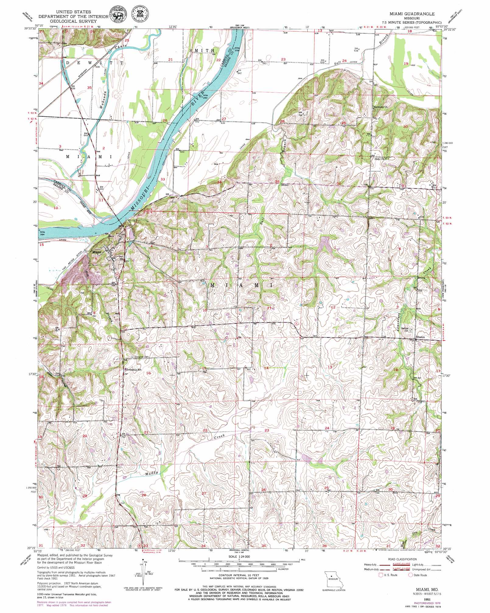
USGS Topo Quad 39093c2 - 1:24,000 scale
| Topo Map Name: | Miami |
| USGS Topo Quad ID: | 39093c2 |
| Print Size: | ca. 21 1/4" wide x 27" high |
| Southeast Coordinates: | 39.25° N latitude / 93.125° W longitude |
| Map Center Coordinates: | 39.3125° N latitude / 93.1875° W longitude |
| U.S. State: | MO |
| Filename: | o39093c2.jpg |
| Download Map JPG Image: | Miami topo map 1:24,000 scale |
| Map Type: | Topographic |
| Topo Series: | 7.5´ |
| Map Scale: | 1:24,000 |
| Source of Map Images: | United States Geological Survey (USGS) |
| Alternate Map Versions: |
Miami MO 1951, updated 1952 Download PDF Buy paper map Miami MO 1951, updated 1979 Download PDF Buy paper map Miami MO 2012 Download PDF Buy paper map Miami MO 2015 Download PDF Buy paper map |
1:24,000 Topo Quads surrounding Miami
Tina |
Hale |
Mendon |
Indian Grove |
Mike |
Standish |
Bosworth |
Brunswick West |
Brunswick East |
Keytesville |
Carrollton East |
Miami Station |
Miami |
New Frankfort |
Cambridge |
Grand Pass |
Malta Bend |
Marshall North |
Slater |
Saline City |
Blackburn |
Shackleford |
Marshall South |
Napton |
Arrow Rock |
> Back to 39093a1 at 1:100,000 scale
> Back to 39092a1 at 1:250,000 scale
> Back to U.S. Topo Maps home
Miami topo map: Gazetteer
Miami: Bends
Lower Miami Bend elevation 192m 629′Middle Miami Bend elevation 192m 629′
Upper Miami Bend elevation 192m 629′
Miami: Dams
Elson Lake Dam elevation 204m 669′Miami: Populated Places
Miami elevation 238m 780′Sharon elevation 228m 748′
Miami: Reservoirs
Elson Reservoir elevation 204m 669′Miami: Streams
Bell Branch elevation 192m 629′Wakenda Creek elevation 192m 629′
Miami digital topo map on disk
Buy this Miami topo map showing relief, roads, GPS coordinates and other geographical features, as a high-resolution digital map file on DVD: