Rothville Topo Map Missouri
To zoom in, hover over the map of Rothville
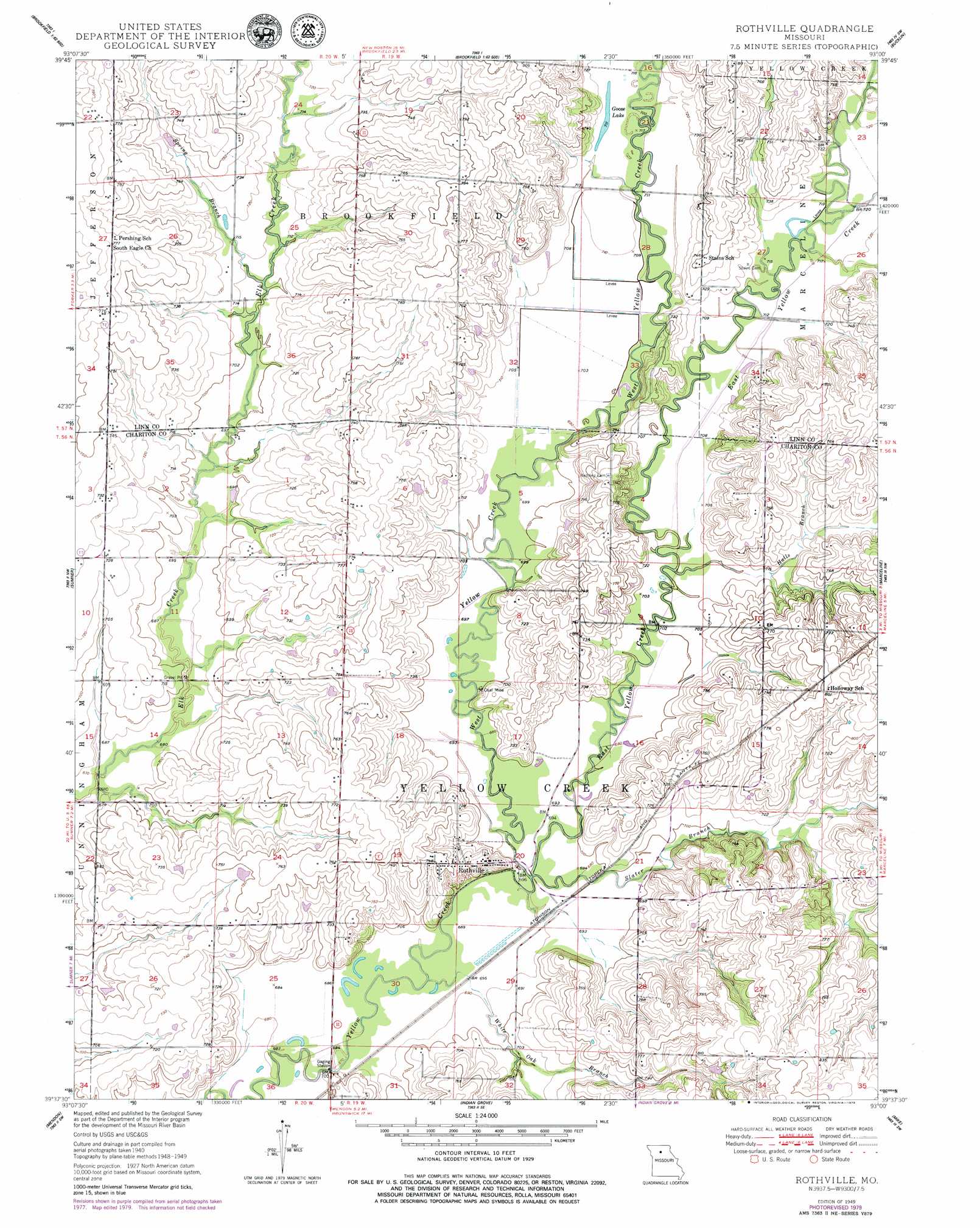
USGS Topo Quad 39093f1 - 1:24,000 scale
| Topo Map Name: | Rothville |
| USGS Topo Quad ID: | 39093f1 |
| Print Size: | ca. 21 1/4" wide x 27" high |
| Southeast Coordinates: | 39.625° N latitude / 93° W longitude |
| Map Center Coordinates: | 39.6875° N latitude / 93.0625° W longitude |
| U.S. State: | MO |
| Filename: | o39093f1.jpg |
| Download Map JPG Image: | Rothville topo map 1:24,000 scale |
| Map Type: | Topographic |
| Topo Series: | 7.5´ |
| Map Scale: | 1:24,000 |
| Source of Map Images: | United States Geological Survey (USGS) |
| Alternate Map Versions: |
Rothville MO 1949 Download PDF Buy paper map Rothville MO 1950 Download PDF Buy paper map Rothville MO 2012 Download PDF Buy paper map Rothville MO 2015 Download PDF Buy paper map |
1:24,000 Topo Quads surrounding Rothville
Eversonville |
Linneus |
Shelby |
Bucklin Nw |
New Boston |
Meadville |
Laclede |
Brookfield |
Bucklin |
New Cambria West |
Fountain Grove |
Sumner |
Rothville |
Marceline |
Wien |
Hale |
Mendon |
Indian Grove |
Mike |
Bynumville |
Bosworth |
Brunswick West |
Brunswick East |
Keytesville |
Salisbury |
> Back to 39093e1 at 1:100,000 scale
> Back to 39092a1 at 1:250,000 scale
> Back to U.S. Topo Maps home
Rothville topo map: Gazetteer
Rothville: Lakes
Goose Lake elevation 218m 715′Rothville: Populated Places
Rothville elevation 226m 741′Rothville: Streams
East Yellow Creek elevation 210m 688′Halls Branch elevation 213m 698′
Slater Branch elevation 210m 688′
Spring Branch elevation 213m 698′
West Yellow Creek elevation 210m 688′
White Oak Branch elevation 207m 679′
Rothville digital topo map on disk
Buy this Rothville topo map showing relief, roads, GPS coordinates and other geographical features, as a high-resolution digital map file on DVD: