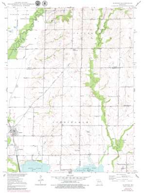
Sumner Topo Map Missouri
To zoom in, hover over the map of Sumner
USGS Topo Quad 39093f2 - 1:24,000 scale
| Topo Map Name: | Sumner |
| USGS Topo Quad ID: | 39093f2 |
| Print Size: | ca. 21 1/4" wide x 27" high |
| Southeast Coordinates: | 39.625° N latitude / 93.125° W longitude |
| Map Center Coordinates: | 39.6875° N latitude / 93.1875° W longitude |
| U.S. State: | MO |
| Filename: | o39093f2.jpg |
| Download Map JPG Image: | Sumner topo map 1:24,000 scale |
| Map Type: | Topographic |
| Topo Series: | 7.5´ |
| Map Scale: | 1:24,000 |
| Source of Map Images: | United States Geological Survey (USGS) |
| Alternate Map Versions: |
Sumner MO 1949 Download PDF Buy paper map Sumner MO 1949, updated 1979 Download PDF Buy paper map Sumner MO 1950 Download PDF Buy paper map Sumner MO 1950 Download PDF Buy paper map Sumner MO 2012 Download PDF Buy paper map Sumner MO 2015 Download PDF Buy paper map |
1:24,000 Topo Quads surrounding Sumner
> Back to 39093e1 at 1:100,000 scale
> Back to 39092a1 at 1:250,000 scale
> Back to U.S. Topo Maps home
Sumner topo map: Gazetteer
Sumner: Dams
C R Wetzel Lake Dam elevation 218m 715′Sumner: Lakes
Boiler Lake elevation 205m 672′Harlow Fay Lakes elevation 204m 669′
Lewis Lakes elevation 204m 669′
Ransom Lake elevation 205m 672′
Sumner: Populated Places
Cunningham elevation 208m 682′Forker elevation 237m 777′
Sumner elevation 208m 682′
Sumner: Post Offices
Forker Boomer Post Office elevation 237m 777′Sumner: Reservoirs
C R Wetzel Lake elevation 218m 715′Sumner: Streams
Coal Creek elevation 204m 669′Little Turkey Creek elevation 213m 698′
Tough Branch elevation 200m 656′
Turkey Creek elevation 202m 662′
Sumner: Trails
Swan Lake National Wildlife Refuge Habitat Trail elevation 207m 679′Sumner digital topo map on disk
Buy this Sumner topo map showing relief, roads, GPS coordinates and other geographical features, as a high-resolution digital map file on DVD:


