Flat Creek Topo Map Missouri
To zoom in, hover over the map of Flat Creek
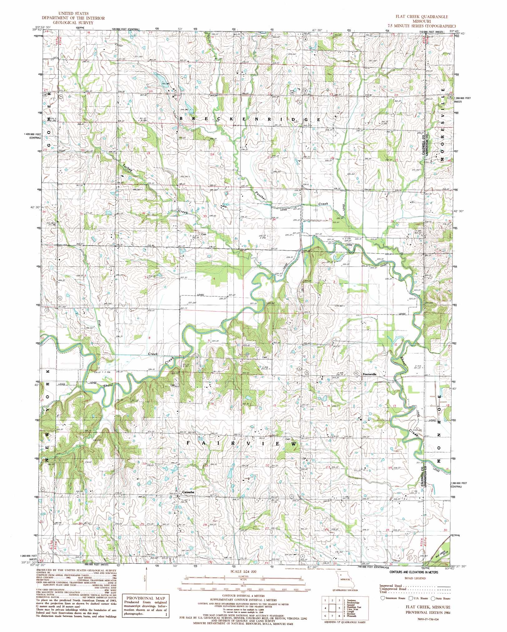
USGS Topo Quad 39093f7 - 1:24,000 scale
| Topo Map Name: | Flat Creek |
| USGS Topo Quad ID: | 39093f7 |
| Print Size: | ca. 21 1/4" wide x 27" high |
| Southeast Coordinates: | 39.625° N latitude / 93.75° W longitude |
| Map Center Coordinates: | 39.6875° N latitude / 93.8125° W longitude |
| U.S. State: | MO |
| Filename: | o39093f7.jpg |
| Download Map JPG Image: | Flat Creek topo map 1:24,000 scale |
| Map Type: | Topographic |
| Topo Series: | 7.5´ |
| Map Scale: | 1:24,000 |
| Source of Map Images: | United States Geological Survey (USGS) |
| Alternate Map Versions: |
Flat Creek MO 1984, updated 1985 Download PDF Buy paper map Flat Creek MO 2012 Download PDF Buy paper map Flat Creek MO 2015 Download PDF Buy paper map |
1:24,000 Topo Quads surrounding Flat Creek
Altamont |
Gallatin |
Jamesport |
Shearwood |
Farmersville |
Kidder |
Nettleton |
Breckenridge |
Sampsel |
Chillicothe |
Hamilton West |
Hamilton East |
Flat Creek |
Utica West |
Utica East |
Polo |
Cowgill |
Braymer |
Plymouth |
Coloma |
Knoxville |
Millville |
Stet |
Roads |
Bogard |
> Back to 39093e1 at 1:100,000 scale
> Back to 39092a1 at 1:250,000 scale
> Back to U.S. Topo Maps home
Flat Creek topo map: Gazetteer
Flat Creek: Dams
Kampen Lake Section 20 Dam elevation 255m 836′Niehaus Brothers Lake Dam elevation 239m 784′
Sieck Lake Dam elevation 243m 797′
Flat Creek: Populated Places
Catawba elevation 263m 862′Proctorville elevation 244m 800′
Flat Creek: Reservoirs
Braymer Lake elevation 220m 721′Number 167 Reservoir elevation 239m 784′
Owens Lake elevation 255m 836′
Sieck Lake elevation 243m 797′
Flat Creek: Streams
Flat Creek elevation 226m 741′Otter Creek elevation 228m 748′
Panther Creek elevation 220m 721′
Turkey Creek elevation 224m 734′
Flat Creek digital topo map on disk
Buy this Flat Creek topo map showing relief, roads, GPS coordinates and other geographical features, as a high-resolution digital map file on DVD: