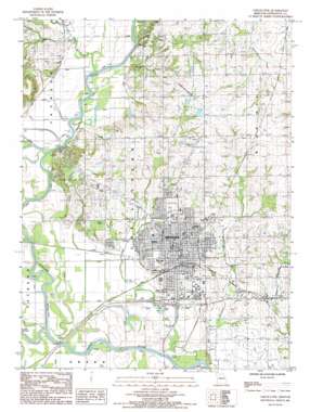
Chillicothe Topo Map Missouri
To zoom in, hover over the map of Chillicothe
USGS Topo Quad 39093g5 - 1:24,000 scale
| Topo Map Name: | Chillicothe |
| USGS Topo Quad ID: | 39093g5 |
| Print Size: | ca. 21 1/4" wide x 27" high |
| Southeast Coordinates: | 39.75° N latitude / 93.5° W longitude |
| Map Center Coordinates: | 39.8125° N latitude / 93.5625° W longitude |
| U.S. State: | MO |
| Filename: | o39093g5.jpg |
| Download Map JPG Image: | Chillicothe topo map 1:24,000 scale |
| Map Type: | Topographic |
| Topo Series: | 7.5´ |
| Map Scale: | 1:24,000 |
| Source of Map Images: | United States Geological Survey (USGS) |
| Alternate Map Versions: |
Chillicothe MO 1984, updated 1985 Download PDF Buy paper map Chillicothe MO 2012 Download PDF Buy paper map Chillicothe MO 2015 Download PDF Buy paper map |
1:24,000 Topo Quads surrounding Chillicothe
> Back to 39093e1 at 1:100,000 scale
> Back to 39092a1 at 1:250,000 scale
> Back to U.S. Topo Maps home
Chillicothe topo map: Gazetteer
Chillicothe: Airports
Chillicothe Municipal Airport elevation 233m 764′Chillicothe: Bridges
Graham Mill Bridge (historical) elevation 211m 692′Chillicothe: Dams
Carlton Lake Dam elevation 221m 725′Copeland Lake Dam elevation 244m 800′
Hamilton Lake East Dam elevation 240m 787′
Hamilton Lake West Dam elevation 219m 718′
Litton Lake North Dam elevation 239m 784′
Litton Lake South Dam elevation 238m 780′
Olenhouse Lake Dam elevation 252m 826′
Smith Lake Dam elevation 270m 885′
Thistlethwait Lake Dam elevation 229m 751′
Chillicothe: Populated Places
Chillicothe elevation 243m 797′Chillicothe: Reservoirs
Number 56 Lake elevation 252m 826′Chillicothe: Streams
Coon Creek elevation 204m 669′Lake Creek elevation 208m 682′
Owl Creek elevation 212m 695′
Thompson River elevation 207m 679′
Chillicothe digital topo map on disk
Buy this Chillicothe topo map showing relief, roads, GPS coordinates and other geographical features, as a high-resolution digital map file on DVD:


