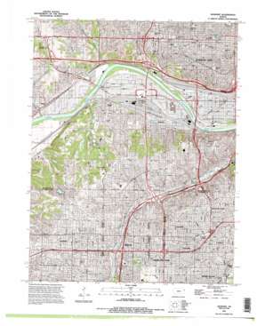
Shawnee Topo Map Kansas
To zoom in, hover over the map of Shawnee
USGS Topo Quad 39094a6 - 1:24,000 scale
| Topo Map Name: | Shawnee |
| USGS Topo Quad ID: | 39094a6 |
| Print Size: | ca. 21 1/4" wide x 27" high |
| Southeast Coordinates: | 39° N latitude / 94.625° W longitude |
| Map Center Coordinates: | 39.0625° N latitude / 94.6875° W longitude |
| U.S. State: | KS |
| Filename: | o39094a6.jpg |
| Download Map JPG Image: | Shawnee topo map 1:24,000 scale |
| Map Type: | Topographic |
| Topo Series: | 7.5´ |
| Map Scale: | 1:24,000 |
| Source of Map Images: | United States Geological Survey (USGS) |
| Alternate Map Versions: |
Shawnee KS 1934 Download PDF Buy paper map Shawnee KS 1934, updated 1954 Download PDF Buy paper map Shawnee KS 1957, updated 1958 Download PDF Buy paper map Shawnee KS 1964, updated 1966 Download PDF Buy paper map Shawnee KS 1964, updated 1971 Download PDF Buy paper map Shawnee KS 1964, updated 1976 Download PDF Buy paper map Shawnee KS 1964, updated 1986 Download PDF Buy paper map Shawnee KS 1991, updated 1995 Download PDF Buy paper map Shawnee KS 2009 Download PDF Buy paper map Shawnee KS 2012 Download PDF Buy paper map Shawnee KS 2015 Download PDF Buy paper map |
1:24,000 Topo Quads surrounding Shawnee
> Back to 39094a1 at 1:100,000 scale
> Back to 39094a1 at 1:250,000 scale
> Back to U.S. Topo Maps home
Shawnee topo map: Gazetteer
Shawnee: Bridges
Tomahawk Road Bridge elevation 276m 905′Turner Memorial Bridge elevation 220m 721′
Shawnee: Crossings
Interchange 228A elevation 301m 987′Interchange 228B and 228C elevation 293m 961′
Interchange 229 elevation 283m 928′
Interchange 230 elevation 275m 902′
Interchange 231 elevation 268m 879′
Interchange 232A elevation 259m 849′
Interchange 232B and 232C elevation 257m 843′
Interchange 233 elevation 242m 793′
Interchange 233B elevation 245m 803′
Interchange 2A elevation 240m 787′
Interchange 2B elevation 237m 777′
Interchange 3 elevation 240m 787′
Interchange 4 elevation 238m 780′
Interchange 415 elevation 259m 849′
Interchange 417 elevation 246m 807′
Interchange 418 elevation 246m 807′
Interchange 419 elevation 253m 830′
Interchange 420 elevation 252m 826′
Interchange 422B elevation 239m 784′
Interchange 5A and 5B elevation 276m 905′
Shawnee: Dams
Black Swan Dam elevation 289m 948′Pierson Park Dam elevation 259m 849′
Shawnee: Lakes
Antioch Lake North elevation 299m 980′Shawnee: Levees
Argentine Levee Unit elevation 233m 764′Armourdale Levee Unit elevation 231m 757′
Shawnee: Parks
Antioch Park elevation 306m 1003′Bethany Park elevation 271m 889′
Blue Jacket Park elevation 302m 990′
Bluejacket Fountain and Sculpture Plaza elevation 307m 1007′
Broadmoor Park elevation 315m 1033′
Brown Park elevation 290m 951′
Campbell Park elevation 282m 925′
Chatlain Park elevation 282m 925′
Chatlain Park elevation 286m 938′
Clifton Park elevation 269m 882′
Crestview Park elevation 313m 1026′
Emerson Park elevation 230m 754′
Fairway City Pool elevation 289m 948′
Hickory Hills Park elevation 296m 971′
Highland Park elevation 298m 977′
Huron Park elevation 268m 879′
Kensington Park elevation 276m 905′
Lucyann C Vavra Memorial Park elevation 295m 967′
McCrum Park elevation 294m 964′
Merriam Aquatic Center elevation 290m 951′
Merriam Parks and Recreation elevation 277m 908′
Mission Municipal Pool elevation 292m 958′
Mohawk Park elevation 316m 1036′
Neale Peterson Park elevation 290m 951′
North Park elevation 290m 951′
North Park elevation 290m 951′
Northrup Park elevation 258m 846′
Park on Beverly elevation 299m 980′
Pearl Harbor Park elevation 295m 967′
Pierson County Park elevation 264m 866′
Quail Creek Park elevation 294m 964′
Robinson Park elevation 310m 1017′
Roeland Park Aquatic Center elevation 311m 1020′
Shawnee Park elevation 228m 748′
Shawnee Swimming Pool East elevation 303m 994′
Streamway Park elevation 288m 944′
Sylvester Powell Jouner Community Center elevation 295m 967′
Thomas Anthony Soetaert Aquatic Center elevation 308m 1010′
Veterans Park elevation 317m 1040′
Victor X Andersen Park elevation 294m 964′
Water Works Park elevation 312m 1023′
Waterfall Park elevation 273m 895′
Waterway Park elevation 259m 849′
Werner Park elevation 279m 915′
Westheight Park elevation 253m 830′
Shawnee: Populated Places
American Eagle Mobile Home Estates elevation 233m 764′Argentine elevation 240m 787′
Countryside elevation 301m 987′
Creekside Estates Mobile Home Park elevation 233m 764′
Fairway elevation 291m 954′
Glenbrook Mobile Home Community elevation 264m 866′
Grays Park elevation 275m 902′
Kansas City elevation 265m 869′
Kansas Trailer Village elevation 248m 813′
Kaw View Mobile Home Estates elevation 232m 761′
M And R Mobile Home Park elevation 231m 757′
Merriam elevation 277m 908′
Min - Rock Village elevation 244m 800′
Mission elevation 312m 1023′
Muncie elevation 247m 810′
Quivira Hills Estates Mobile Home Park elevation 298m 977′
Roeland Park elevation 302m 990′
Royal Mobile Home Court elevation 231m 757′
Shawnee elevation 325m 1066′
Sunflower Trailer Park elevation 260m 853′
Turner elevation 252m 826′
Shawnee: Post Offices
Argentine Post Office elevation 232m 761′Indian Springs Post Office elevation 296m 971′
Mission Post Office elevation 289m 948′
Muncie Post Office elevation 234m 767′
Shawnee Branch Post Office elevation 295m 967′
Shawnee Mission Main Office elevation 309m 1013′
Shawnee: Reservoirs
Antioch Lake South elevation 301m 987′Big Eleven Lake elevation 252m 826′
Black Swan Lake elevation 289m 948′
Shawnee: Streams
Brenner Heights Creek elevation 226m 741′Mattoon Creek elevation 220m 721′
Mill Creek elevation 222m 728′
Muncie Creek elevation 221m 725′
Shawnee: Trails
Oregon Trail elevation 284m 931′Turkey Creek Streamway Trail elevation 288m 944′
Shawnee digital topo map on disk
Buy this Shawnee topo map showing relief, roads, GPS coordinates and other geographical features, as a high-resolution digital map file on DVD:


