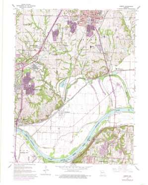
Liberty Topo Map Missouri
To zoom in, hover over the map of Liberty
USGS Topo Quad 39094b4 - 1:24,000 scale
| Topo Map Name: | Liberty |
| USGS Topo Quad ID: | 39094b4 |
| Print Size: | ca. 21 1/4" wide x 27" high |
| Southeast Coordinates: | 39.125° N latitude / 94.375° W longitude |
| Map Center Coordinates: | 39.1875° N latitude / 94.4375° W longitude |
| U.S. State: | MO |
| Filename: | o39094b4.jpg |
| Download Map JPG Image: | Liberty topo map 1:24,000 scale |
| Map Type: | Topographic |
| Topo Series: | 7.5´ |
| Map Scale: | 1:24,000 |
| Source of Map Images: | United States Geological Survey (USGS) |
| Alternate Map Versions: |
Liberty MO 1935, updated 1955 Download PDF Buy paper map Liberty MO 1935, updated 1960 Download PDF Buy paper map Liberty MO 1965, updated 1966 Download PDF Buy paper map Liberty MO 1965, updated 1971 Download PDF Buy paper map Liberty MO 1965, updated 1976 Download PDF Buy paper map Liberty MO 1990, updated 1996 Download PDF Buy paper map Liberty MO 1996, updated 2002 Download PDF Buy paper map Liberty MO 2012 Download PDF Buy paper map Liberty MO 2015 Download PDF Buy paper map |
1:24,000 Topo Quads surrounding Liberty
> Back to 39094a1 at 1:100,000 scale
> Back to 39094a1 at 1:250,000 scale
> Back to U.S. Topo Maps home
Liberty topo map: Gazetteer
Liberty: Bends
Big Blue Bend elevation 218m 715′Liberty Bend elevation 215m 705′
Sissons Bend (historical) elevation 222m 728′
Wayne City Bend (historical) elevation 216m 708′
Liberty: Bridges
Harry S Truman Bridge elevation 217m 711′Independence-Liberty Bridge elevation 222m 728′
Liberty Bend Bridge elevation 216m 708′
Liberty: Crossings
Interchange 12A elevation 254m 833′Interchange 13 elevation 240m 787′
Interchange 14 elevation 248m 813′
Interchange 16 elevation 268m 879′
Interchange 52A elevation 246m 807′
Interchange 52B elevation 241m 790′
Interchange 57 elevation 223m 731′
Liberty: Dams
Catholic Diocese of Kansas City - Saint Joseph Lake Dam elevation 246m 807′Great Midwest Corporation Dam elevation 248m 813′
Great Midwest Lake Dam elevation 252m 826′
Moore Lake Dam elevation 257m 843′
Morgan Lake Dam elevation 260m 853′
Number 173 Dam (historical) elevation 229m 751′
Odd Fellows Home Lake Dam elevation 240m 787′
Virginia Holding Corporation North Lake Dam elevation 250m 820′
Virginia Holding Corporation South Lake Dam elevation 245m 803′
Liberty: Islands
Liberty Island (historical) elevation 222m 728′Liberty: Lakes
Browns Lake (historical) elevation 224m 734′Liberty: Levees
Birmingham Levee Unit elevation 224m 734′Liberty: Parks
Barnes Memorial Fountain elevation 271m 889′Greene Stadium elevation 274m 898′
Midwest Worlds of Fun elevation 266m 872′
Liberty: Populated Places
Birmingham elevation 224m 734′Cement City elevation 242m 793′
Claycomo elevation 246m 807′
Courtney elevation 225m 738′
East Kansas City elevation 238m 780′
Glenaire elevation 244m 800′
Liberty elevation 270m 885′
Minneville elevation 227m 744′
Pleasant Valley elevation 235m 770′
Randolph elevation 234m 767′
Ravena Gardens elevation 252m 826′
River Bend elevation 224m 734′
South Liberty elevation 223m 731′
White Hall Fields elevation 257m 843′
Liberty: Post Offices
Minaville Post Office (historical) elevation 256m 839′Liberty: Reservoirs
Dd Fellows Home Lake elevation 240m 787′Great Midwest Corporation Lake elevation 252m 826′
Number 168 Reservoir elevation 248m 813′
Number 173 Reservoir (historical) elevation 229m 751′
Number 174 Reservoir elevation 245m 803′
Number 175 Reservoir elevation 250m 820′
Number 176 Reservoir elevation 246m 807′
Urban Lake (historical) elevation 231m 757′
William L Howard Lake elevation 260m 853′
Liberty: Streams
Blue River elevation 220m 721′Cates Branch elevation 225m 738′
Little Shoal Creek elevation 224m 734′
Mill Creek elevation 222m 728′
Old Channel Missouri River elevation 218m 715′
Shoal Creek elevation 217m 711′
Sugar Creek elevation 217m 711′
Town Branch elevation 221m 725′
Liberty: Summits
Arsenal Hill elevation 273m 895′Liberty digital topo map on disk
Buy this Liberty topo map showing relief, roads, GPS coordinates and other geographical features, as a high-resolution digital map file on DVD:


