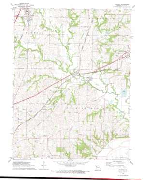
Kearney Topo Map Missouri
To zoom in, hover over the map of Kearney
USGS Topo Quad 39094c3 - 1:24,000 scale
| Topo Map Name: | Kearney |
| USGS Topo Quad ID: | 39094c3 |
| Print Size: | ca. 21 1/4" wide x 27" high |
| Southeast Coordinates: | 39.25° N latitude / 94.25° W longitude |
| Map Center Coordinates: | 39.3125° N latitude / 94.3125° W longitude |
| U.S. State: | MO |
| Filename: | o39094c3.jpg |
| Download Map JPG Image: | Kearney topo map 1:24,000 scale |
| Map Type: | Topographic |
| Topo Series: | 7.5´ |
| Map Scale: | 1:24,000 |
| Source of Map Images: | United States Geological Survey (USGS) |
| Alternate Map Versions: |
Kearney MO 1971, updated 1972 Download PDF Buy paper map Kearney MO 1990, updated 1996 Download PDF Buy paper map Kearney MO 2012 Download PDF Buy paper map Kearney MO 2014 Download PDF Buy paper map |
1:24,000 Topo Quads surrounding Kearney
> Back to 39094a1 at 1:100,000 scale
> Back to 39094a1 at 1:250,000 scale
> Back to U.S. Topo Maps home
Kearney topo map: Gazetteer
Kearney: Airports
Royal Wood Aerodrome Airport elevation 233m 764′Kearney: Dams
Lone Star Lake Dam elevation 236m 774′Williams Creek Watershed Dam Number 4 elevation 251m 823′
Kearney: Lakes
Cooley Lake (historical) elevation 218m 715′Kearney: Populated Places
Kearney elevation 261m 856′Mosby elevation 232m 761′
Prathersville elevation 230m 754′
Stockdale elevation 253m 830′
Kearney: Post Offices
Mosby Post Office elevation 232m 761′Kearney: Reservoirs
Lone Star Lake elevation 236m 774′Kearney: Streams
Carroll Creek elevation 230m 754′Clear Creek elevation 231m 757′
Crockett Creek elevation 229m 751′
Holmes Creek elevation 223m 731′
Muddy Fork elevation 233m 764′
Williams Creek elevation 223m 731′
Kearney digital topo map on disk
Buy this Kearney topo map showing relief, roads, GPS coordinates and other geographical features, as a high-resolution digital map file on DVD:


