Clarksdale Topo Map Missouri
To zoom in, hover over the map of Clarksdale
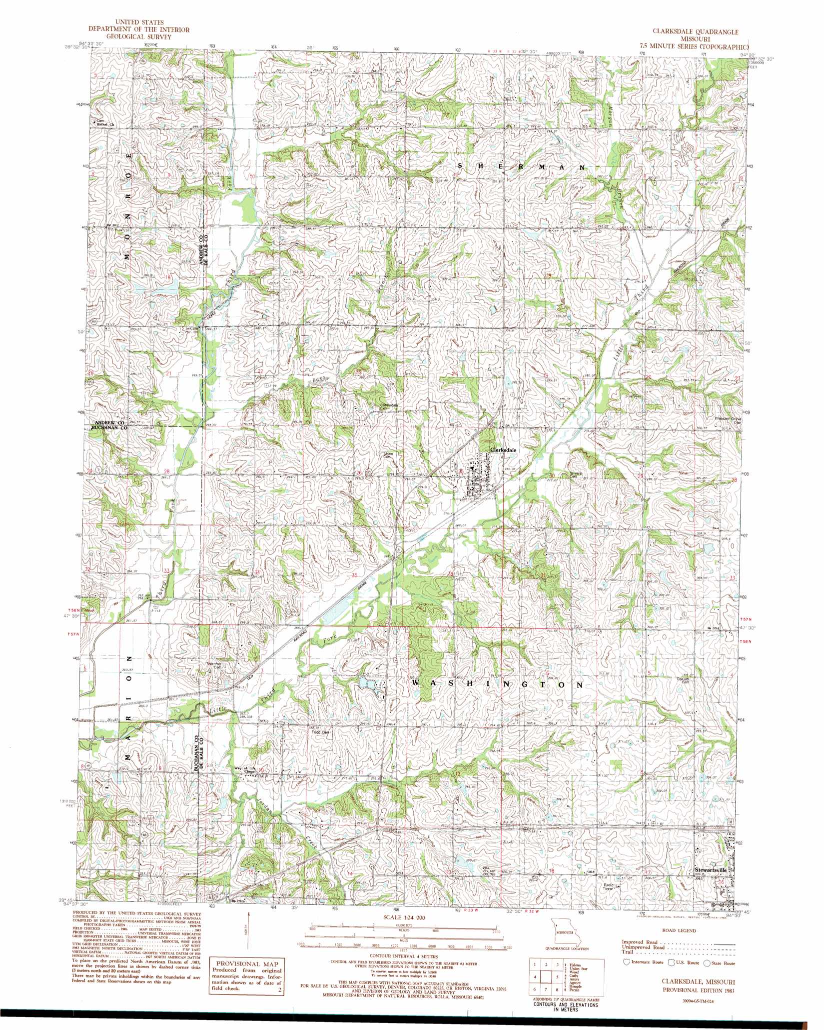
USGS Topo Quad 39094g5 - 1:24,000 scale
| Topo Map Name: | Clarksdale |
| USGS Topo Quad ID: | 39094g5 |
| Print Size: | ca. 21 1/4" wide x 27" high |
| Southeast Coordinates: | 39.75° N latitude / 94.5° W longitude |
| Map Center Coordinates: | 39.8125° N latitude / 94.5625° W longitude |
| U.S. State: | MO |
| Filename: | o39094g5.jpg |
| Download Map JPG Image: | Clarksdale topo map 1:24,000 scale |
| Map Type: | Topographic |
| Topo Series: | 7.5´ |
| Map Scale: | 1:24,000 |
| Source of Map Images: | United States Geological Survey (USGS) |
| Alternate Map Versions: |
Clarksdale MO 1983, updated 1984 Download PDF Buy paper map Clarksdale MO 2012 Download PDF Buy paper map Clarksdale MO 2014 Download PDF Buy paper map |
1:24,000 Topo Quads surrounding Clarksdale
Blockow |
Whitesville |
King City |
Ford City |
Berlin |
Savannah |
Helena |
Union Star |
Wood |
Maysville |
Saint Joseph North |
Cosby |
Clarksdale |
Amity |
Fordham |
Saint Joseph South |
Agency |
Hemple |
Perrin |
Cameron West |
Dearborn |
Edgerton |
Gower |
Plattsburg |
Lathrop |
> Back to 39094e1 at 1:100,000 scale
> Back to 39094a1 at 1:250,000 scale
> Back to U.S. Topo Maps home
Clarksdale topo map: Gazetteer
Clarksdale: Dams
Baker Dam elevation 264m 866′Peterson Lake Dam elevation 285m 935′
Clarksdale: Populated Places
Bayfield (historical) elevation 270m 885′Boxford (historical) elevation 292m 958′
Clarksdale elevation 286m 938′
Clarksdale: Reservoirs
Baker Lake elevation 264m 866′Peterson Lake elevation 285m 935′
Clarksdale: Streams
Bays Branch elevation 264m 866′Jordan Creek elevation 262m 859′
Morgan Branch elevation 276m 905′
Clarksdale digital topo map on disk
Buy this Clarksdale topo map showing relief, roads, GPS coordinates and other geographical features, as a high-resolution digital map file on DVD: