Cosby Topo Map Missouri
To zoom in, hover over the map of Cosby
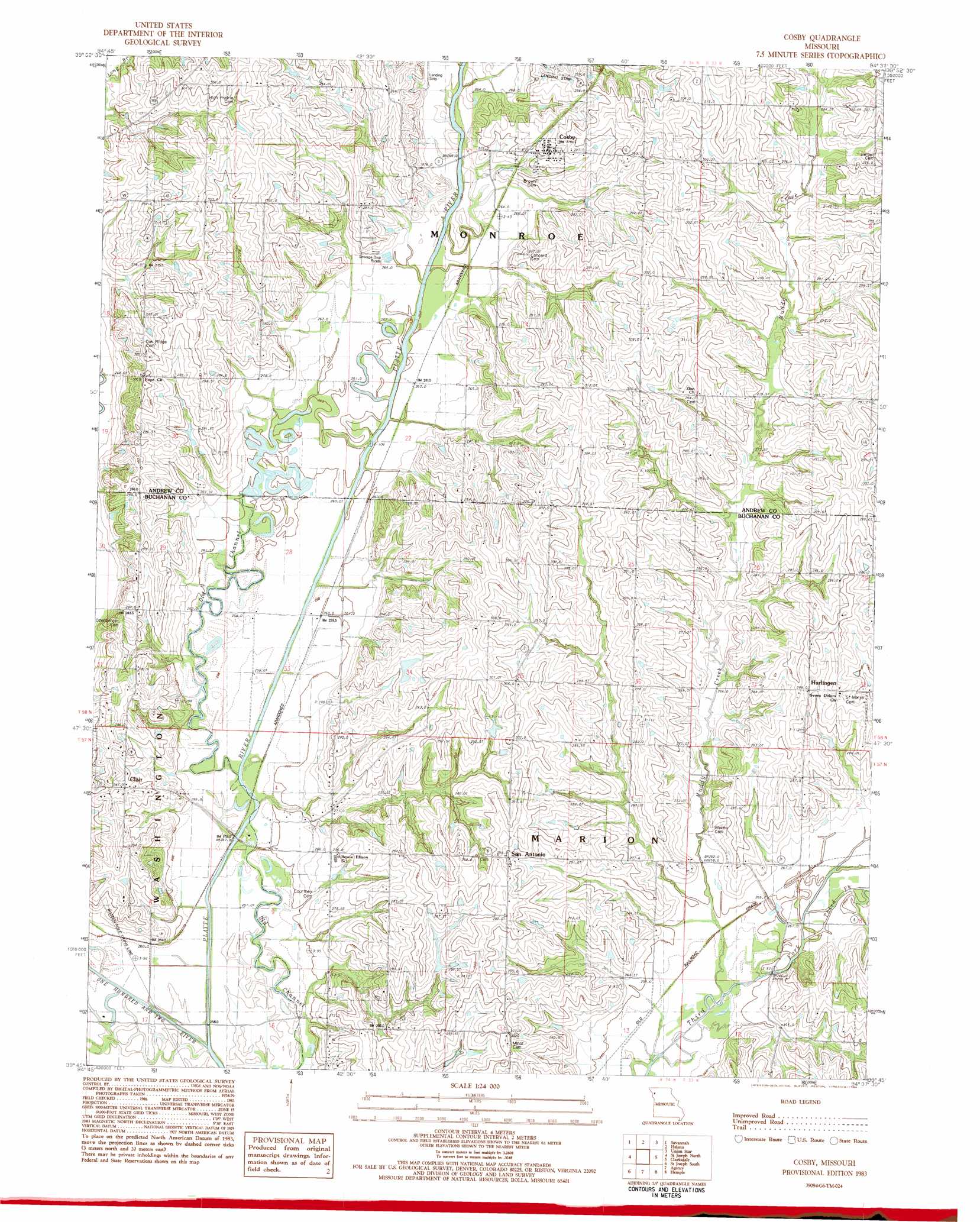
USGS Topo Quad 39094g6 - 1:24,000 scale
| Topo Map Name: | Cosby |
| USGS Topo Quad ID: | 39094g6 |
| Print Size: | ca. 21 1/4" wide x 27" high |
| Southeast Coordinates: | 39.75° N latitude / 94.625° W longitude |
| Map Center Coordinates: | 39.8125° N latitude / 94.6875° W longitude |
| U.S. State: | MO |
| Filename: | o39094g6.jpg |
| Download Map JPG Image: | Cosby topo map 1:24,000 scale |
| Map Type: | Topographic |
| Topo Series: | 7.5´ |
| Map Scale: | 1:24,000 |
| Source of Map Images: | United States Geological Survey (USGS) |
| Alternate Map Versions: |
Cosby MO 1983, updated 1984 Download PDF Buy paper map Cosby MO 2012 Download PDF Buy paper map Cosby MO 2015 Download PDF Buy paper map |
1:24,000 Topo Quads surrounding Cosby
Fillmore |
Blockow |
Whitesville |
King City |
Ford City |
Amazonia |
Savannah |
Helena |
Union Star |
Wood |
Wathena |
Saint Joseph North |
Cosby |
Clarksdale |
Amity |
Halls |
Saint Joseph South |
Agency |
Hemple |
Perrin |
De Kalb |
Dearborn |
Edgerton |
Gower |
Plattsburg |
> Back to 39094e1 at 1:100,000 scale
> Back to 39094a1 at 1:250,000 scale
> Back to U.S. Topo Maps home
Cosby topo map: Gazetteer
Cosby: Areas
Northwestern Loess Hills elevation 276m 905′Cosby: Dams
Wales Lake Dam elevation 280m 918′Cosby: Populated Places
Clair elevation 282m 925′Cosby elevation 286m 938′
Hurlingen elevation 294m 964′
San Antonio elevation 300m 984′
Stockbridge (historical) elevation 258m 846′
Cosby: Reservoirs
Wales Lake elevation 280m 918′Cosby: Streams
Little Third Fork elevation 260m 853′Muddy Creek elevation 258m 846′
Cosby digital topo map on disk
Buy this Cosby topo map showing relief, roads, GPS coordinates and other geographical features, as a high-resolution digital map file on DVD: