Union Star Topo Map Missouri
To zoom in, hover over the map of Union Star
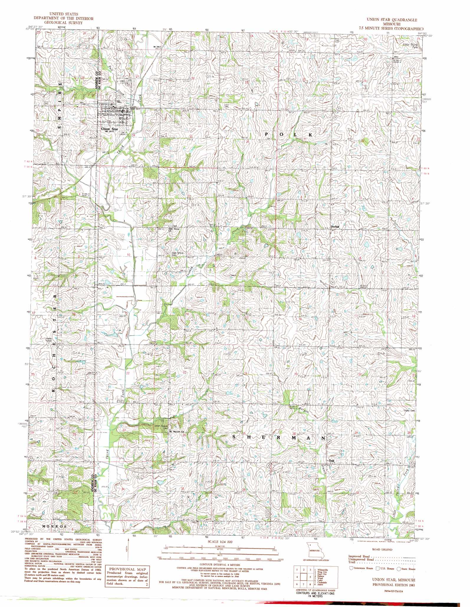
USGS Topo Quad 39094h5 - 1:24,000 scale
| Topo Map Name: | Union Star |
| USGS Topo Quad ID: | 39094h5 |
| Print Size: | ca. 21 1/4" wide x 27" high |
| Southeast Coordinates: | 39.875° N latitude / 94.5° W longitude |
| Map Center Coordinates: | 39.9375° N latitude / 94.5625° W longitude |
| U.S. State: | MO |
| Filename: | o39094h5.jpg |
| Download Map JPG Image: | Union Star topo map 1:24,000 scale |
| Map Type: | Topographic |
| Topo Series: | 7.5´ |
| Map Scale: | 1:24,000 |
| Source of Map Images: | United States Geological Survey (USGS) |
| Alternate Map Versions: |
Union Star MO 1983, updated 1984 Download PDF Buy paper map Union Star MO 2012 Download PDF Buy paper map Union Star MO 2014 Download PDF Buy paper map |
1:24,000 Topo Quads surrounding Union Star
Barnard |
Guilford |
Stanberry |
Darlington |
Albany South |
Blockow |
Whitesville |
King City |
Ford City |
Berlin |
Savannah |
Helena |
Union Star |
Wood |
Maysville |
Saint Joseph North |
Cosby |
Clarksdale |
Amity |
Fordham |
Saint Joseph South |
Agency |
Hemple |
Perrin |
Cameron West |
> Back to 39094e1 at 1:100,000 scale
> Back to 39094a1 at 1:250,000 scale
> Back to U.S. Topo Maps home
Union Star topo map: Gazetteer
Union Star: Populated Places
Oak elevation 293m 961′Orchid elevation 317m 1040′
Union Star elevation 292m 958′
Union Star: Streams
Bull Creek elevation 286m 938′Crooked Creek elevation 281m 921′
Union Star digital topo map on disk
Buy this Union Star topo map showing relief, roads, GPS coordinates and other geographical features, as a high-resolution digital map file on DVD: