Helena Topo Map Missouri
To zoom in, hover over the map of Helena
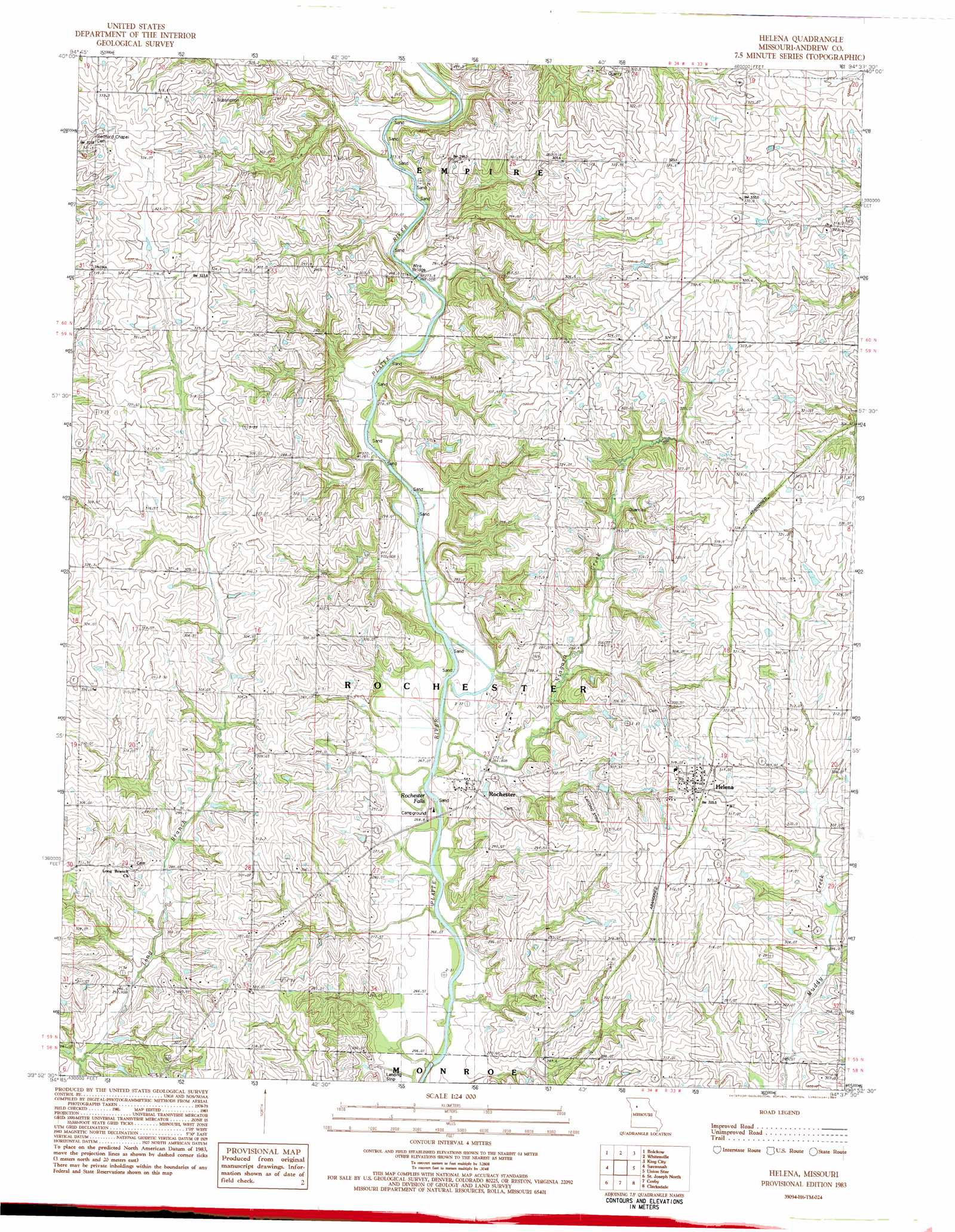
USGS Topo Quad 39094h6 - 1:24,000 scale
| Topo Map Name: | Helena |
| USGS Topo Quad ID: | 39094h6 |
| Print Size: | ca. 21 1/4" wide x 27" high |
| Southeast Coordinates: | 39.875° N latitude / 94.625° W longitude |
| Map Center Coordinates: | 39.9375° N latitude / 94.6875° W longitude |
| U.S. State: | MO |
| Filename: | o39094h6.jpg |
| Download Map JPG Image: | Helena topo map 1:24,000 scale |
| Map Type: | Topographic |
| Topo Series: | 7.5´ |
| Map Scale: | 1:24,000 |
| Source of Map Images: | United States Geological Survey (USGS) |
| Alternate Map Versions: |
Helena MO 1983, updated 1984 Download PDF Buy paper map Helena MO 2012 Download PDF Buy paper map Helena MO 2014 Download PDF Buy paper map |
1:24,000 Topo Quads surrounding Helena
Bolckow Nw |
Barnard |
Guilford |
Stanberry |
Darlington |
Fillmore |
Blockow |
Whitesville |
King City |
Ford City |
Amazonia |
Savannah |
Helena |
Union Star |
Wood |
Wathena |
Saint Joseph North |
Cosby |
Clarksdale |
Amity |
Halls |
Saint Joseph South |
Agency |
Hemple |
Perrin |
> Back to 39094e1 at 1:100,000 scale
> Back to 39094a1 at 1:250,000 scale
> Back to U.S. Topo Maps home
Helena topo map: Gazetteer
Helena: Bridges
Van Meter Bridge (historical) elevation 273m 895′Wire Bridge elevation 271m 889′
Helena: Falls
Rochester Falls elevation 264m 866′Helena: Lakes
Lillabridge Lake (historical) elevation 267m 875′Middle Lake (historical) elevation 268m 879′
Taylor Lake (historical) elevation 268m 879′
Helena: Populated Places
Fountainbleau elevation 303m 994′Helena elevation 325m 1066′
Rochester elevation 273m 895′
Helena: Streams
Niagara Creek elevation 268m 879′Helena digital topo map on disk
Buy this Helena topo map showing relief, roads, GPS coordinates and other geographical features, as a high-resolution digital map file on DVD: