Mclouth Topo Map Kansas
To zoom in, hover over the map of Mclouth
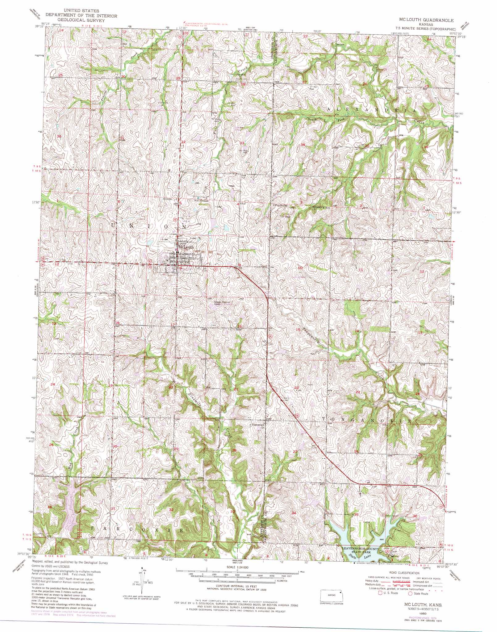
USGS Topo Quad 39095b2 - 1:24,000 scale
| Topo Map Name: | Mclouth |
| USGS Topo Quad ID: | 39095b2 |
| Print Size: | ca. 21 1/4" wide x 27" high |
| Southeast Coordinates: | 39.125° N latitude / 95.125° W longitude |
| Map Center Coordinates: | 39.1875° N latitude / 95.1875° W longitude |
| U.S. State: | KS |
| Filename: | o39095b2.jpg |
| Download Map JPG Image: | Mclouth topo map 1:24,000 scale |
| Map Type: | Topographic |
| Topo Series: | 7.5´ |
| Map Scale: | 1:24,000 |
| Source of Map Images: | United States Geological Survey (USGS) |
| Alternate Map Versions: |
Mc Louth KS 1950, updated 1979 Download PDF Buy paper map Mc Louth KS 1950, updated 1979 Download PDF Buy paper map Mc Louth KS 1951 Download PDF Buy paper map McLouth KS 2010 Download PDF Buy paper map McLouth KS 2012 Download PDF Buy paper map McLouth KS 2015 Download PDF Buy paper map |
1:24,000 Topo Quads surrounding Mclouth
Half Mound |
Nortonville |
Potter |
Oak Mills |
Weston |
Valley Falls |
Winchester |
Easton Sw |
Easton |
Leavenworth |
Ozawkie |
Oskaloosa |
Mclouth |
Jarbalo |
Basehor |
Perry |
Williamstown |
Midland |
Tonganoxie |
Bonner Springs |
Clinton |
Lawrence West |
Lawrence East |
Eudora |
De Soto |
> Back to 39095a1 at 1:100,000 scale
> Back to 39094a1 at 1:250,000 scale
> Back to U.S. Topo Maps home
Mclouth topo map: Gazetteer
Mclouth: Airports
Dorei Airport elevation 344m 1128′Threshing Bee Airport elevation 347m 1138′
Mclouth: Parks
Leavenworth County State Park elevation 309m 1013′Mclouth: Populated Places
McLouth elevation 357m 1171′Mclouth: Post Offices
McLouth Post Office elevation 356m 1167′Mclouth: Reservoirs
Lake Dabanawa elevation 295m 967′Mclouth: Streams
South Fork Fall Creek elevation 268m 879′Mclouth digital topo map on disk
Buy this Mclouth topo map showing relief, roads, GPS coordinates and other geographical features, as a high-resolution digital map file on DVD: