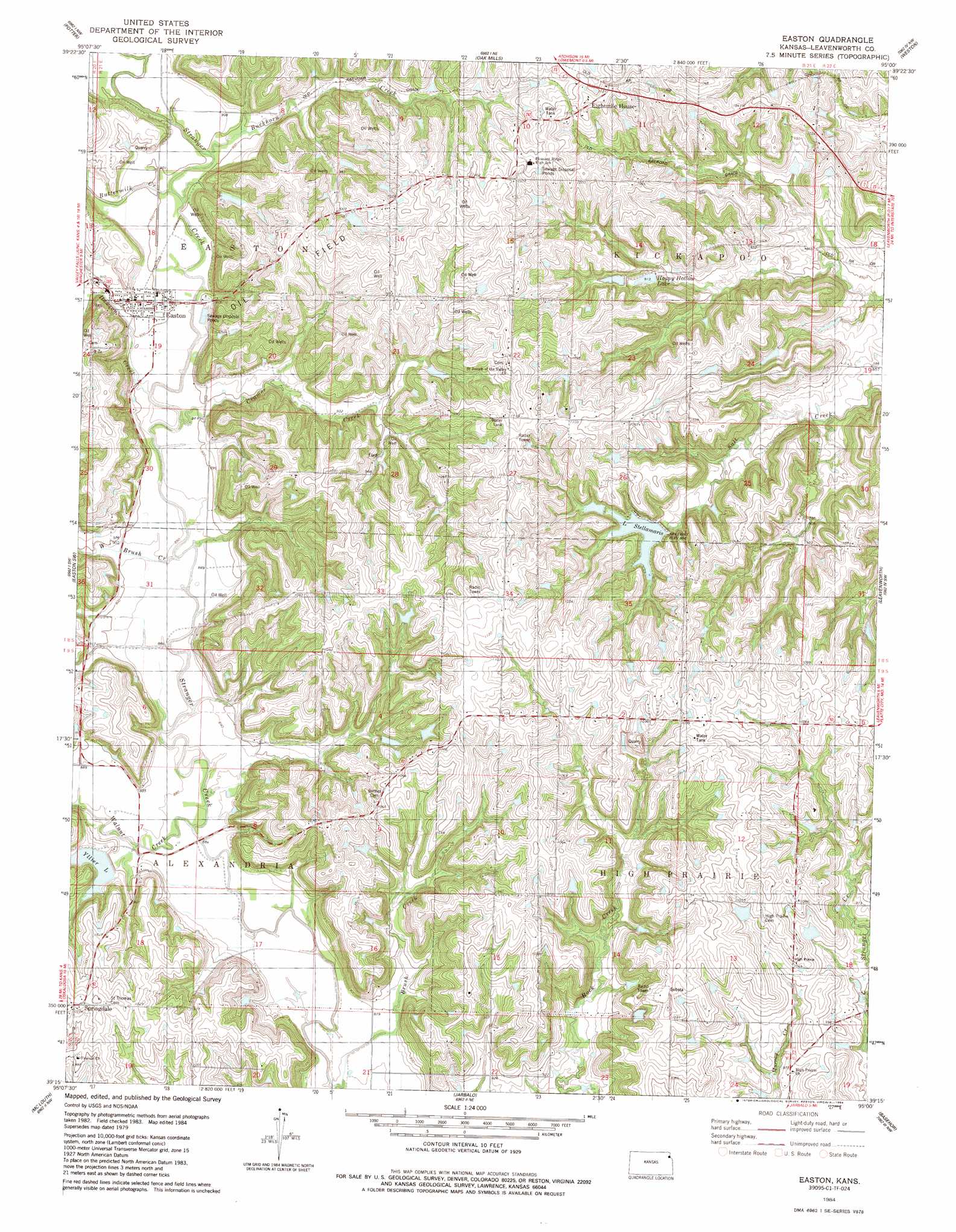
Easton Topo Map Kansas
To zoom in, hover over the map of Easton
USGS Topo Quad 39095c1 - 1:24,000 scale
| Topo Map Name: | Easton |
| USGS Topo Quad ID: | 39095c1 |
| Print Size: | ca. 21 1/4" wide x 27" high |
| Southeast Coordinates: | 39.25° N latitude / 95° W longitude |
| Map Center Coordinates: | 39.3125° N latitude / 95.0625° W longitude |
| U.S. State: | KS |
| Filename: | o39095c1.jpg |
| Download Map JPG Image: | Easton topo map 1:24,000 scale |
| Map Type: | Topographic |
| Topo Series: | 7.5´ |
| Map Scale: | 1:24,000 |
| Source of Map Images: | United States Geological Survey (USGS) |
| Alternate Map Versions: |
Easton KS 1950 Download PDF Buy paper map Easton KS 1961, updated 1962 Download PDF Buy paper map Easton KS 1961, updated 1979 Download PDF Buy paper map Easton KS 1984, updated 1984 Download PDF Buy paper map Easton KS 2009 Download PDF Buy paper map Easton KS 2012 Download PDF Buy paper map Easton KS 2015 Download PDF Buy paper map |
1:24,000 Topo Quads surrounding Easton
Lancaster |
Atchison West |
Atchison East |
De Kalb |
Dearborn |
Nortonville |
Potter |
Oak Mills |
Weston |
Tracy |
Winchester |
Easton Sw |
Easton |
Leavenworth |
Platte City |
Oskaloosa |
Mclouth |
Jarbalo |
Basehor |
Wolcott |
Williamstown |
Midland |
Tonganoxie |
Bonner Springs |
Edwardsville |
> Back to 39095a1 at 1:100,000 scale
> Back to 39094a1 at 1:250,000 scale
> Back to U.S. Topo Maps home
Easton topo map: Gazetteer
Easton: Populated Places
Easton elevation 276m 905′Springdale elevation 316m 1036′
Easton: Post Offices
Easton Post Office elevation 276m 905′Easton: Reservoirs
Happy Hollow Lake elevation 277m 908′Lake Stellamaris elevation 291m 954′
Yllier Lake elevation 276m 905′
Easton: Streams
Brush Creek elevation 262m 859′Buckhorn Creek elevation 271m 889′
Buttermilk Creek elevation 271m 889′
Cramer Creek elevation 268m 879′
Dawson Creek elevation 268m 879′
Walnut Creek elevation 265m 869′
West Brush Creek elevation 268m 879′
Easton digital topo map on disk
Buy this Easton topo map showing relief, roads, GPS coordinates and other geographical features, as a high-resolution digital map file on DVD: