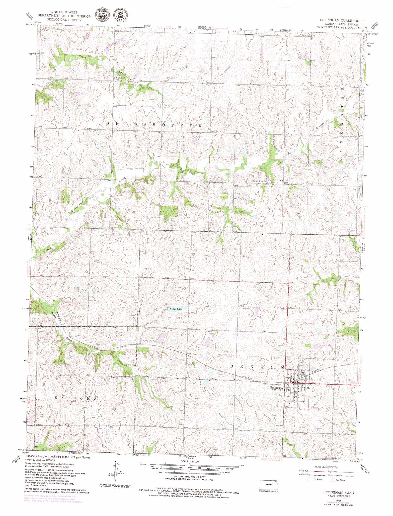
Effingham Topo Map Kansas
To zoom in, hover over the map of Effingham
USGS Topo Quad 39095e4 - 1:24,000 scale
| Topo Map Name: | Effingham |
| USGS Topo Quad ID: | 39095e4 |
| Print Size: | ca. 21 1/4" wide x 27" high |
| Southeast Coordinates: | 39.5° N latitude / 95.375° W longitude |
| Map Center Coordinates: | 39.5625° N latitude / 95.4375° W longitude |
| U.S. State: | KS |
| Filename: | o39095e4.jpg |
| Download Map JPG Image: | Effingham topo map 1:24,000 scale |
| Map Type: | Topographic |
| Topo Series: | 7.5´ |
| Map Scale: | 1:24,000 |
| Source of Map Images: | United States Geological Survey (USGS) |
| Alternate Map Versions: |
Effingham KS 1961, updated 1962 Download PDF Buy paper map Effingham KS 1961, updated 1979 Download PDF Buy paper map Effingham KS 2009 Download PDF Buy paper map Effingham KS 2012 Download PDF Buy paper map Effingham KS 2016 Download PDF Buy paper map |
1:24,000 Topo Quads surrounding Effingham
Fairview |
Hiawatha |
Robinson |
Highland |
Sparks |
Horton Nw |
Horton |
Everest |
Denton |
Bendena |
Netawaka |
Whiting |
Effingham |
Lancaster |
Atchison West |
Holton |
Arrington |
Half Mound |
Nortonville |
Potter |
Mayetta |
Holton Se |
Valley Falls |
Winchester |
Easton Sw |
> Back to 39095e1 at 1:100,000 scale
> Back to 39094a1 at 1:250,000 scale
> Back to U.S. Topo Maps home
Effingham topo map: Gazetteer
Effingham: Airports
Strafuss Airport elevation 338m 1108′Effingham: Plains
Glacier Uplands elevation 336m 1102′Effingham: Populated Places
Effingham elevation 346m 1135′Effingham: Reservoirs
Figge Lake elevation 327m 1072′Effingham digital topo map on disk
Buy this Effingham topo map showing relief, roads, GPS coordinates and other geographical features, as a high-resolution digital map file on DVD: