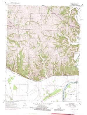
Forbes Topo Map Missouri
To zoom in, hover over the map of Forbes
USGS Topo Quad 39095h1 - 1:24,000 scale
| Topo Map Name: | Forbes |
| USGS Topo Quad ID: | 39095h1 |
| Print Size: | ca. 21 1/4" wide x 27" high |
| Southeast Coordinates: | 39.875° N latitude / 95° W longitude |
| Map Center Coordinates: | 39.9375° N latitude / 95.0625° W longitude |
| U.S. States: | MO, KS |
| Filename: | o39095h1.jpg |
| Download Map JPG Image: | Forbes topo map 1:24,000 scale |
| Map Type: | Topographic |
| Topo Series: | 7.5´ |
| Map Scale: | 1:24,000 |
| Source of Map Images: | United States Geological Survey (USGS) |
| Alternate Map Versions: |
Forbes MO 1961, updated 1962 Download PDF Buy paper map Forbes MO 1961, updated 1973 Download PDF Buy paper map Forbes MO 1961, updated 1986 Download PDF Buy paper map Forbes MO 2009 Download PDF Buy paper map Forbes MO 2011 Download PDF Buy paper map Forbes MO 2015 Download PDF Buy paper map |
1:24,000 Topo Quads surrounding Forbes
> Back to 39095e1 at 1:100,000 scale
> Back to 39094a1 at 1:250,000 scale
> Back to U.S. Topo Maps home
Forbes topo map: Gazetteer
Forbes: Airports
Mark Twain Air Strip elevation 353m 1158′Forbes: Dams
Frank Milne Dam elevation 274m 898′Forbes: Parks
Riverbreaks Conservation Area elevation 323m 1059′Forbes: Populated Places
Forbes elevation 261m 856′Richville elevation 314m 1030′
Forbes: Reservoirs
Milne Lake elevation 274m 898′Forbes: Streams
Dyer Branch elevation 258m 846′Easter Creek elevation 251m 823′
Forbes Creek elevation 251m 823′
Lincoln Creek elevation 253m 830′
McWilliams Creek elevation 252m 826′
Meade Creek elevation 252m 826′
Pullen Branch elevation 253m 830′
Thorp Branch elevation 276m 905′
Whales Creek elevation 251m 823′
Forbes: Valleys
Barrett Hollow elevation 259m 849′Hicks Hollow elevation 257m 843′
Forbes digital topo map on disk
Buy this Forbes topo map showing relief, roads, GPS coordinates and other geographical features, as a high-resolution digital map file on DVD:


