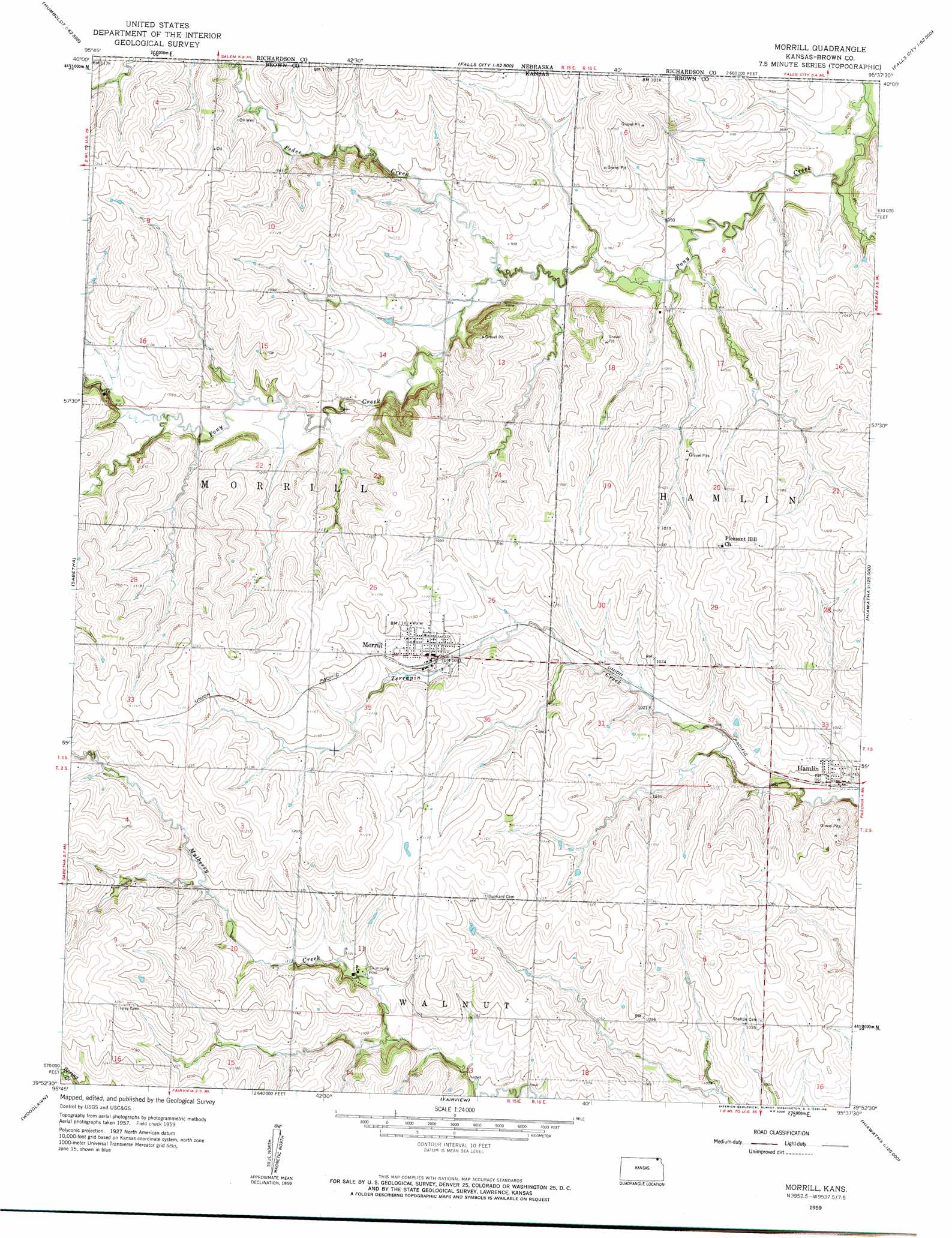
Morrill Topo Map Kansas
To zoom in, hover over the map of Morrill
USGS Topo Quad 39095h6 - 1:24,000 scale
| Topo Map Name: | Morrill |
| USGS Topo Quad ID: | 39095h6 |
| Print Size: | ca. 21 1/4" wide x 27" high |
| Southeast Coordinates: | 39.875° N latitude / 95.625° W longitude |
| Map Center Coordinates: | 39.9375° N latitude / 95.6875° W longitude |
| U.S. State: | KS |
| Filename: | o39095h6.jpg |
| Download Map JPG Image: | Morrill topo map 1:24,000 scale |
| Map Type: | Topographic |
| Topo Series: | 7.5´ |
| Map Scale: | 1:24,000 |
| Source of Map Images: | United States Geological Survey (USGS) |
| Alternate Map Versions: |
Morrill KS 1959, updated 1961 Download PDF Buy paper map Morrill KS 2009 Download PDF Buy paper map Morrill KS 2012 Download PDF Buy paper map Morrill KS 2016 Download PDF Buy paper map |
1:24,000 Topo Quads surrounding Morrill
Humboldt |
Dawson |
Verdon |
Barada |
Corning |
Humboldt Sw |
Humboldt Se |
Salem |
Falls City |
Rulo |
Bern |
Sabetha |
Morrill |
Reserve |
Highland Nw |
Oneida |
Woodlawn |
Fairview |
Hiawatha |
Robinson |
Goff |
Wetmore |
Horton Nw |
Horton |
Everest |
> Back to 39095e1 at 1:100,000 scale
> Back to 39094a1 at 1:250,000 scale
> Back to U.S. Topo Maps home
Morrill topo map: Gazetteer
Morrill: Populated Places
Hamlin elevation 302m 990′Morrill elevation 334m 1095′
Sun Springs elevation 331m 1085′
Morrill: Streams
Pedee Creek elevation 292m 958′Morrill digital topo map on disk
Buy this Morrill topo map showing relief, roads, GPS coordinates and other geographical features, as a high-resolution digital map file on DVD: