Maple Hill Topo Map Kansas
To zoom in, hover over the map of Maple Hill
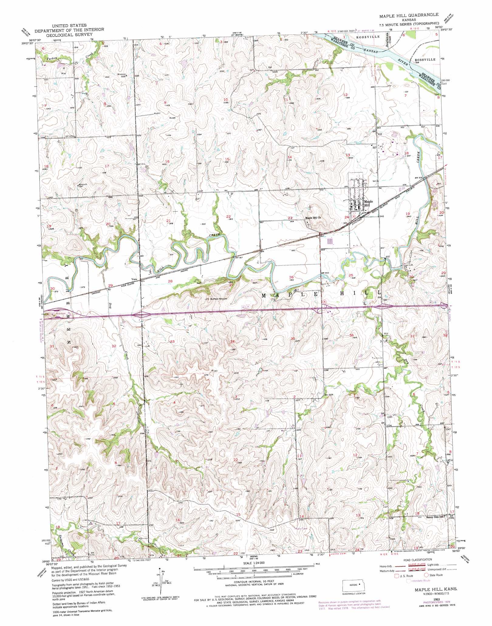
USGS Topo Quad 39096a1 - 1:24,000 scale
| Topo Map Name: | Maple Hill |
| USGS Topo Quad ID: | 39096a1 |
| Print Size: | ca. 21 1/4" wide x 27" high |
| Southeast Coordinates: | 39° N latitude / 96° W longitude |
| Map Center Coordinates: | 39.0625° N latitude / 96.0625° W longitude |
| U.S. State: | KS |
| Filename: | o39096a1.jpg |
| Download Map JPG Image: | Maple Hill topo map 1:24,000 scale |
| Map Type: | Topographic |
| Topo Series: | 7.5´ |
| Map Scale: | 1:24,000 |
| Source of Map Images: | United States Geological Survey (USGS) |
| Alternate Map Versions: |
Maple Hill KS 1953, updated 1954 Download PDF Buy paper map Maple Hill KS 1953, updated 1978 Download PDF Buy paper map Maple Hill KS 2009 Download PDF Buy paper map Maple Hill KS 2012 Download PDF Buy paper map Maple Hill KS 2016 Download PDF Buy paper map |
1:24,000 Topo Quads surrounding Maple Hill
Louisville |
Laclede |
Emmett |
Soldier Creek Sw |
Soldier Creek Se |
Wamego |
Belvue |
Saint Marys |
Rossville |
Grove |
Alma |
Mcfarland |
Maple Hill |
Willard |
Silver Lake |
Allendorph |
Hessdale |
Keene |
Dover |
Auburn |
Alta Vista Se |
Lake Wabaunsee |
Eskridge |
Harveyville |
Burlingame |
> Back to 39096a1 at 1:100,000 scale
> Back to 39096a1 at 1:250,000 scale
> Back to U.S. Topo Maps home
Maple Hill topo map: Gazetteer
Maple Hill: Airports
Morelock Airport elevation 321m 1053′Maple Hill: Populated Places
Maple Hill elevation 297m 974′Vera elevation 296m 971′
Maple Hill: Streams
Bourbonais Creek elevation 277m 908′Dog Creek elevation 288m 944′
Dry Creek elevation 276m 905′
Maple Hill: Summits
Buffalo Mound elevation 387m 1269′Tabor Hill elevation 329m 1079′
Maple Hill digital topo map on disk
Buy this Maple Hill topo map showing relief, roads, GPS coordinates and other geographical features, as a high-resolution digital map file on DVD: