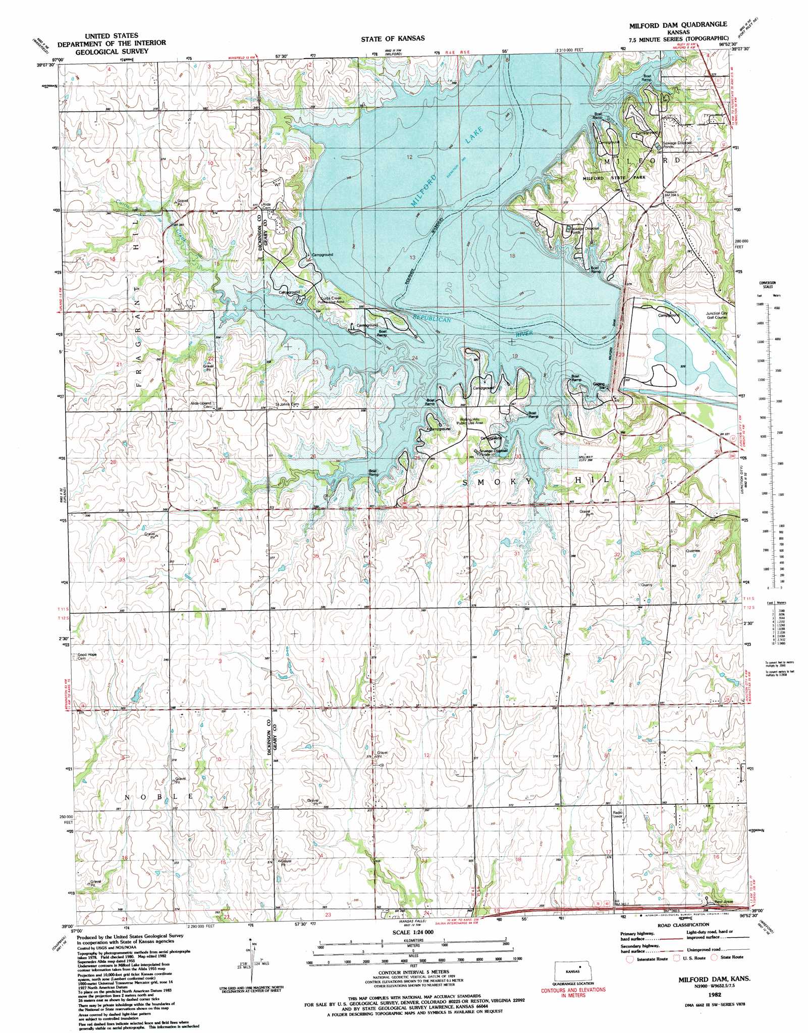
Milford Dam Topo Map Kansas
To zoom in, hover over the map of Milford Dam
USGS Topo Quad 39096a8 - 1:24,000 scale
| Topo Map Name: | Milford Dam |
| USGS Topo Quad ID: | 39096a8 |
| Print Size: | ca. 21 1/4" wide x 27" high |
| Southeast Coordinates: | 39° N latitude / 96.875° W longitude |
| Map Center Coordinates: | 39.0625° N latitude / 96.9375° W longitude |
| U.S. State: | KS |
| Filename: | o39096a8.jpg |
| Download Map JPG Image: | Milford Dam topo map 1:24,000 scale |
| Map Type: | Topographic |
| Topo Series: | 7.5´ |
| Map Scale: | 1:24,000 |
| Source of Map Images: | United States Geological Survey (USGS) |
| Alternate Map Versions: |
Alida KS 1950 Download PDF Buy paper map Alida KS 1955, updated 1958 Download PDF Buy paper map Alida KS 1955, updated 1976 Download PDF Buy paper map Milford Dam KS 1955, updated 1978 Download PDF Buy paper map Milford Dam KS 1982, updated 1982 Download PDF Buy paper map Milford Dam KS 2009 Download PDF Buy paper map Milford Dam KS 2012 Download PDF Buy paper map Milford Dam KS 2016 Download PDF Buy paper map |
1:24,000 Topo Quads surrounding Milford Dam
Clay Center Sw |
Clay Center Se |
Bala |
Riley |
Olsburg Sw |
Industry |
Wakefield |
Milford |
Fort Riley Ne |
Keats |
Buckeye |
Upland |
Milford Dam |
Junction City |
Ogden |
Abilene |
Chapman |
Kansas Falls |
Wreford |
White City Nw |
Abilene Sw |
Navarre |
Woodbine |
Skiddy |
White City |
> Back to 39096a1 at 1:100,000 scale
> Back to 39096a1 at 1:250,000 scale
> Back to U.S. Topo Maps home
Milford Dam topo map: Gazetteer
Milford Dam: Airports
Ritter Airport (historical) elevation 391m 1282′Milford Dam: Dams
Milford Dam elevation 349m 1145′Milford Dam: Parks
Curtis Creek Public Use Area elevation 361m 1184′Milford State Park elevation 370m 1213′
Northerns Airport elevation 349m 1145′
Rolling Hills Public Use Area elevation 366m 1200′
Milford Dam: Populated Places
Alida elevation 349m 1145′Milford Dam: Reservoirs
Milford Lake elevation 349m 1145′Milford Dam: Streams
Curtis Creek elevation 349m 1145′Rush Creek elevation 349m 1145′
Milford Dam digital topo map on disk
Buy this Milford Dam topo map showing relief, roads, GPS coordinates and other geographical features, as a high-resolution digital map file on DVD: