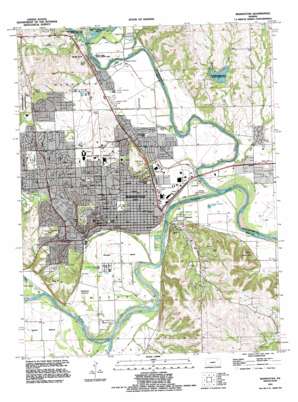
Manhattan Topo Map Kansas
To zoom in, hover over the map of Manhattan
USGS Topo Quad 39096b5 - 1:24,000 scale
| Topo Map Name: | Manhattan |
| USGS Topo Quad ID: | 39096b5 |
| Print Size: | ca. 21 1/4" wide x 27" high |
| Southeast Coordinates: | 39.125° N latitude / 96.5° W longitude |
| Map Center Coordinates: | 39.1875° N latitude / 96.5625° W longitude |
| U.S. State: | KS |
| Filename: | o39096b5.jpg |
| Download Map JPG Image: | Manhattan topo map 1:24,000 scale |
| Map Type: | Topographic |
| Topo Series: | 7.5´ |
| Map Scale: | 1:24,000 |
| Source of Map Images: | United States Geological Survey (USGS) |
| Alternate Map Versions: |
Manhattan KS 1950 Download PDF Buy paper map Manhattan KS 1955, updated 1958 Download PDF Buy paper map Manhattan KS 1955, updated 1964 Download PDF Buy paper map Manhattan KS 1955, updated 1972 Download PDF Buy paper map Manhattan KS 1955, updated 1978 Download PDF Buy paper map Manhattan KS 1982, updated 1982 Download PDF Buy paper map Manhattan KS 1991, updated 1995 Download PDF Buy paper map Manhattan KS 2010 Download PDF Buy paper map Manhattan KS 2012 Download PDF Buy paper map Manhattan KS 2016 Download PDF Buy paper map |
1:24,000 Topo Quads surrounding Manhattan
> Back to 39096a1 at 1:100,000 scale
> Back to 39096a1 at 1:250,000 scale
> Back to U.S. Topo Maps home
Manhattan topo map: Gazetteer
Manhattan: Airports
Mankan Airport (historical) elevation 311m 1020′Pottawatomie Airport (historical) elevation 307m 1007′
Saint Mary Hospital Airport elevation 322m 1056′
Manhattan: Bends
Ashland Bottoms elevation 314m 1030′Hunters Island elevation 309m 1013′
Moehlman Bottoms elevation 309m 1013′
Manhattan: Lakes
Sand Lake elevation 309m 1013′Manhattan: Parks
Battery Park elevation 310m 1017′CiCo Park elevation 349m 1145′
Finney State Fishing Lake and Wildlife Area elevation 326m 1069′
Goodnow Park elevation 309m 1013′
Griffith Ball Park elevation 312m 1023′
Kaw River Access elevation 303m 994′
Longs Park elevation 313m 1026′
Longview Hill Park (historical) elevation 348m 1141′
Memorial Stadium elevation 319m 1046′
Northview Park elevation 311m 1020′
Pioneer Park elevation 326m 1069′
Pottawatomie State Fishing Lake Number Two elevation 345m 1131′
Riverside Park elevation 308m 1010′
Rocky Ford State Fishing Area elevation 312m 1023′
Warner Memorial Park elevation 346m 1135′
Washington Marlatt Memorial Park elevation 391m 1282′
Westwood Park elevation 335m 1099′
Manhattan: Populated Places
Bluemont Hill elevation 306m 1003′Fairmont elevation 308m 1010′
Manhattan elevation 312m 1023′
Rocky Ford elevation 335m 1099′
Sunset Park elevation 339m 1112′
Manhattan: Reservoirs
Fairman Lake elevation 322m 1056′Manhattan: Streams
Big Blue River elevation 304m 997′Cedar Creek elevation 305m 1000′
Elbo Creek elevation 301m 987′
Little Kitten Creek elevation 315m 1033′
McDowell Creek elevation 306m 1003′
Phiel Creek elevation 313m 1026′
Shane Creek elevation 308m 1010′
Wildcat Creek elevation 308m 1010′
Manhattan: Summits
Longview Hill elevation 351m 1151′Prospect Hill elevation 352m 1154′
Rocky Hill elevation 348m 1141′
Stagg Hill elevation 376m 1233′
Manhattan digital topo map on disk
Buy this Manhattan topo map showing relief, roads, GPS coordinates and other geographical features, as a high-resolution digital map file on DVD:


