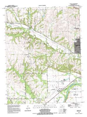
Keats Topo Map Kansas
To zoom in, hover over the map of Keats
USGS Topo Quad 39096b6 - 1:24,000 scale
| Topo Map Name: | Keats |
| USGS Topo Quad ID: | 39096b6 |
| Print Size: | ca. 21 1/4" wide x 27" high |
| Southeast Coordinates: | 39.125° N latitude / 96.625° W longitude |
| Map Center Coordinates: | 39.1875° N latitude / 96.6875° W longitude |
| U.S. State: | KS |
| Filename: | o39096b6.jpg |
| Download Map JPG Image: | Keats topo map 1:24,000 scale |
| Map Type: | Topographic |
| Topo Series: | 7.5´ |
| Map Scale: | 1:24,000 |
| Source of Map Images: | United States Geological Survey (USGS) |
| Alternate Map Versions: |
Keats KS 1950 Download PDF Buy paper map Keats KS 1955, updated 1958 Download PDF Buy paper map Keats KS 1955, updated 1978 Download PDF Buy paper map Keats KS 1982, updated 1982 Download PDF Buy paper map Keats KS 1992, updated 1995 Download PDF Buy paper map Keats KS 2009 Download PDF Buy paper map Keats KS 2012 Download PDF Buy paper map Keats KS 2015 Download PDF Buy paper map |
1:24,000 Topo Quads surrounding Keats
> Back to 39096a1 at 1:100,000 scale
> Back to 39096a1 at 1:250,000 scale
> Back to U.S. Topo Maps home
Keats topo map: Gazetteer
Keats: Airports
Manhattan Municipal Airport elevation 318m 1043′Keats: Basins
Eureka Valley elevation 318m 1043′Keats: Lakes
Eureka Lake elevation 311m 1020′Keats: Parks
Frank Anneberg Park elevation 321m 1053′Prairie National Park elevation 407m 1335′
Keats: Populated Places
Elm Hollow Corner elevation 411m 1348′Eureka Lake elevation 315m 1033′
Keats elevation 345m 1131′
Keats: Streams
Honey Creek elevation 341m 1118′Kitten Creek elevation 340m 1115′
Natalies Creek elevation 334m 1095′
Sevenmile Creek elevation 313m 1026′
Silver Creek elevation 343m 1125′
Keats digital topo map on disk
Buy this Keats topo map showing relief, roads, GPS coordinates and other geographical features, as a high-resolution digital map file on DVD:


