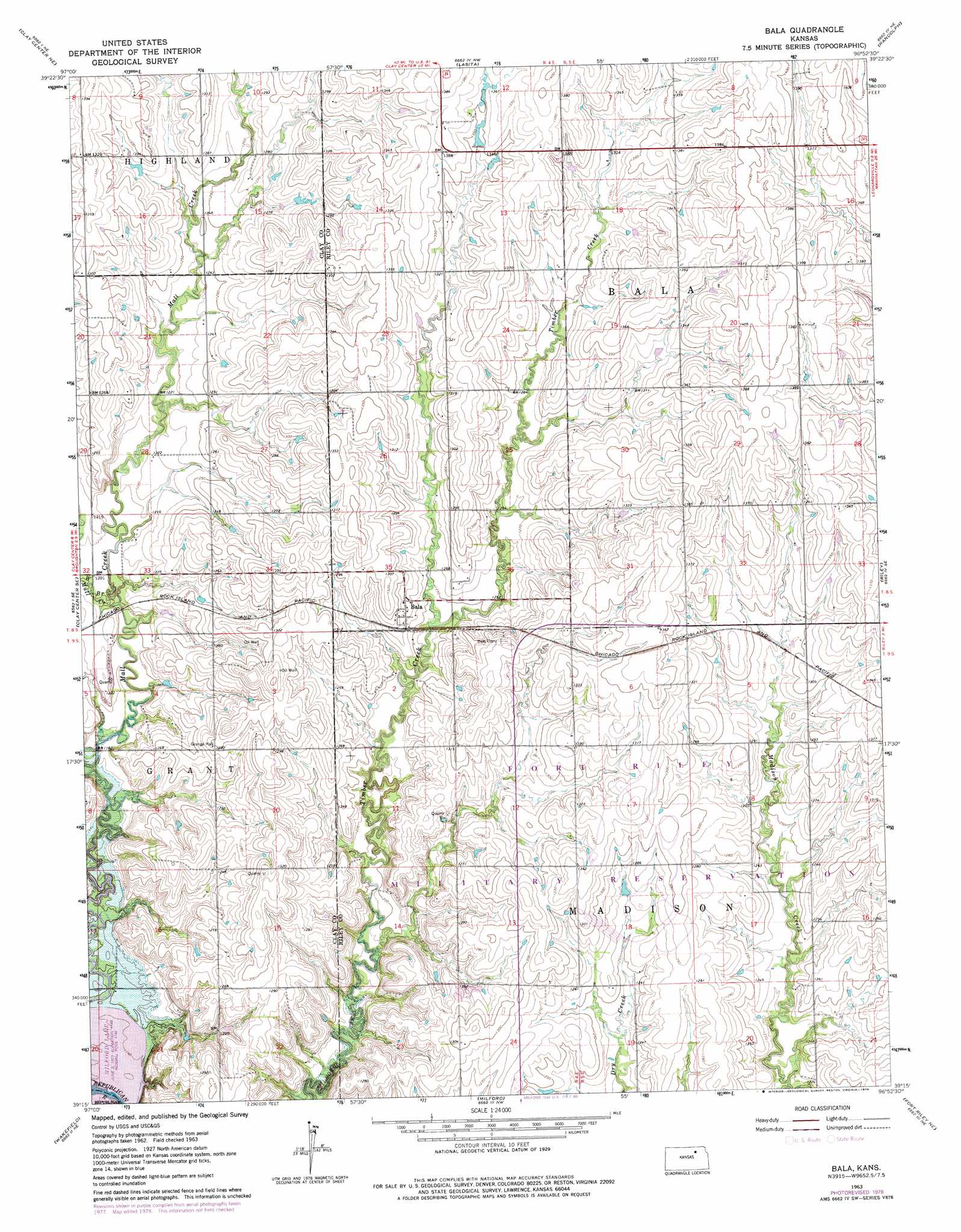
Bala Topo Map Kansas
To zoom in, hover over the map of Bala
USGS Topo Quad 39096c8 - 1:24,000 scale
| Topo Map Name: | Bala |
| USGS Topo Quad ID: | 39096c8 |
| Print Size: | ca. 21 1/4" wide x 27" high |
| Southeast Coordinates: | 39.25° N latitude / 96.875° W longitude |
| Map Center Coordinates: | 39.3125° N latitude / 96.9375° W longitude |
| U.S. State: | KS |
| Filename: | o39096c8.jpg |
| Download Map JPG Image: | Bala topo map 1:24,000 scale |
| Map Type: | Topographic |
| Topo Series: | 7.5´ |
| Map Scale: | 1:24,000 |
| Source of Map Images: | United States Geological Survey (USGS) |
| Alternate Map Versions: |
Bala KS 1963, updated 1964 Download PDF Buy paper map Bala KS 1963, updated 1978 Download PDF Buy paper map Bala KS 2009 Download PDF Buy paper map Bala KS 2012 Download PDF Buy paper map Bala KS 2015 Download PDF Buy paper map |
1:24,000 Topo Quads surrounding Bala
Linn Sw |
Linn Se |
Kimeo |
Greenleaf Se |
Blue Rapids Sw |
Clay Center Nw |
Clay Center Ne |
Lasita |
Randolph |
Olsburg Nw |
Clay Center Sw |
Clay Center Se |
Bala |
Riley |
Olsburg Sw |
Industry |
Wakefield |
Milford |
Fort Riley Ne |
Keats |
Buckeye |
Upland |
Milford Dam |
Junction City |
Ogden |
> Back to 39096a1 at 1:100,000 scale
> Back to 39096a1 at 1:250,000 scale
> Back to U.S. Topo Maps home
Bala topo map: Gazetteer
Bala: Populated Places
Bala elevation 391m 1282′Bala: Streams
West Branch Mall Creek elevation 362m 1187′Bala digital topo map on disk
Buy this Bala topo map showing relief, roads, GPS coordinates and other geographical features, as a high-resolution digital map file on DVD: