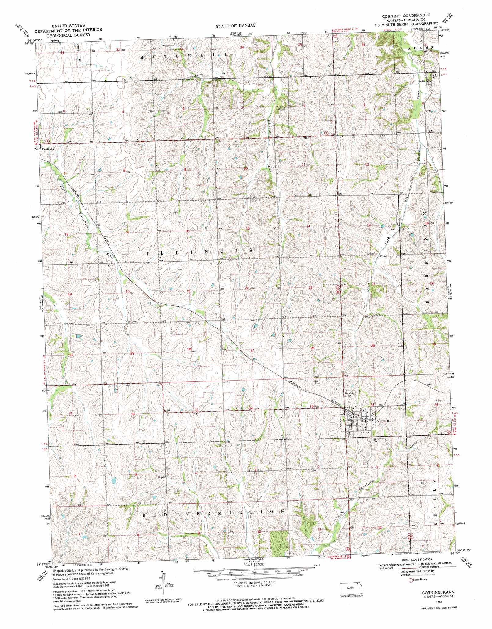
Corning Topo Map Kansas
To zoom in, hover over the map of Corning
USGS Topo Quad 39096f1 - 1:24,000 scale
| Topo Map Name: | Corning |
| USGS Topo Quad ID: | 39096f1 |
| Print Size: | ca. 21 1/4" wide x 27" high |
| Southeast Coordinates: | 39.625° N latitude / 96° W longitude |
| Map Center Coordinates: | 39.6875° N latitude / 96.0625° W longitude |
| U.S. State: | KS |
| Filename: | o39096f1.jpg |
| Download Map JPG Image: | Corning topo map 1:24,000 scale |
| Map Type: | Topographic |
| Topo Series: | 7.5´ |
| Map Scale: | 1:24,000 |
| Source of Map Images: | United States Geological Survey (USGS) |
| Alternate Map Versions: |
Corning KS 1969, updated 1971 Download PDF Buy paper map Corning KS 2009 Download PDF Buy paper map Corning KS 2012 Download PDF Buy paper map Corning KS 2015 Download PDF Buy paper map |
1:24,000 Topo Quads surrounding Corning
Summerfield |
Seneca Nw |
Saint Benedict |
Bern |
Sabetha |
Axtell |
Baileyville |
Seneca |
Oneida |
Woodlawn |
Vermillon |
Centralia |
Corning |
Goff |
Wetmore |
Wheaton |
Duluth |
Havenville |
Soldier |
Circleville |
Westmoreland Ne |
Onaga |
Onaga Ne |
Soldier Creek Nw |
Soldier Creek Ne |
> Back to 39096e1 at 1:100,000 scale
> Back to 39096a1 at 1:250,000 scale
> Back to U.S. Topo Maps home
Corning topo map: Gazetteer
Corning: Populated Places
Corning elevation 409m 1341′Kelly elevation 369m 1210′
Corning: Streams
Honey Creek elevation 407m 1335′Corning digital topo map on disk
Buy this Corning topo map showing relief, roads, GPS coordinates and other geographical features, as a high-resolution digital map file on DVD: