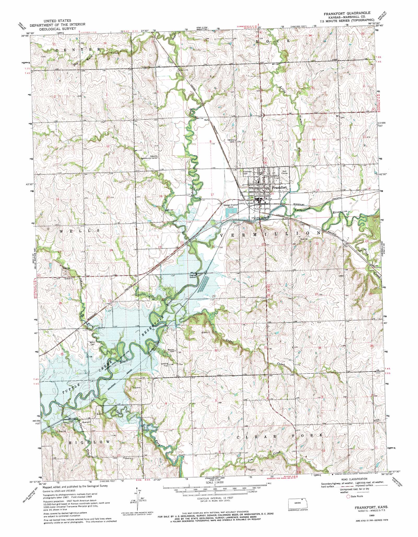
Frankfort Topo Map Kansas
To zoom in, hover over the map of Frankfort
USGS Topo Quad 39096f4 - 1:24,000 scale
| Topo Map Name: | Frankfort |
| USGS Topo Quad ID: | 39096f4 |
| Print Size: | ca. 21 1/4" wide x 27" high |
| Southeast Coordinates: | 39.625° N latitude / 96.375° W longitude |
| Map Center Coordinates: | 39.6875° N latitude / 96.4375° W longitude |
| U.S. State: | KS |
| Filename: | o39096f4.jpg |
| Download Map JPG Image: | Frankfort topo map 1:24,000 scale |
| Map Type: | Topographic |
| Topo Series: | 7.5´ |
| Map Scale: | 1:24,000 |
| Source of Map Images: | United States Geological Survey (USGS) |
| Alternate Map Versions: |
Frankfort KS 1969, updated 1971 Download PDF Buy paper map Frankfort KS 2009 Download PDF Buy paper map Frankfort KS 2012 Download PDF Buy paper map Frankfort KS 2016 Download PDF Buy paper map |
1:24,000 Topo Quads surrounding Frankfort
Herkimer |
Oketo |
Axtell Nw |
Summerfield |
Seneca Nw |
Marysville |
Home |
Beattie |
Axtell |
Baileyville |
Blue Rapids |
Blue Rapids Ne |
Frankfort |
Vermillon |
Centralia |
Blue Rapids Sw |
Blue Rapids Se |
Frankfort Sw |
Wheaton |
Duluth |
Olsburg Nw |
Olsburg |
Westmoreland |
Westmoreland Ne |
Onaga |
> Back to 39096e1 at 1:100,000 scale
> Back to 39096a1 at 1:250,000 scale
> Back to U.S. Topo Maps home
Frankfort topo map: Gazetteer
Frankfort: Populated Places
Barret elevation 344m 1128′Frankfort elevation 353m 1158′
Frankfort: Streams
Cedar Creek elevation 337m 1105′Clear Fork elevation 335m 1099′
De Shazer Creek elevation 335m 1099′
Irish Creek elevation 345m 1131′
Johnson Fork elevation 341m 1118′
Little Timber Creek elevation 345m 1131′
Robidoux Creek elevation 343m 1125′
Skeeter Creek elevation 354m 1161′
Snipe Creek elevation 351m 1151′
Frankfort digital topo map on disk
Buy this Frankfort topo map showing relief, roads, GPS coordinates and other geographical features, as a high-resolution digital map file on DVD: