Blue Rapids Ne Topo Map Kansas
To zoom in, hover over the map of Blue Rapids Ne
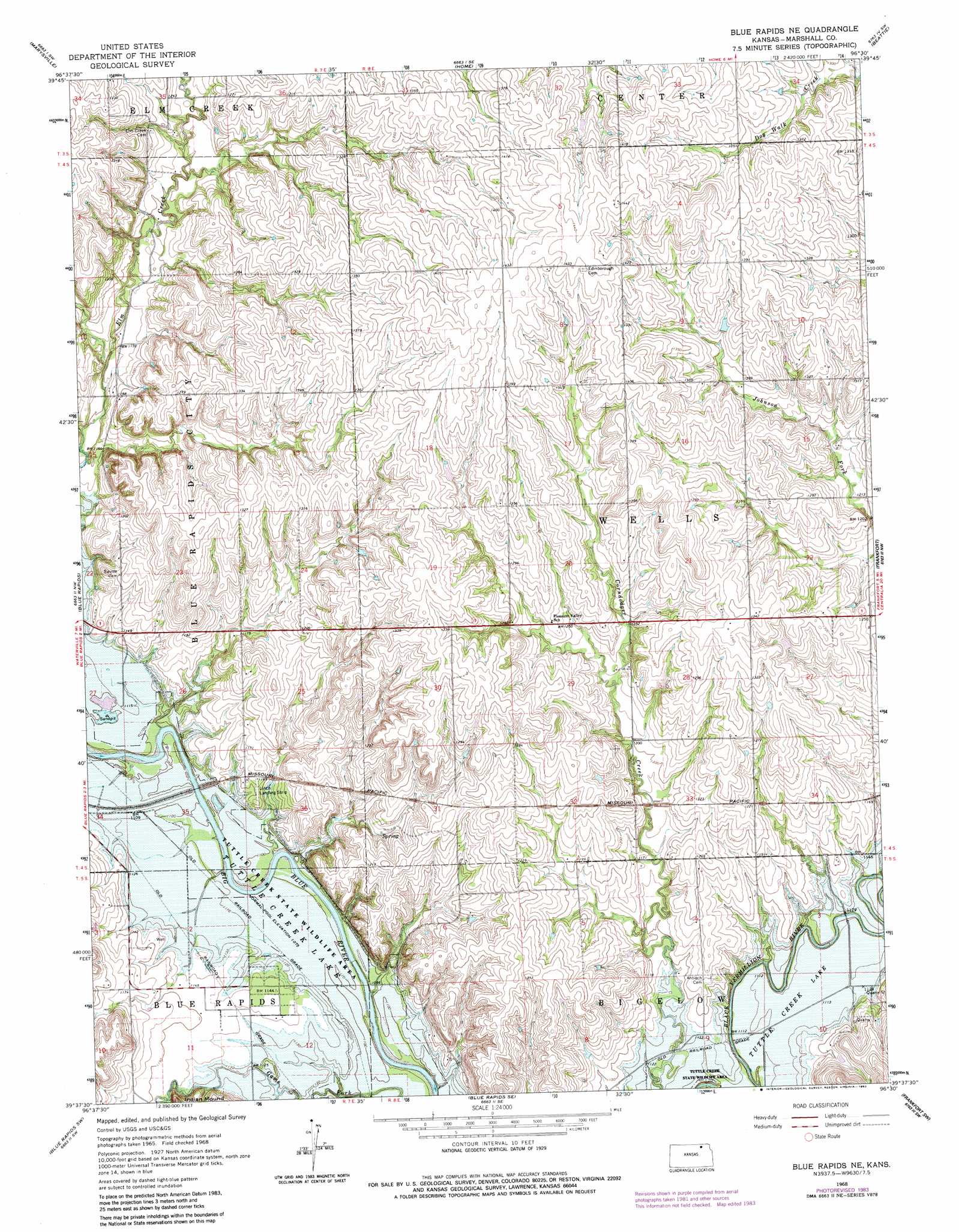
USGS Topo Quad 39096f5 - 1:24,000 scale
| Topo Map Name: | Blue Rapids Ne |
| USGS Topo Quad ID: | 39096f5 |
| Print Size: | ca. 21 1/4" wide x 27" high |
| Southeast Coordinates: | 39.625° N latitude / 96.5° W longitude |
| Map Center Coordinates: | 39.6875° N latitude / 96.5625° W longitude |
| U.S. State: | KS |
| Filename: | o39096f5.jpg |
| Download Map JPG Image: | Blue Rapids Ne topo map 1:24,000 scale |
| Map Type: | Topographic |
| Topo Series: | 7.5´ |
| Map Scale: | 1:24,000 |
| Source of Map Images: | United States Geological Survey (USGS) |
| Alternate Map Versions: |
Blue Rapids NE KS 1968, updated 1969 Download PDF Buy paper map Blue Rapids NE KS 1968, updated 1983 Download PDF Buy paper map Blue Rapids NE KS 2009 Download PDF Buy paper map Blue Rapids NE KS 2012 Download PDF Buy paper map Blue Rapids NE KS 2015 Download PDF Buy paper map |
1:24,000 Topo Quads surrounding Blue Rapids Ne
Hanover East |
Herkimer |
Oketo |
Axtell Nw |
Summerfield |
Hanover Se |
Marysville |
Home |
Beattie |
Axtell |
Barnes |
Blue Rapids |
Blue Rapids Ne |
Frankfort |
Vermillon |
Greenleaf Se |
Blue Rapids Sw |
Blue Rapids Se |
Frankfort Sw |
Wheaton |
Randolph |
Olsburg Nw |
Olsburg |
Westmoreland |
Westmoreland Ne |
> Back to 39096e1 at 1:100,000 scale
> Back to 39096a1 at 1:250,000 scale
> Back to U.S. Topo Maps home
Blue Rapids Ne topo map: Gazetteer
Blue Rapids Ne: Airports
Linch Landing Strip elevation 354m 1161′Blue Rapids Ne: Summits
Indian Mound elevation 359m 1177′Blue Rapids Ne digital topo map on disk
Buy this Blue Rapids Ne topo map showing relief, roads, GPS coordinates and other geographical features, as a high-resolution digital map file on DVD: