Blue Rapids Topo Map Kansas
To zoom in, hover over the map of Blue Rapids
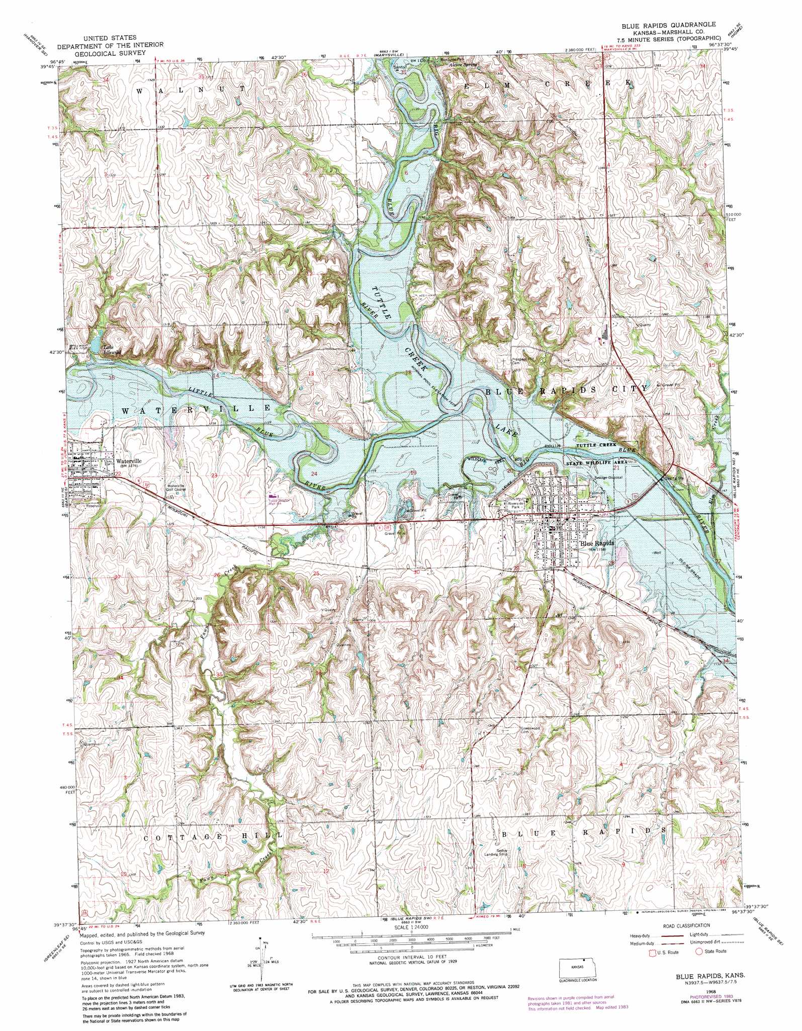
USGS Topo Quad 39096f6 - 1:24,000 scale
| Topo Map Name: | Blue Rapids |
| USGS Topo Quad ID: | 39096f6 |
| Print Size: | ca. 21 1/4" wide x 27" high |
| Southeast Coordinates: | 39.625° N latitude / 96.625° W longitude |
| Map Center Coordinates: | 39.6875° N latitude / 96.6875° W longitude |
| U.S. State: | KS |
| Filename: | o39096f6.jpg |
| Download Map JPG Image: | Blue Rapids topo map 1:24,000 scale |
| Map Type: | Topographic |
| Topo Series: | 7.5´ |
| Map Scale: | 1:24,000 |
| Source of Map Images: | United States Geological Survey (USGS) |
| Alternate Map Versions: |
Blue Rapids KS 1968, updated 1970 Download PDF Buy paper map Blue Rapids KS 1968, updated 1983 Download PDF Buy paper map Blue Rapids KS 2009 Download PDF Buy paper map Blue Rapids KS 2012 Download PDF Buy paper map Blue Rapids KS 2016 Download PDF Buy paper map |
1:24,000 Topo Quads surrounding Blue Rapids
Hanover West |
Hanover East |
Herkimer |
Oketo |
Axtell Nw |
Hanover Sw |
Hanover Se |
Marysville |
Home |
Beattie |
Greenleaf |
Barnes |
Blue Rapids |
Blue Rapids Ne |
Frankfort |
Kimeo |
Greenleaf Se |
Blue Rapids Sw |
Blue Rapids Se |
Frankfort Sw |
Lasita |
Randolph |
Olsburg Nw |
Olsburg |
Westmoreland |
> Back to 39096e1 at 1:100,000 scale
> Back to 39096a1 at 1:250,000 scale
> Back to U.S. Topo Maps home
Blue Rapids topo map: Gazetteer
Blue Rapids: Airports
Sedivy Landing Strip elevation 421m 1381′Blue Rapids: Dams
Waterville Dam elevation 352m 1154′Blue Rapids: Parks
Alcove Springs Park elevation 359m 1177′Riverside Park elevation 342m 1122′
Blue Rapids: Populated Places
Bestwall elevation 390m 1279′Blue Rapids elevation 352m 1154′
Waterville elevation 359m 1177′
Blue Rapids: Reservoirs
Idlewild Lake elevation 352m 1154′Blue Rapids: Springs
Alcove Spring elevation 353m 1158′Blue Rapids: Streams
Elm Creek elevation 331m 1085′Fawn Creek elevation 335m 1099′
Little Blue River elevation 335m 1099′
Blue Rapids digital topo map on disk
Buy this Blue Rapids topo map showing relief, roads, GPS coordinates and other geographical features, as a high-resolution digital map file on DVD: