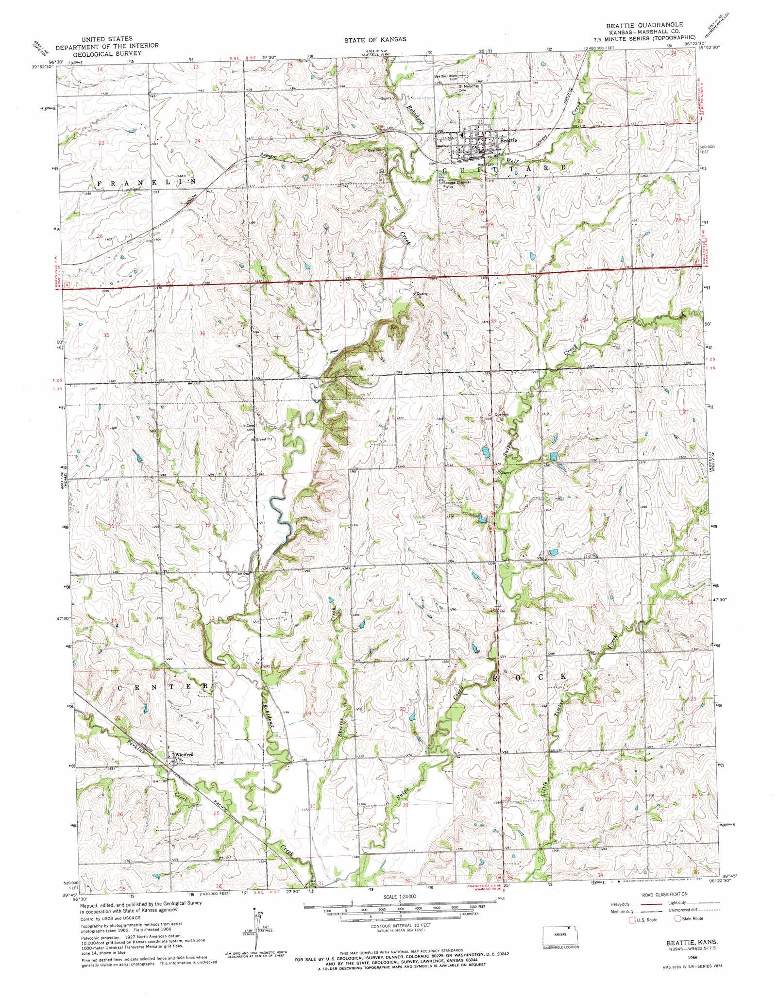
Beattie Topo Map Kansas
To zoom in, hover over the map of Beattie
USGS Topo Quad 39096g4 - 1:24,000 scale
| Topo Map Name: | Beattie |
| USGS Topo Quad ID: | 39096g4 |
| Print Size: | ca. 21 1/4" wide x 27" high |
| Southeast Coordinates: | 39.75° N latitude / 96.375° W longitude |
| Map Center Coordinates: | 39.8125° N latitude / 96.4375° W longitude |
| U.S. State: | KS |
| Filename: | o39096g4.jpg |
| Download Map JPG Image: | Beattie topo map 1:24,000 scale |
| Map Type: | Topographic |
| Topo Series: | 7.5´ |
| Map Scale: | 1:24,000 |
| Source of Map Images: | United States Geological Survey (USGS) |
| Alternate Map Versions: |
Beattie KS 1966, updated 1967 Download PDF Buy paper map Beattie KS 2009 Download PDF Buy paper map Beattie KS 2012 Download PDF Buy paper map Beattie KS 2016 Download PDF Buy paper map |
1:24,000 Topo Quads surrounding Beattie
Wymore |
Barneston |
Liberty |
Liberty Se |
Pawnee City |
Herkimer |
Oketo |
Axtell Nw |
Summerfield |
Seneca Nw |
Marysville |
Home |
Beattie |
Axtell |
Baileyville |
Blue Rapids |
Blue Rapids Ne |
Frankfort |
Vermillon |
Centralia |
Blue Rapids Sw |
Blue Rapids Se |
Frankfort Sw |
Wheaton |
Duluth |
> Back to 39096e1 at 1:100,000 scale
> Back to 39096a1 at 1:250,000 scale
> Back to U.S. Topo Maps home
Beattie topo map: Gazetteer
Beattie: Populated Places
Beattie elevation 401m 1315′Winifred elevation 369m 1210′
Beattie: Streams
Dog Walk Creek elevation 350m 1148′Perkins Creek elevation 352m 1154′
Wolf Creek elevation 379m 1243′
Beattie digital topo map on disk
Buy this Beattie topo map showing relief, roads, GPS coordinates and other geographical features, as a high-resolution digital map file on DVD: