Seneca Nw Topo Map Kansas
To zoom in, hover over the map of Seneca Nw
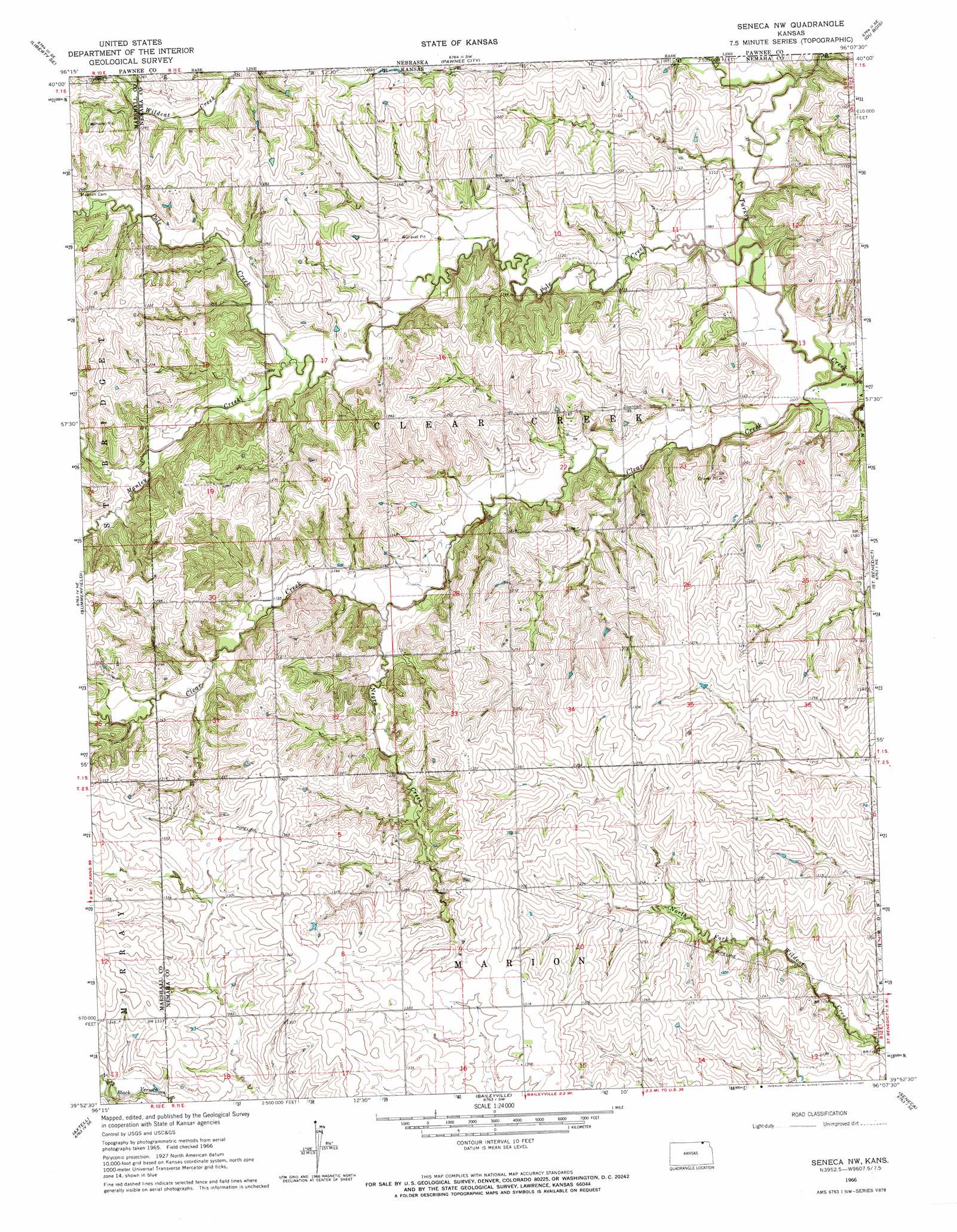
USGS Topo Quad 39096h2 - 1:24,000 scale
| Topo Map Name: | Seneca Nw |
| USGS Topo Quad ID: | 39096h2 |
| Print Size: | ca. 21 1/4" wide x 27" high |
| Southeast Coordinates: | 39.875° N latitude / 96.125° W longitude |
| Map Center Coordinates: | 39.9375° N latitude / 96.1875° W longitude |
| U.S. State: | KS |
| Filename: | o39096h2.jpg |
| Download Map JPG Image: | Seneca Nw topo map 1:24,000 scale |
| Map Type: | Topographic |
| Topo Series: | 7.5´ |
| Map Scale: | 1:24,000 |
| Source of Map Images: | United States Geological Survey (USGS) |
| Alternate Map Versions: |
Seneca NW KS 1966, updated 1967 Download PDF Buy paper map Seneca NW KS 2009 Download PDF Buy paper map Seneca NW KS 2012 Download PDF Buy paper map Seneca NW KS 2015 Download PDF Buy paper map |
1:24,000 Topo Quads surrounding Seneca Nw
Lewiston |
Burchard |
Steinauer |
Table Rock |
Humboldt |
Liberty |
Liberty Se |
Pawnee City |
Du Bois |
Humboldt Sw |
Axtell Nw |
Summerfield |
Seneca Nw |
Saint Benedict |
Bern |
Beattie |
Axtell |
Baileyville |
Seneca |
Oneida |
Frankfort |
Vermillon |
Centralia |
Corning |
Goff |
> Back to 39096e1 at 1:100,000 scale
> Back to 39096a1 at 1:250,000 scale
> Back to U.S. Topo Maps home
Seneca Nw topo map: Gazetteer
Seneca Nw: Streams
Clear Creek elevation 326m 1069′Negro Creek elevation 354m 1161′
Pole Creek elevation 323m 1059′
Seneca Nw digital topo map on disk
Buy this Seneca Nw topo map showing relief, roads, GPS coordinates and other geographical features, as a high-resolution digital map file on DVD: