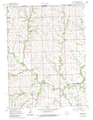
Herkimer Topo Map Kansas
To zoom in, hover over the map of Herkimer
USGS Topo Quad 39096h6 - 1:24,000 scale
| Topo Map Name: | Herkimer |
| USGS Topo Quad ID: | 39096h6 |
| Print Size: | ca. 21 1/4" wide x 27" high |
| Southeast Coordinates: | 39.875° N latitude / 96.625° W longitude |
| Map Center Coordinates: | 39.9375° N latitude / 96.6875° W longitude |
| U.S. State: | KS |
| Filename: | o39096h6.jpg |
| Download Map JPG Image: | Herkimer topo map 1:24,000 scale |
| Map Type: | Topographic |
| Topo Series: | 7.5´ |
| Map Scale: | 1:24,000 |
| Source of Map Images: | United States Geological Survey (USGS) |
| Alternate Map Versions: |
Herkimer KS 1966, updated 1967 Download PDF Buy paper map Herkimer KS 1966, updated 1983 Download PDF Buy paper map Herkimer KS 2009 Download PDF Buy paper map Herkimer KS 2012 Download PDF Buy paper map Herkimer KS 2015 Download PDF Buy paper map |
1:24,000 Topo Quads surrounding Herkimer
> Back to 39096e1 at 1:100,000 scale
> Back to 39096a1 at 1:250,000 scale
> Back to U.S. Topo Maps home
Herkimer topo map: Gazetteer
Herkimer: Populated Places
Herkimer elevation 382m 1253′Lone Elm elevation 386m 1266′
Herkimer: Streams
Blodgett Creek elevation 358m 1174′Deer Creek elevation 351m 1151′
Horseshoe Creek elevation 349m 1145′
Indian Creek elevation 363m 1190′
Meadow Creek elevation 371m 1217′
Mountain Creek elevation 359m 1177′
Nieman Creek elevation 357m 1171′
Raemer Creek elevation 355m 1164′
Scotch Creek elevation 350m 1148′
Herkimer digital topo map on disk
Buy this Herkimer topo map showing relief, roads, GPS coordinates and other geographical features, as a high-resolution digital map file on DVD:


