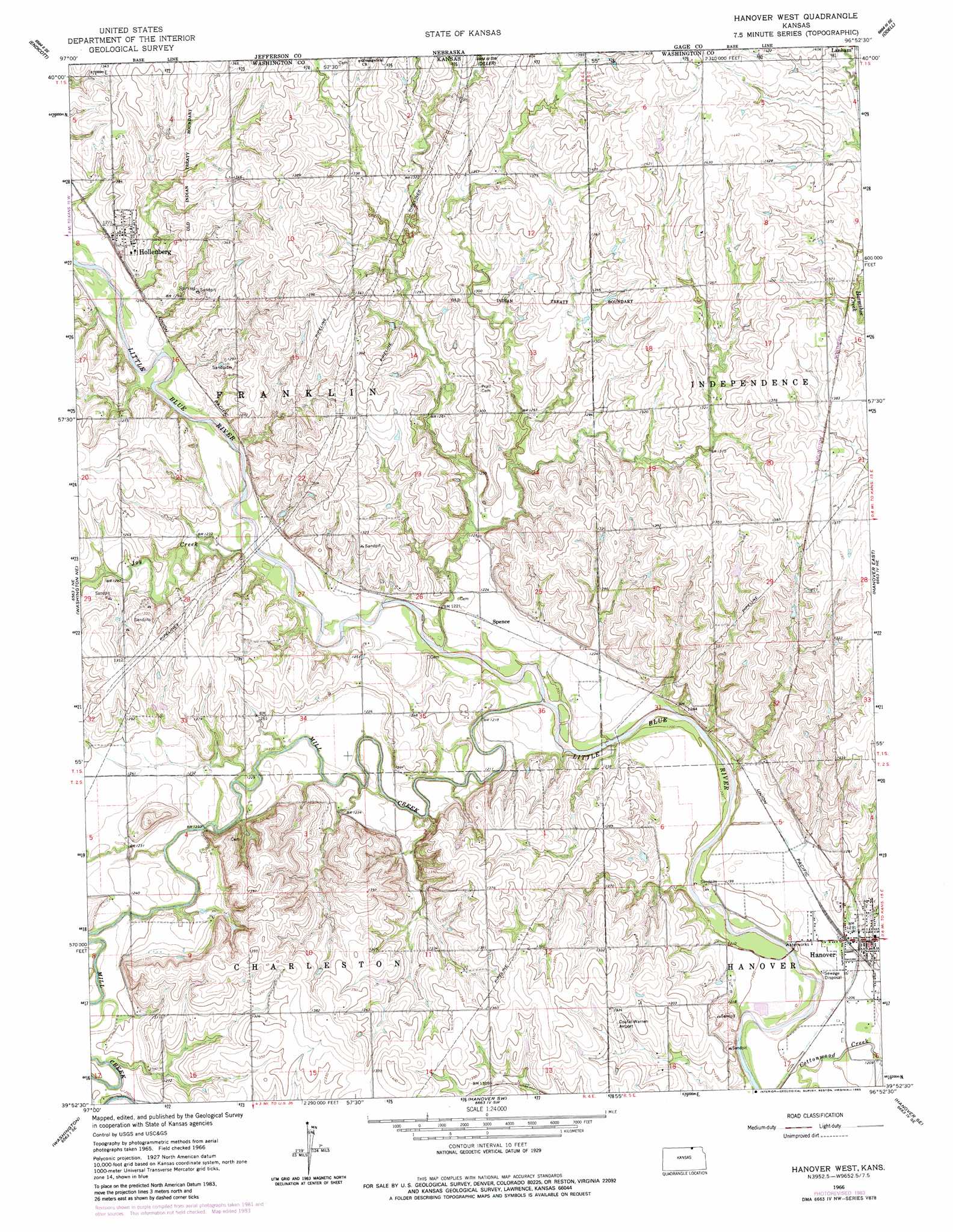
Hanover West Topo Map Kansas
To zoom in, hover over the map of Hanover West
USGS Topo Quad 39096h8 - 1:24,000 scale
| Topo Map Name: | Hanover West |
| USGS Topo Quad ID: | 39096h8 |
| Print Size: | ca. 21 1/4" wide x 27" high |
| Southeast Coordinates: | 39.875° N latitude / 96.875° W longitude |
| Map Center Coordinates: | 39.9375° N latitude / 96.9375° W longitude |
| U.S. State: | KS |
| Filename: | o39096h8.jpg |
| Download Map JPG Image: | Hanover West topo map 1:24,000 scale |
| Map Type: | Topographic |
| Topo Series: | 7.5´ |
| Map Scale: | 1:24,000 |
| Source of Map Images: | United States Geological Survey (USGS) |
| Alternate Map Versions: |
Hanover West KS 1966, updated 1967 Download PDF Buy paper map Hanover West KS 1966, updated 1983 Download PDF Buy paper map Hanover West KS 2009 Download PDF Buy paper map Hanover West KS 2012 Download PDF Buy paper map Hanover West KS 2015 Download PDF Buy paper map |
1:24,000 Topo Quads surrounding Hanover West
Fairbury |
Jansen |
Harbine |
Odell Ne |
Blue Springs |
Fairbury Sw |
Endicott |
Diller |
Odell |
Wymore |
Washington Nw |
Washington Ne |
Hanover West |
Hanover East |
Herkimer |
Morrowville |
Washington |
Hanover Sw |
Hanover Se |
Marysville |
Palmer |
Linn |
Greenleaf |
Barnes |
Blue Rapids |
> Back to 39096e1 at 1:100,000 scale
> Back to 39096a1 at 1:250,000 scale
> Back to U.S. Topo Maps home
Hanover West topo map: Gazetteer
Hanover West: Airports
Coufal-Warren Airport elevation 406m 1332′Wasseman Farms Airport elevation 419m 1374′
Hanover West: Populated Places
Hanover elevation 375m 1230′Hollenberg elevation 395m 1295′
Spence elevation 373m 1223′
Hanover West: Streams
Joy Creek elevation 368m 1207′Mill Creek elevation 366m 1200′
Hanover West digital topo map on disk
Buy this Hanover West topo map showing relief, roads, GPS coordinates and other geographical features, as a high-resolution digital map file on DVD: