Tescott Ne Topo Map Kansas
To zoom in, hover over the map of Tescott Ne
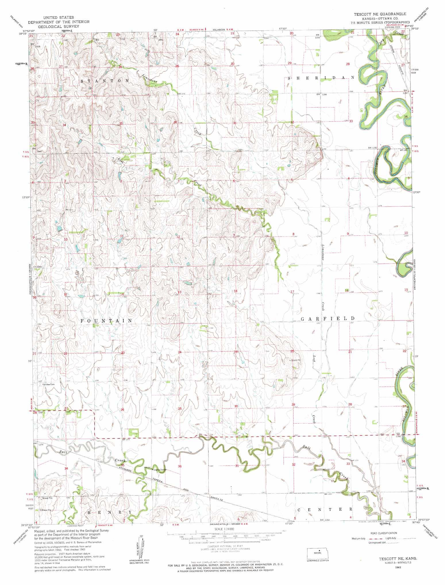
USGS Topo Quad 39097b7 - 1:24,000 scale
| Topo Map Name: | Tescott Ne |
| USGS Topo Quad ID: | 39097b7 |
| Print Size: | ca. 21 1/4" wide x 27" high |
| Southeast Coordinates: | 39.125° N latitude / 97.75° W longitude |
| Map Center Coordinates: | 39.1875° N latitude / 97.8125° W longitude |
| U.S. State: | KS |
| Filename: | o39097b7.jpg |
| Download Map JPG Image: | Tescott Ne topo map 1:24,000 scale |
| Map Type: | Topographic |
| Topo Series: | 7.5´ |
| Map Scale: | 1:24,000 |
| Source of Map Images: | United States Geological Survey (USGS) |
| Alternate Map Versions: |
Tescott NE KS 1961, updated 1963 Download PDF Buy paper map Tescott NE KS 2009 Download PDF Buy paper map Tescott NE KS 2012 Download PDF Buy paper map Tescott NE KS 2015 Download PDF Buy paper map |
1:24,000 Topo Quads surrounding Tescott Ne
Beloit |
Simpson |
Glasco Ne |
Aurora Nw |
Aurora |
Beloit Se |
Glasco Sw |
Glasco |
Aurora Sw |
Lamar |
Barnard |
Ada |
Tescott Ne |
Minneapolis North |
Wells |
Shady Bend |
Tescott |
Tescott Se |
Minneapolis South |
Bennington |
Westfall |
Juniata |
Culver |
Trenton |
New Cambria |
> Back to 39097a1 at 1:100,000 scale
> Back to 39096a1 at 1:250,000 scale
> Back to U.S. Topo Maps home
Tescott Ne topo map: Gazetteer
Tescott Ne: Streams
Dry Creek elevation 387m 1269′Limestone Creek elevation 383m 1256′
Tescott Ne digital topo map on disk
Buy this Tescott Ne topo map showing relief, roads, GPS coordinates and other geographical features, as a high-resolution digital map file on DVD: