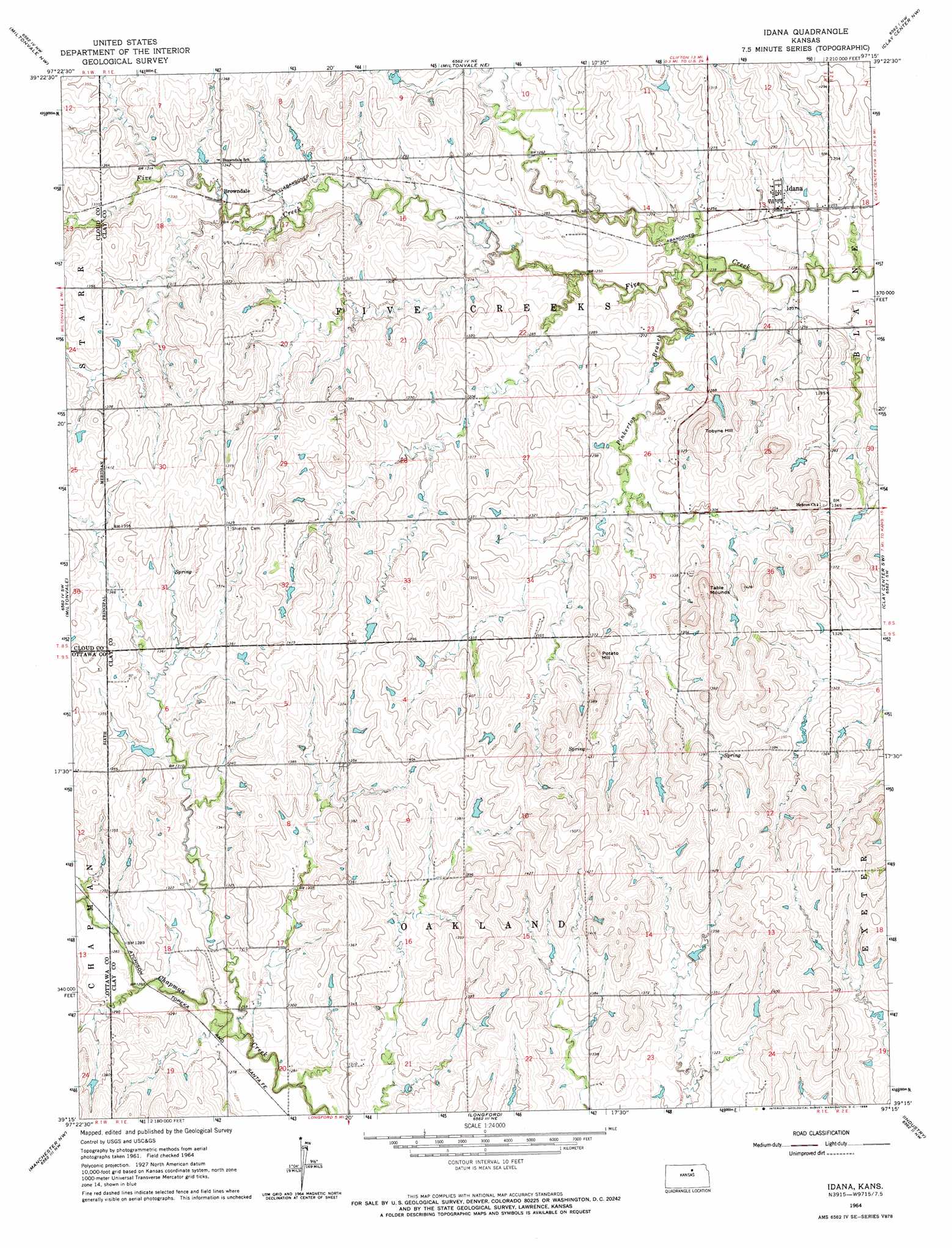
Idana Topo Map Kansas
To zoom in, hover over the map of Idana
USGS Topo Quad 39097c3 - 1:24,000 scale
| Topo Map Name: | Idana |
| USGS Topo Quad ID: | 39097c3 |
| Print Size: | ca. 21 1/4" wide x 27" high |
| Southeast Coordinates: | 39.25° N latitude / 97.25° W longitude |
| Map Center Coordinates: | 39.3125° N latitude / 97.3125° W longitude |
| U.S. State: | KS |
| Filename: | o39097c3.jpg |
| Download Map JPG Image: | Idana topo map 1:24,000 scale |
| Map Type: | Topographic |
| Topo Series: | 7.5´ |
| Map Scale: | 1:24,000 |
| Source of Map Images: | United States Geological Survey (USGS) |
| Alternate Map Versions: |
Idana KS 1964, updated 1966 Download PDF Buy paper map Idana KS 2009 Download PDF Buy paper map Idana KS 2012 Download PDF Buy paper map Idana KS 2015 Download PDF Buy paper map |
1:24,000 Topo Quads surrounding Idana
Rice |
Clyde |
Clifton |
Linn Sw |
Linn Se |
Aurora |
Miltonvale Nw |
Miltonvale Ne |
Clay Center Nw |
Clay Center Ne |
Lamar |
Miltonvale |
Idana |
Clay Center Sw |
Clay Center Se |
Wells |
Manchester Nw |
Longford |
Industry |
Wakefield |
Bennington |
Vine Creek |
Manchester |
Buckeye |
Upland |
> Back to 39097a1 at 1:100,000 scale
> Back to 39096a1 at 1:250,000 scale
> Back to U.S. Topo Maps home
Idana topo map: Gazetteer
Idana: Populated Places
Browndale elevation 397m 1302′Idana elevation 384m 1259′
Idana: Streams
Pinkerton Branch elevation 375m 1230′Idana: Summits
Potato Hill elevation 445m 1459′Table Mounds elevation 456m 1496′
Tobyne Hill elevation 431m 1414′
Idana digital topo map on disk
Buy this Idana topo map showing relief, roads, GPS coordinates and other geographical features, as a high-resolution digital map file on DVD: